- Coopersville, Michigan
-
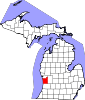
Coopersville, Michigan — City — Location of Coopersville in Ottawa County, Michigan
Coordinates: 43°2′23″N 85°55′48″W / 43.03972°N 85.93°WCoordinates: 43°2′23″N 85°55′48″W / 43.03972°N 85.93°W Country United States State Michigan County Ottawa incorporated 1871 (as village)
January 1, 1967 (as city)Government – Mayor Kenneth L Bush Area – Total 4.8 sq mi (12.5 km2) – Land 4.8 sq mi (12.5 km2) – Water 0.0 sq mi (0.0 km2) 0.0% Elevation 636 ft (193.8 m) Population (2010) – Total 4,275 – Density 885.8/sq mi (342/km2) Time zone EST (UTC-5) – Summer (DST) EDT (UTC-4) ZIP code 49404 Area code(s) 616 FIPS code 26-18020[1] GNIS feature ID 0623797[2] Website http://www.cityofcoopersville.com/ Coopersville is a city located in north central Ottawa County in the U.S. state of Michigan. The population was 4,275 at the 2010 census. It is primarily a farming community.
The city is located within Polkton Township, though it is administratively autonomous. It lies just north of Interstate 96 along the eastern township boundary, adjacent to Wright Township on the east. There are two exits on I-96, one at the southeast corner of the city and the other at the southwest corner.
Contents
Geography
According to the United States Census Bureau, the city has a total area of 4.8 square miles (12 km2). Very little of this area is covered with water, there is only a small creek known as "Deer Creek".
Demographics
As of the census[1] of 2000, there were 3,910 people, 1,420 households, and 1,036 families residing in the city. The population density was 812.5 per square mile (313.9/km²). There were 1,521 housing units at an average density of 316.1 per square mile (122.1/km²). The racial makeup of the city was 96.37% White, 0.20% African American, 0.64% Native American, 0.69% Asian, 1.28% from other races, and 0.82% from two or more races. Hispanic or Latino of any race were 2.71% of the population.

There were 1,420 households out of which 39.6% had children under the age of 18 living with them, 57.9% were married couples living together, 11.7% had a female householder with no husband present, and 27.0% were non-families. 22.6% of all households were made up of individuals and 8.9% had someone living alone who was 65 years of age or older. The average household size was 2.74 and the average family size was 3.21.
In the city the population was spread out with 30.2% under the age of 18, 10.9% from 18 to 24, 30.5% from 25 to 44, 18.3% from 45 to 64, and 10.1% who were 65 years of age or older. The median age was 31 years. For every 100 females there were 93.9 males. For every 100 females age 18 and over, there were 86.2 males.
The median income for a household in the city was $48,875, and the median income for a family was $55,226. Males had a median income of $39,725 versus $22,464 for females. The per capita income for the city was $19,241. About 4.5% of families and 7.7% of the population were below the poverty line, including 5.4% of those under age 18 and 17.5% of those age 65 or over.
Education
Primary and secondary schools
- Coopersville Public Schools
- Coopersville High School
- Coopersville Middle School
- East Elementary
- West Elementary
- West Early Childhood Center
Transportation
Major highways
 I-96
I-96
Notable residents
- Del Shannon, an early rock singer and guitarist
- Butch Miller, a NASCAR driver
- Tim Steele, an ARCA racer
References
External links
Municipalities and communities of Ottawa County, Michigan Cities Coopersville | Ferrysburg | Grand Haven | Holland‡ | Hudsonville | Zeeland
Village Charter
townshipsAllendale | Georgetown | Grand Haven | Holland | Jamestown | Polkton | Tallmadge | Zeeland
General law
townshipsBlendon | Chester | Crockery | Olive | Park | Port Sheldon | Robinson | Spring Lake | Wright
Unincorporated
communitiesAgnew | Allendale | Beechwood | Conklin | Drenthe | Eastmanville | Grand Valley | Lamont | Marne | Nunica | Jenison | West Olive
Footnotes ‡This populated place also has portions in an adjacent county or counties
Categories:- Populated places in Ottawa County, Michigan
- Cities in Michigan
- Coopersville Public Schools


Wikimedia Foundation. 2010.