- Allendale, Michigan
Infobox Settlement
official_name = Allendale, Michigan
settlement_type = CDP
nickname =
motto =
mapsize = 250px
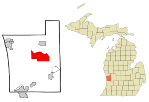
map_caption = Location of Allendale, Michigan
mapsize1 =
map_caption1 =subdivision_type = Country
subdivision_name =United States
subdivision_type1 = State
subdivision_name1 =Michigan
subdivision_type2 = County
subdivision_name2 = Ottawagovernment_footnotes =
government_type =
leader_title =
leader_name =
leader_title1 =
leader_name1 =
established_title =
established_date =unit_pref = Imperial
area_footnotes =area_magnitude =
area_total_km2 = 61.5
area_land_km2 = 59.1
area_water_km2 = 2.3
area_total_sq_mi = 23.7
area_land_sq_mi = 22.8
area_water_sq_mi = 0.9population_as_of = 2000
population_footnotes =
population_total = 11555
population_density_km2 = 51.0
population_density_sq_mi = 132.1timezone = Eastern (EST)
utc_offset = -5
timezone_DST = EDT
utc_offset_DST = -4
elevation_footnotes =
elevation_m = 199
elevation_ft = 653
latd = 42 |latm = 58 |lats = 20 |latNS = N
longd = 85 |longm = 57 |longs = 13 |longEW = W
coordinates_type = region:US-MI_type:city_source:GNISpostal_code_type =
ZIP code
postal_code = 49401 (Allendale),
49417 Grand Haven),
49460 (West Olive)
area_code = 616
blank_name = FIPS code
blank_info = 26-01340GR|2
blank1_name = GNIS feature ID
blank1_info = 1626370 [gnis|1626370]
website = http://www.allendale-twp.org/
footnotes =Allendale is an
unincorporated community in Ottawa County in theU.S. state ofMichigan . It is also acensus-designated place (CDP) for statistical purposes. The population was 11,555 at the 2000 census. The community is located within Allendale Charter Township and the CDP area consists of about the northern two thirds of the township, from the eastern boundary with the Grand River west along Pierce St., north along 75th Ave., then west along Lake Michigan Drive (M-45) to the western boundary of the township. Apart from the CDP definition, the community is centered at the intersection of M-45 and 68th Ave., which are the only roads which cross the Grand River in the county east of Grand Haven. [ [http://factfinder.census.gov/servlet/MapItDrawServlet?geo_id=16000US2601340&_bucket_id=50&tree_id=4001&context=AdvSearch&_lang=en Allendale CDP, Michigan - Reference Map - American FactFinder] , U.S. Census Bureau, 2000 census]The Allendale
ZIP code 49401 serves most of the area of the CDP except for the westernmost portion. The 49401 ZIP code also serve portions of southern Allendale Township not included in the the CDP as well as portions of Blendon Township to the south and Georgetown Township to the southeast. [ [http://factfinder.census.gov/servlet/MapItDrawServlet?geo_id=86000US49401&_bucket_id=50&tree_id=420&context=AdvSearch&_lang=en 49401 5-Digit ZCTA, 494 3-Digit ZCTA - Reference Map - American FactFinder] , U.S. Census Bureau, 2000 census] The northwestern part of the CDP is served by the Grand Haven ZIP code 49417. [ [http://factfinder.census.gov/servlet/MapItDrawServlet?geo_id=86000US49417&_bucket_id=50&tree_id=420&context=AdvSearch&_lang=en 49417 5-Digit ZCTA, 494 3-Digit ZCTA - Reference Map - American FactFinder] , U.S. Census Bureau, 2000 census] The west central portion of the CDP is served by the West Olive ZIP code 49460. [ [http://factfinder.census.gov/servlet/MapItDrawServlet?geo_id=86000US49460&_bucket_id=50&tree_id=420&context=AdvSearch&_lang=en 49460 5-Digit ZCTA, 494 3-Digit ZCTA - Reference Map - American FactFinder] , U.S. Census Bureau, 2000 census]Allendale is named for the township. Malta was initially chosen as the name for the township, however when the township was organized in 1849, state senator Pennoyer changed the name to Allendale, after Agnes Allen, the first person on the tax roll in the area and the widow of Hannibal Allen, who was the son of Revolutionary War hero
Ethan Allen . [ [http://www.allendale-twp.org/clerk/docs/2004_historical_recognition_plan.pdf Allendale Historical Recognition Program] ,p. 19]Geography
According to the
United States Census Bureau , the CDP has a total area of 23.7square mile s (61.5km² ), of which, 22.8 square miles (59.1 km²) of it is land and 0.9 square miles (2.3 km²) of it (3.79%) is water.Demographics
As of the
census GR|2 of 2000, there were 11,555 people, 2,864 households, and 1,913 families residing in the CDP. Thepopulation density was 506.1 per square mile (195.4/km²). There were 3,016 housing units at an average density of 132.1/sq mi (51.0/km²). The racial makeup of the CDP was 93.22% White, 2.97% African American, 0.34% Native American, 0.89% Asian, 0.08% Pacific Islander, 1.45% from other races, and 1.06% from two or more races. Hispanic or Latino of any race were 3.03% of the population.There were 2,864 households out of which 38.5% had children under the age of 18 living with them, 57.8% were married couples living together, 6.3% had a female householder with no husband present, and 33.2% were non-families. 16.1% of all households were made up of individuals and 3.5% had someone living alone who was 65 years of age or older. The average household size was 2.98 and the average family size was 3.36.
In the CDP the population was spread out with 20.7% under the age of 18, 43.1% from 18 to 24, 22.1% from 25 to 44, 9.6% from 45 to 64, and 4.6% who were 65 years of age or older. The median age was 21 years. For every 100 females there were 87.3 males. For every 100 females age 18 and over, there were 83.6 males.
The median income for a household in the CDP was $46,671, and the median income for a family was $58,371. Males had a median income of $39,038 versus $25,146 for females. The
per capita income for the community was $14,580. About 2.4% of families and 12.5% of the population were below thepoverty line , including 2.5% of those under age 18 and 3.6% of those age 65 or over.Schools
* [http://www.allendale.k12.mi.us/ Allendale Public Schools]
* [http://www.allendalechristian.com/ Allendale Christian School]Universities
*
Grand Valley State University References
External links
* [http://www.allendale-twp.org/ Allendale Charter Township]
Wikimedia Foundation. 2010.


