- Cozad, Nebraska
-
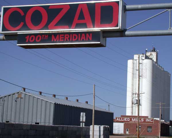
Cozad, Nebraska — City — Sign marking the 100th meridian on U.S. Highway 30 in Cozad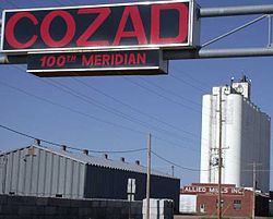 Location of Cozad, Nebraska
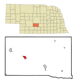
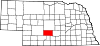
Coordinates: 40°51′44″N 99°59′3″W / 40.86222°N 99.98417°WCoordinates: 40°51′44″N 99°59′3″W / 40.86222°N 99.98417°W Country United States State Nebraska County Dawson Area - Total 2.1 sq mi (5.4 km2) - Land 2.1 sq mi (5.4 km2) - Water 0.0 sq mi (0.0 km2) Elevation 2,490 ft (759 m) Population (2010) - Total 3,977 - Density 2,007.2/sq mi (775.0/km2) Time zone Central (CST) (UTC-6) - Summer (DST) CDT (UTC-5) ZIP code 69130 Area code(s) 308 FIPS code 31-11020[1] GNIS feature ID 0828431[2] Cozad is a city in Dawson County, Nebraska, United States. The population was 3,977 at the 2010 census. The town is on the Great Plains of central Nebraska, along the Union Pacific Railroad and U.S. Highway 30, just north of the Platte River. The 100th meridian, which roughly marks the eastward boundary of the arid plains, passes just west of the town as is marked nearby on a prominent sign across U.S. Highway 30. In the early 1860s, it was a stop along the Pony Express.
Cozad is part of the Lexington, Nebraska Micropolitan Statistical Area.
Contents
Geography
Cozad is located at 40°51′44″N 99°59′3″W / 40.86222°N 99.98417°W (40.862141, -99.984082)[3].
According to the United States Census Bureau, the city has a total area of 2.1 square miles (5.4 km2), all of it land.
Cozad was settled by John J. Cozad, father of Robert Henri. Cozad also founded Cozaddale, Ohio, a small, unincorporated village 25 miles northeast of Cincinnati.[citation needed]
Notable natives and residents
- Robert Henri, American painter of the Ashcan School, was the son of John J. Cozad
- Dan Christensen, American abstract painter, was born in Cozad
- Chris Dishman, an NFL lineman
Demographics
As of the census[1] of 2000, there were 4,163 people, 1,722 households, and 1,127 families residing in the city. The population density was 2,007.2 people per square mile (776.5/km²). There were 1,851 housing units at an average density of 892.5 per square mile (345.3/km²). The racial makeup of the city was 93.39% White, 0.17% African American, 0.43% Native American, 0.43% Asian, 3.82% from other races, and 1.75% from two or more races. Hispanic or Latino of any race were 10.95% of the population.
There were 1,722 households out of which 32.0% had children under the age of 18 living with them, 52.6% were married couples living together, 8.9% had a female householder with no husband present, and 34.5% were non-families. 30.4% of all households were made up of individuals and 14.7% had someone living alone who was 65 years of age or older. The average household size was 2.37 and the average family size was 2.95.
In the city the population was spread out with 26.4% under the age of 18, 7.8% from 18 to 24, 27.0% from 25 to 44, 22.2% from 45 to 64, and 16.6% who were 65 years of age or older. The median age was 37 years. For every 100 females there were 92.8 males. For every 100 females age 18 and over, there were 90.8 males.
The median income for a household in the city was $32,392, and the median income for a family was $43,413. Males had a median income of $27,217 versus $20,089 for females. The per capita income for the city was $18,139. About 9.8% of families and 12.1% of the population were below the poverty line, including 17.1% of those under age 18 and 11.3% of those age 65 or over.
References
- ^ a b "American FactFinder". United States Census Bureau. http://factfinder.census.gov. Retrieved 2008-01-31.
- ^ "US Board on Geographic Names". United States Geological Survey. 2007-10-25. http://geonames.usgs.gov. Retrieved 2008-01-31.
- ^ "US Gazetteer files: 2010, 2000, and 1990". United States Census Bureau. 2011-02-12. http://www.census.gov/geo/www/gazetteer/gazette.html. Retrieved 2011-04-23.
External links
Municipalities and communities of Dawson County, Nebraska Cities Cozad | Gothenburg | Lexington
Villages Unincorporated
communitiesCategories:- Cities in Nebraska
- Populated places in Dawson County, Nebraska
- Lexington micropolitan area
- Pony Express stations

Wikimedia Foundation. 2010.