- Opheim, Montana
-
Opheim, Montana — Town — Location of Opheim, Montana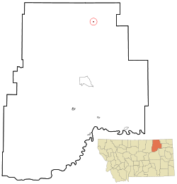
Coordinates: 48°51′29″N 106°24′35″W / 48.85806°N 106.40972°WCoordinates: 48°51′29″N 106°24′35″W / 48.85806°N 106.40972°W Country United States State Montana County Valley Area – Total 0.2 sq mi (0.6 km2) – Land 0.2 sq mi (0.6 km2) – Water 0.0 sq mi (0.0 km2) Elevation 3,264 ft (995 m) Population (2000) – Total 111 – Density 508.5/sq mi (196.3/km2) Time zone Mountain (MST) (UTC-7) – Summer (DST) MDT (UTC-6) ZIP code 59250 Area code(s) 406 FIPS code 30-55525 GNIS feature ID 0774973 Opheim is a town in Valley County, Montana, United States. The population was 111 at the 2000 census.
Contents
Geography
Opheim is located at 48°51′29″N 106°24′35″W / 48.85806°N 106.40972°W (48.857981, -106.409816)[1].
According to the United States Census Bureau, the town has a total area of 0.2 square miles (0.52 km2), all of it land.
Demographics
As of the census[2] of 2000, there were 111 people, 56 households, and 31 families residing in the town. The population density was 508.5 people per square mile (194.8/km²). There were 83 housing units at an average density of 380.2 per square mile (145.7/km²). The racial makeup of the town was 99.1% White, and 0.9% from two or more races. No African Americans, Native Americans, Asians, Pacific Islanders, or people of other races live in Opheim. Nobody in Opheim is Hispanic or Latino of any race.
There were 56 households out of which 21.4% had children under the age of 18 living with them, 44.6% were married couples living together, 10.7% had a female householder with no husband present, and 42.9% were non-families. 41.1% of all households were made up of individuals and 23.2% had someone living alone who was 65 years of age or older. The average household size was 1.98 and the average family size was 2.63.
In the town the population was spread out with 17.1% under the age of 18, 3.6% from 18 to 24, 20.7% from 25 to 44, 27.0% from 45 to 64, and 31.5% who were 65 years of age or older. The median age was 50 years. For every 100 females there were 105.6 males. For every 100 females age 18 and over, there were 100 males.
The median income for a household in the town was $24,583, and the median income for a family was $36,563. Males had a median income of $38,333 versus $25,625 for females. The per capita income for the town was $24,680. 7.2% of the population and no families were below the poverty line. none under the age of 18 and 20.7% of those 65 and older were living below the poverty line.
History
Opheim was once the location of a radar base, since its closing, the population has decreased significantly.
It was created before the expansion of the railroads, but benefitted from them, having its own depot.
The city was also home to many banks, bars, stores, and a movie theater, all of which have changed hands or closed.
The town has no major source of income, and is currently facing a slow economic decline.
Granrud's Lefse Shack, in Opheim, MT, is one of the few bakeries that still produces the traditional Norwegian potato bread that resembles a tortilla. Opheim has a strong Norwegian heritage, as evidenced by this and the high school's mascot, the Viking.
Opheim has been the source of recent media attention, due to the high school's 2008 graduating class, which consists of one student.
Opheim celebrated its 100th anniversary over the 4th of July weekend, 2011, with hundreds of former residents and former students enjoying a number of events marking a rich history of immigrant homesteaders that once made Opheim a thriving town of 3,000 residents and business providing services to all of north Valley County.
References
- ^ "US Gazetteer files: 2010, 2000, and 1990". United States Census Bureau. 2011-02-12. http://www.census.gov/geo/www/gazetteer/gazette.html. Retrieved 2011-04-23.
- ^ "American FactFinder". United States Census Bureau. http://factfinder.census.gov. Retrieved 2008-01-31.
Municipalities and communities of Valley County, Montana City 
Towns CDPs Unincorporated
communitiesGlentana | Hinsdale | Larslan | Lustre | Oswego | Richland | Tampico | Vandalia
Indian reservation Footnotes ‡This populated place also has portions in an adjacent county or counties
Categories:- Towns in Montana
- Populated places in Valley County, Montana


Wikimedia Foundation. 2010.