- Charlo, Montana
-
Charlo, Montana — CDP — Location of Charlo, Montana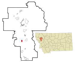
Coordinates: 47°26′24″N 114°10′23″W / 47.44°N 114.17306°WCoordinates: 47°26′24″N 114°10′23″W / 47.44°N 114.17306°W Country United States State Montana County Lake Area – Total 2.0 sq mi (5.2 km2) – Land 2.0 sq mi (5.2 km2) – Water 0.0 sq mi (0.0 km2) Elevation 2,936 ft (895 m) Population (2000) – Total 439 – Density 219.4/sq mi (84.7/km2) Time zone Mountain (MST) (UTC-7) – Summer (DST) MDT (UTC-6) ZIP code 59824 Area code(s) 406 FIPS code 30-13900 GNIS feature ID 0769768 Charlo is a census-designated place (CDP) in Lake County, Montana, United States. The population was 439 at the 2000 census.
Contents
Geography
Charlo is located at 47°26′24″N 114°10′23″W / 47.44°N 114.17306°W (47.440017, -114.173171).[1]
According to the United States Census Bureau, the CDP has a total area of 2.0 square miles (5.2 km2), all of it land.
Charlo is a part of the Flathead Indian Reservation.
Demographics
As of the census[2] of 2000, there were 439 people, 166 households, and 112 families residing in the CDP. The population density was 219.4 people per square mile (84.7/km²). There were 175 housing units at an average density of 87.5 per square mile (33.8/km²). The racial makeup of the CDP was 76.77% White, 1.14% African American, 17.77% Native American, 2.05% from other races, and 2.28% from two or more races. Hispanic or Latino of any race were 2.73% of the population.
There were 166 households out of which 42.8% had children under the age of 18 living with them, 47.6% were married couples living together, 15.7% had a female householder with no husband present, and 32.5% were non-families. 26.5% of all households were made up of individuals and 14.5% had someone living alone who was 65 years of age or older. The average household size was 2.64 and the average family size was 3.22.
In the CDP the population was spread out with 36.0% under the age of 18, 7.3% from 18 to 24, 26.4% from 25 to 44, 18.2% from 45 to 64, and 12.1% who were 65 years of age or older. The median age was 32 years. For every 100 females there were 96.0 males. For every 100 females age 18 and over, there were 97.9 males.
The median income for a household in the CDP was $24,167, and the median income for a family was $32,500. Males had a median income of $25,577 versus $17,250 for females. The per capita income for the CDP was $10,687. About 16.0% of families and 21.2% of the population were below the poverty line, including 23.9% of those under age 18 and 8.1% of those age 65 or over.
Town Events
Each year, residents of Charlo host a 4 July parade and cookout along Main Street (Highway 212). Regular participants include local equestrian units, Charlo 'all school' alumni, representatives from all branches of military service, and the local fire department.
Conservation
Charlo borders several protected areas, including the Herak Waterfowl Production area and Ninepipes Reservoir. These protected areas, along with seasonal flood irrigation provide habitats for various native fauna such as white tail deer, pheasants, bald eagles, and western painted turtles.
References
- ^ "US Gazetteer files: 2010, 2000, and 1990". United States Census Bureau. 2011-02-12. http://www.census.gov/geo/www/gazetteer/gazette.html. Retrieved 2011-04-23.
- ^ "American FactFinder". United States Census Bureau. http://factfinder.census.gov. Retrieved 2008-01-31.
Municipalities and communities of Lake County, Montana Cities 
Town CDPs Arlee | Big Arm | Charlo | Dayton | Elmo | Finley Point | Jette | Kerr | Kicking Horse | Kings Point | Niarada‡ | Pablo | Ravalli | Rocky Point | Rollins | Turtle Lake | Woods Bay
Indian reservation Footnotes ‡This populated place also has portions in an adjacent county or counties
Categories:- Populated places in Lake County, Montana
- Census-designated places in Montana


Wikimedia Foundation. 2010.