- Fenny Drayton
-
Coordinates: 52°34′01″N 1°29′06″W / 52.567°N 1.485°W
Fenny Drayton 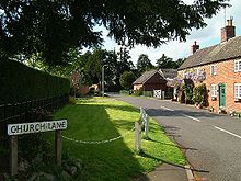
Church Lane, Fenny Drayton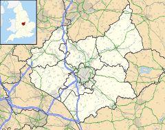
 Fenny Drayton
Fenny Drayton shown within LeicestershireDistrict Hinckley and Bosworth Shire county Leicestershire Region East Midlands Country England Sovereign state United Kingdom Post town NUNEATON Police Leicestershire Fire Leicestershire Ambulance East Midlands EU Parliament East Midlands List of places: UK • England • Leicestershire Fenny Drayton (formerly Drayton-in-the-Clay) is a village in Leicestershire England, in the district of Hinckley and Bosworth. Near to the county border of Warwickshire and using a Warwickshire County postcode, it is just off the A444 road an old Roman road, north of Nuneaton close to its crossroads with the A5 (the Roman road called Watling Street). The hamlet is also crossed by another Roman Road, and is found at the end of the scenic country lane of the Fenn Lanes. It is four miles from the village of Stoke Golding (where King Henry VII was crowned immediately after the Battle of Bosworth Field in 1485).
Contents
Geography
Primary school children mostly attend either the well respected St Margaret's Church of England Primary School in Stoke Golding, or the internationally awarded Dixie Grammar School in nearby Market Bosworth village.
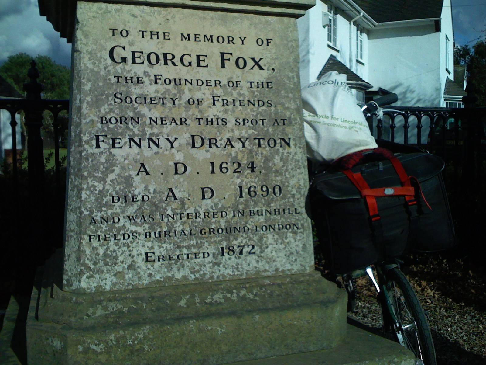
The hamlet church of St Michael and All Angels', Church of England, in the Diocese of Leicester is of a Gothic design, having 12th century Norman features with a 13th century fully operational bell tower and is surrounded by one of the oldest circles of giant [yew] trees in the United Kingdom. George Fox, the founder of the worldwide Quaker (Religious Society of Friends) movement, was born in Fenny Drayton and is reputed to have been baptized in the older of the two fonts in the church. There is a large monument to him in the hamlet where two roads, George Fox Lane and Old Forge Road meet. Quakers from all over the world visit the hamlet and church, and sign the church visitors' book. There are two important monuments of the Purefoy Family dating back to 1543 in the church grounds. One has an incised slab which is very rare. The church is open to the public free of charge by appointment.
The Ordnance Survey have defined the nearby Lindley Hall Farm as the centre point of England.
The Casa Blanca public house, which was renamed The Royal Haven, is now the site of a housing estate.
Centre of England
In 2002 the Ordnance Survey defined 'Lindley Hall farm' as the Geographical Centre of England.[1] (SP362964) In 2003 the Ordnance Survey placed Coton in the Elms, Derbyshire, 24 kilometres (15 mi) north, as the 'furthest point from the sea' in Great Britain.[2][3]
Notable residents
 George Fox memorial
- George Fox, founder of the Religious Society of Friends spent his childhood in Fenny Drayton.
See also
- Coastline of the United Kingdom
- Coton in the Elms, Derbyshire, 24 kilometres (15 mi) north, 'furthest point from the sea' in Great Britain.
References
- ^ Haran, Brady (2002-10-22). "A tale of two centres". BBC News. http://news.bbc.co.uk/1/hi/england/2271925.stm.
- ^ "The farm furthest from the sea". BBC News. 2003-07-23. http://news.bbc.co.uk/1/hi/england/derbyshire/3090539.stm.
- ^ Ordnance Survey - MapZone
External links
- Map sources for Fenny Drayton
Categories:- Hamlets in Leicestershire
- Leicestershire geography stubs


Wikimedia Foundation. 2010.