- Moorhead, Mississippi
-
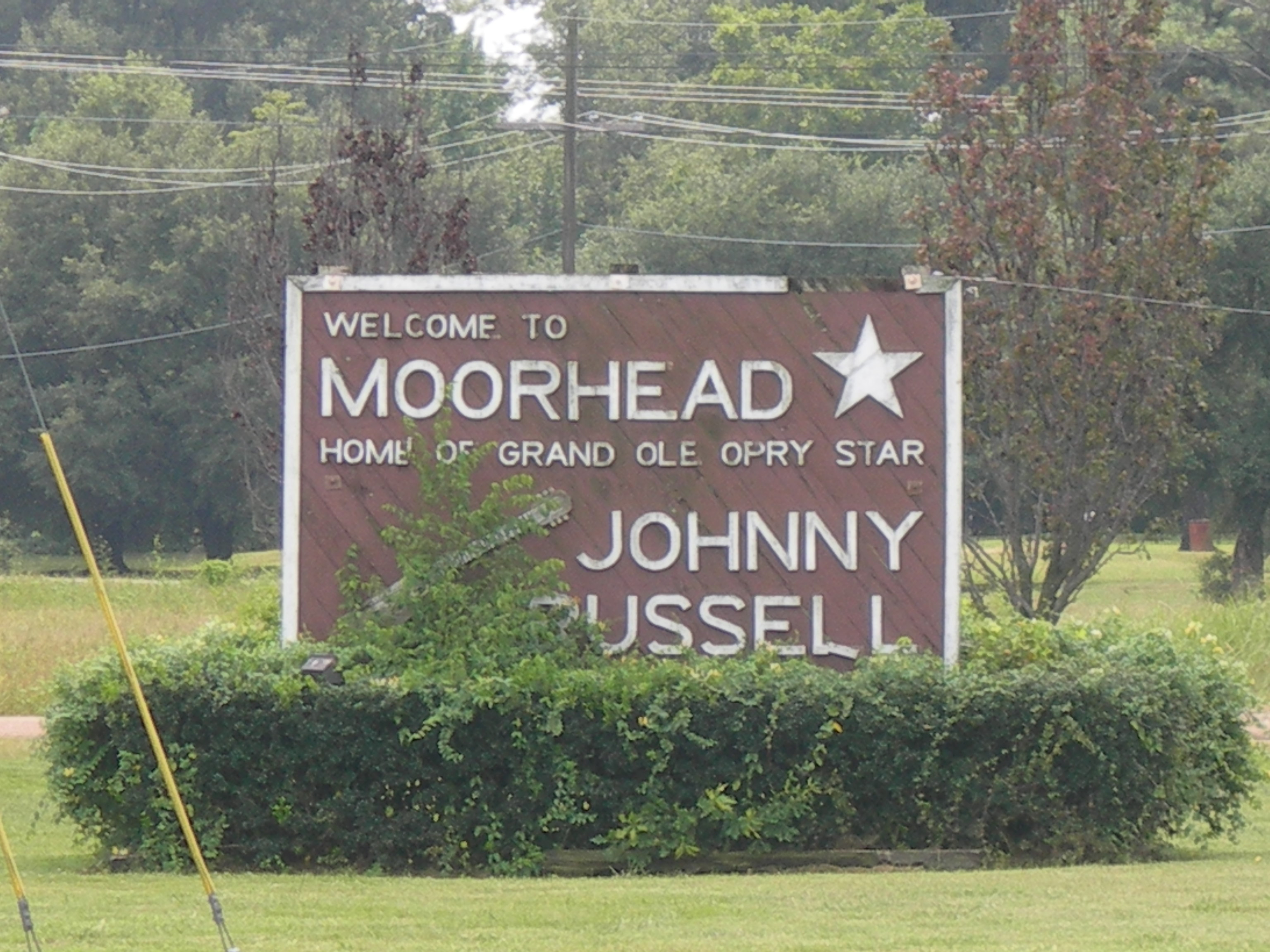
Moorhead, Mississippi — City — Entrance sign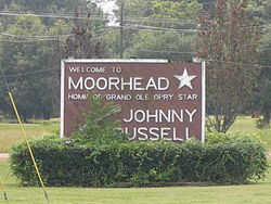 Location of Moorhead, Mississippi
Coordinates: 33°26′57″N 90°30′17″W / 33.44917°N 90.50472°WCoordinates: 33°26′57″N 90°30′17″W / 33.44917°N 90.50472°W Country United States State Mississippi County Sunflower Area – Total 1.3 sq mi (3.4 km2) – Land 1.3 sq mi (3.4 km2) – Water 0.0 sq mi (0.0 km2) Elevation 115 ft (35 m) Population (2000) – Total 2,573 – Density 1,988.9/sq mi (767.9/km2) Time zone Central (CST) (UTC-6) – Summer (DST) CDT (UTC-5) ZIP code 38761 Area code(s) 662 FIPS code 28-48760 GNIS feature ID 0673795 Moorhead is a city in Sunflower County, Mississippi, United States. As of the 2000 census, the city population was 2,573. The city includes the legendary blues crossroads "where the Southern cross the Dog". It claims as a native son musician Johnny Russell.[citation needed]
Contents
Geography
Moorhead is located at 33°26′57″N 90°30′17″W / 33.44917°N 90.50472°W (33.449119, -90.504827)[1].
According to the United States Census Bureau, the city has a total area of 1.3 square miles (3.4 km2), of which, 1.3 square miles (3.4 km2) of it is land and 0.77% is water.
Demographics
As of the census[2] of 2000, there were 2,573 people, 688 households, and 520 families residing in the city. The population density was 1,988.9 people per square mile (770.1/km²). There were 720 housing units at an average density of 556.6 per square mile (215.5/km²). The racial makeup of the city was 20.44% White, 78.97% African American, 0.19% Asian, 0.27% from other races, and 0.12% from two or more races. Hispanic or Latino of any race were 1.24% of the population.
There were 8,391 households out of which 37.6% had children under the age of 18 living with them, 34.7% were married couples living together, 34.7% had a female householder with no husband present, and 24.3% were non-families. 20.3% of all households were made up of individuals and 9.0% had someone living alone who was 65 years of age or older. The average household size was 3.14 and the average family size was 3.67.
In the city the population was spread out with 28.1% under the age of 18, 26.7% from 18 to 24, 21.3% from 25 to 44, 16.3% from 45 to 64, and 7.7% who were 65 years of age or older. The median age was 22 years. For every 100 females there were 88.8 males. For every 100 females age 18 and over, there were 82.8 males.
The median income for a household in the city was $20,401, and the median income for a family was $23,000. Males had a median income of $26,538 versus $17,697 for females. The per capita income for the city was $8,631. About 32.4% of families and 38.0% of the population were below the poverty line, including 46.3% of those under age 18 and 33.5% of those age 65 or over.
Education
The City of Moorhead is served by the Sunflower County School District.[3] Schools serving Moorehead and in Moorhead include James Rosser Elementary School and Moorhead Middle School. Ruleville Central High School in Ruleville is the district's sole high school.[4]
Moorhead is home to Mississippi Delta Community College.
References
- ^ "US Gazetteer files: 2010, 2000, and 1990". United States Census Bureau. 2011-02-12. http://www.census.gov/geo/www/gazetteer/gazette.html. Retrieved 2011-04-23.
- ^ "American FactFinder". United States Census Bureau. http://factfinder.census.gov. Retrieved 2008-01-31.
- ^ "Moorhead Schools." Sunflower County School District. Retrieved on August 17, 2010.
- ^ "Sunflower County." Mississippi Department of Education. Retrieved on August 17, 2010.
External links
Municipalities and communities of Sunflower County, Mississippi Cities 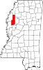
Towns Unincorporated
communitiesBaird | Baltzer | Blaine | Boyer | Caile | Dockery | Dwyer | Fairview | Heathman | Holly Ridge | Kinlock | Linn | Parchman | Rome | Roundaway | Steiner | Stephensville
Ghost towns Cottondale | Inwood
Footnotes ‡This populated place also has portions in an adjacent county or counties
Categories:- Cities in Mississippi
- Populated places in Sunflower County, Mississippi
- Populated places in Mississippi with African American majority populations


Wikimedia Foundation. 2010.