- Doddsville, Mississippi
-
Doddsville, Mississippi — Town — Location of Doddsville, Mississippi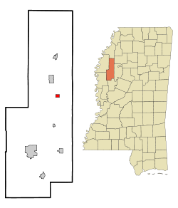
Coordinates: 33°39′27″N 90°31′27″W / 33.6575°N 90.52417°WCoordinates: 33°39′27″N 90°31′27″W / 33.6575°N 90.52417°W Country United States State Mississippi County Sunflower Area – Total 0.8 sq mi (2.0 km2) – Land 0.8 sq mi (2.0 km2) – Water 0.0 sq mi (0.0 km2) Elevation 131 ft (40 m) Population (2000) – Total 108 – Density 141.0/sq mi (54.4/km2) Time zone Central (CST) (UTC-6) – Summer (DST) CDT (UTC-5) ZIP code 38736 Area code(s) 662 FIPS code 28-19420 GNIS feature ID 0669310 Doddsville is a town in Sunflower County, Mississippi, United States. The population was 108 at the 2000 census.
Doddsville was the hometown of longtime United States Senator James Eastland (1943–79).
Contents
Geography
Doddsville is located at 33°39′27″N 90°31′27″W / 33.6575°N 90.52417°W (33.657509, -90.524204)[1].
According to the United States Census Bureau, the town has a total area of 0.8 square miles (2.1 km2), all of it land.
Demographics
As of the census[2] of 2000, there were 108 people, 38 households, and 22 families residing in the town. The population density was 141.0 people per square mile (54.2/km²). There were 40 housing units at an average density of 52.2 per square mile (20.1/km²). The racial makeup of the town was 67.59% African American and 32.41% White.
There were 38 households out of which 34.2% had children under the age of 18 living with them, 36.8% were married couples living together, 21.1% had a female householder with no husband present, and 39.5% were non-families. 31.6% of all households were made up of individuals and 18.4% had someone living alone who was 65 years of age or older. The average household size was 2.84 and the average family size was 3.87.
In the town the population was spread out with 32.4% under the age of 18, 5.6% from 18 to 24, 28.7% from 25 to 44, 19.4% from 45 to 64, and 13.9% who were 65 years of age or older. The median age was 32 years. For every 100 females there were 100.0 males. For every 100 females age 18 and over, there were 82.5 males.
The median income for a household in the town was $19,000, and the median income for a family was $25,250. Males had a median income of $16,250 versus $15,625 for females. The per capita income for the town was $6,359. There were 10.5% of families and 30.7% of the population living below the poverty line, including 38.5% of under eighteens and none of those over 64.
Education
The Town of Doddsville is served by the Sunflower County School District.
As of 2002 some children in Doddsville attended the North Sunflower Academy in unincorporated Sunflower County.[3]
References
- ^ "US Gazetteer files: 2010, 2000, and 1990". United States Census Bureau. 2011-02-12. http://www.census.gov/geo/www/gazetteer/gazette.html. Retrieved 2011-04-23.
- ^ "American FactFinder". United States Census Bureau. http://factfinder.census.gov. Retrieved 2008-01-31.
- ^ "No simple solutions to education, workforce training problems. (Focus Delta & River Cities)." Mississippi Business Journal. May 27, 2002. Retrieved on August 10, 2010.
External links
Municipalities and communities of Sunflower County, Mississippi Cities 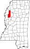
Towns Unincorporated
communitiesBaird | Baltzer | Blaine | Boyer | Caile | Dockery | Dwyer | Fairview | Heathman | Holly Ridge | Kinlock | Linn | Parchman | Rome | Roundaway | Steiner | Stephensville
Ghost towns Cottondale | Inwood
Footnotes ‡This populated place also has portions in an adjacent county or counties
Categories:- Populated places in Sunflower County, Mississippi
- Towns in Mississippi
- Populated places in Mississippi with African American majority populations


Wikimedia Foundation. 2010.