- Coleraine, Minnesota
-
Coleraine, Minnesota — City — Location of Coleraine, Minnesota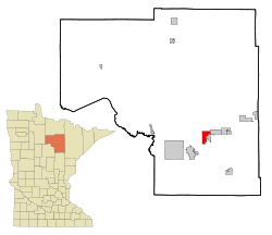
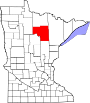
Coordinates: 47°17′27″N 93°25′51″W / 47.29083°N 93.43083°W Country United States State Minnesota County Itasca Area – Total 6.4 sq mi (16.5 km2) – Land 6.2 sq mi (16.1 km2) – Water 0.2 sq mi (0.4 km2) Elevation 1,322 ft (403 m) Population (2010)[1] – Total 1,970 – Density 178.5/sq mi (68.9/km2) Time zone Central (CST) (UTC-6) – Summer (DST) CDT (UTC-5) ZIP code 55722 Area code(s) 218 FIPS code 27-12502[2] GNIS feature ID 0655778[3] Website City of Coleraine MN Web Portal Coleraine is a city in Itasca County, Minnesota, United States. The population was 1,970 at the 2010 census.[1]
U.S. Highway 169 serves as a main arterial route in the city.
It was named by John C. Greenway after Thomas F. Cole, the president of the Oliver Mining Company.
Geography
According to the United States Census Bureau, the city has a total area of 6.4 square miles (17 km2), of which, 6.2 square miles (16 km2) of it is land and 0.2 square miles (0.52 km2) of it (2.51%) is water.
Demographics
Historical populations Census Pop. %± 1910 1,613 — 1920 1,300 −19.4% 1930 1,243 −4.4% 1940 1,325 6.6% 1950 1,321 −0.3% 1960 1,346 1.9% 1970 1,086 −19.3% 1980 1,116 2.8% 1990 1,041 −6.7% 2000 1,110 6.6% 2010 1,970 77.5% U.S. Decennial Census As of the census[2] of 2000, there were 1,110 people, 443 households, and 317 families residing in the city. The population density was 178.5 people per square mile (68.9/km²). There were 462 housing units at an average density of 74.3 per square mile (28.7/km²). The racial makeup of the city was 98.47% White, 0.54% Native American, 0.18% Asian, 0.09% from other races, and 0.72% from two or more races. Hispanic or Latino of any race were 0.81% of the population.
There were 443 households out of which 32.7% had children under the age of 18 living with them, 59.1% were married couples living together, 9.9% had a female householder with no husband present, and 28.4% were non-families. 23.9% of all households were made up of individuals and 13.5% had someone living alone who was 65 years of age or older. The average household size was 2.51 and the average family size was 3.00.
In the city the population was spread out with 25.9% under the age of 18, 8.5% from 18 to 24, 26.0% from 25 to 44, 22.5% from 45 to 64, and 17.1% who were 65 years of age or older. The median age was 37 years. For every 100 females there were 98.6 males. For every 100 females age 18 and over, there were 94.6 males.
The median income for a household in the city was $38,681, and the median income for a family was $52,361. Males had a median income of $39,875 versus $22,353 for females. The per capita income for the city was $16,514. About 6.4% of families and 9.8% of the population were below the poverty line, including 10.7% of those under age 18 and 11.2% of those age 65 or over.
References
- ^ a b "2010 Census Redistricting Data (Public Law 94-171) Summary File". American FactFinder. U.S. Census Bureau, 2010 Census. http://factfinder2.census.gov/faces/tableservices/jsf/pages/productview.xhtml?pid=DEC_10_PL_GCTPL2.ST13&prodType=table. Retrieved 23 April 2011.
- ^ a b "American FactFinder". United States Census Bureau. http://factfinder.census.gov. Retrieved 2008-01-31.
- ^ "US Board on Geographic Names". United States Geological Survey. 2007-10-25. http://geonames.usgs.gov. Retrieved 2008-01-31.
Municipalities and communities of Itasca County, Minnesota Cities Bigfork | Bovey | Calumet | Cohasset | Coleraine | Deer River | Effie | Grand Rapids | Keewatin | La Prairie | Marble | Nashwauk | Squaw Lake | Taconite | Warba | Zemple
Townships Alvwood | Arbo | Ardenhurst | Balsam | Bearville | Bigfork | Blackberry | Bowstring | Carpenter | Deer River | Feeley | Good Hope | Goodland | Grand Rapids | Grattan | Greenway | Harris | Iron Range | Kinghurst | Lake Jessie | Lawrence | Liberty | Lone Pine | Marcell | Max | Moose Park | Morse | Nashwauk | Nore | Oteneagen | Pomroy | Sago | Sand Lake | Spang | Splithand | Stokes | Third River | Trout Lake | Wabana | Wawina | Wildwood | Wirt
Unorganized
territoriesUnincorporated
communitiesIndian
reservationsCoordinates: 47°17′20″N 93°25′40″W / 47.28889°N 93.42778°W
Categories:- Cities in Minnesota
- Populated places in Itasca County, Minnesota
- Mining communities in Minnesota


Wikimedia Foundation. 2010.