- Dry Falls
-
For Dry Falls in Macon County, NC, see Dry Falls (Macon County).
Dry Falls 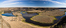
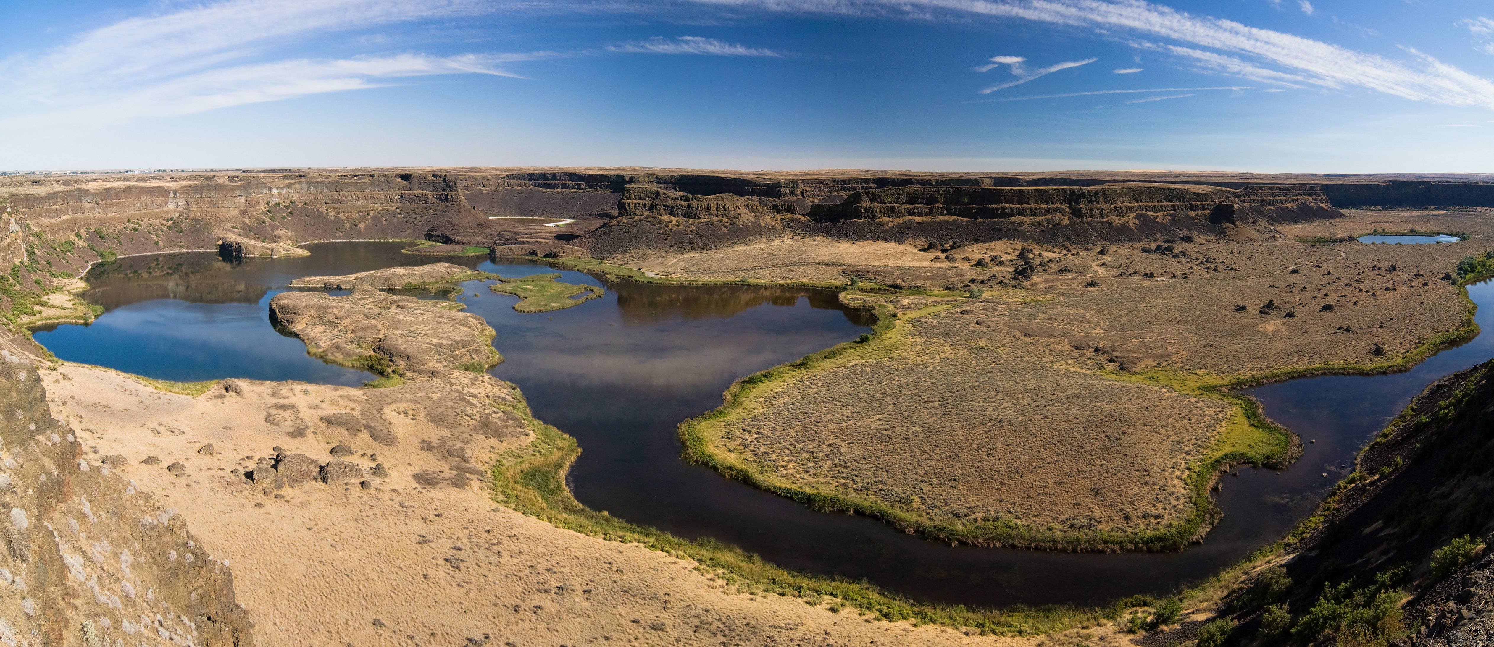
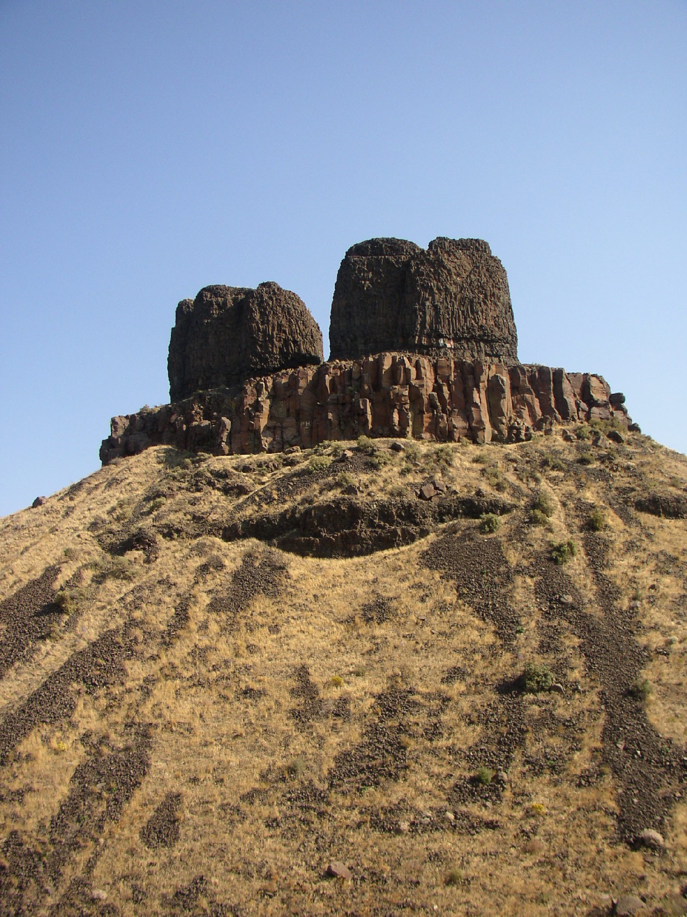
During the Ice Age Floods, Dry Falls was under 300 feet (91 m) of water approaching at a speed of 65 miles per hour.Location Grant County, Washington, USA Type Block Elevation 1510 feet (460 m) Total height 400 feet (121 m) Total width 3.5 miles (5.63 km) Average flow rate extinct Dry Falls is a 3.5 mile long scalloped precipice in central Washington, on the opposite side of the Upper Grand Coulee from the Columbia River, and at the head of the Lower Grand Coulee. Ten times the size of Niagara, Dry Falls is thought to be the greatest known waterfall that ever existed. According to the current geological model, catastrophic flooding channeled water at 65 miles per hour through the Upper Grand Coulee and over this 400-foot (120 m) rock face at the end of the last ice age. At this time, it is estimated that the flow of the falls was ten times the current flow of all the rivers in the world combined.
Nearly twenty thousand years ago, as glaciers moved south, an ice sheet dammed the Clark Fork (river) near Sandpoint, Idaho. Consequently, a significant portion of western Montana flooded, forming the gigantic Lake Missoula. About the same time, Glacial Lake Columbia was formed on the ice-dammed Columbia River behind the Okanogan lobe of the Cordilleran Ice Sheet. Lake Columbia's overflow – the diverted Columbia River – drained first through Moses Coulee and as the ice dam grew, later through the Grand Coulee.
Eventually, water in lake Missoula rose high enough to float the ice dam until it gave way, and a portion of this cataclysmic flood spilled into Glacial Lake Columbia, and then down the Grand Coulee. It is generally accepted that this process of ice-damming of the Clark Fork, refilling of Lake Missoula and subsequent cataclysmic flooding happened dozens of times over the years of the last Ice Age.[1][2]
This sudden flood put parts of Idaho, Washington, and Oregon under hundreds of feet of water in just a few days. These extraordinary floods greatly enlarged the Grand Coulee and Dry Falls in a short period. The large plunge pools at the base of Dry Falls were created by these floods.
Once the ice sheet that obstructed the Columbia melted, the river returned to its normal course, leaving the Grand Coulee and the falls dry. Today, this massive cliff can be viewed from the Dry Falls Interpretive Center, part of Sun Lakes State Park, and located on Route 17 near the town of Coulee City. Admission is free.
References
- Allen, John Eliot; Burns, Majorie; and Sargent, Sam C. (1986). Cataclysms on the Columbia. Portland: Timber Press. ISBN 0-88192-215-3.
External links
Ice Age Floods National Geologic Trail in the Pacific Northwest Ice Age Glacial Floods 
Glacial Lakes Temporary Lakes Ice Age Floods Glacial Residue Ice Age Floods Erosion & Deposition Features Moses Coulee • Channeled Scablands • Grand Coulee • Dry Falls • Drumheller Channels • Crab Creek • Corfu Slide • Palouse Falls • Touchet Formation • Wallula Gap • Columbia River Gorge • Alameda RidgeRelated contemporaneous events Bonneville Flood
Coordinates: 47°36′20.61″N 119°21′13.12″W / 47.605725°N 119.3536444°WCategories:- Geology of Washington (state)
- Waterfalls of Washington (state)
- Landforms of Grant County, Washington
- Visitor attractions in Grant County, Washington
Wikimedia Foundation. 2010.