- Drewsteignton
-
Coordinates: 50°42′11″N 3°47′20″W / 50.703°N 3.789°W
Drewsteignton 
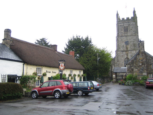
Centre of Drewsteignton, showing the Drewe Arms and Holy Trinity Church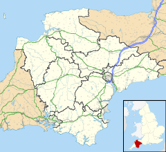
 Drewsteignton
Drewsteignton shown within DevonPopulation 818 [1](2001 Census) OS grid reference SX736908 - London 190 miles (306 km) Parish Drewsteignton District West Devon Shire county Devon Region South West Country England Sovereign state United Kingdom Post town EXETER Postcode district EX6 Dialling code 01647 Police Devon and Cornwall Fire Devon and Somerset Ambulance South Western EU Parliament South West England UK Parliament Torridge and West Devon List of places: UK • England • Devon Drewsteignton is a village and civil parish within the administrative area of West Devon, England, also lying within the Dartmoor National Park. It is located in the Teign valley, 13 miles (21 km) west of Exeter and 9 miles (14 km) south east of Okehampton. It is known for its attractive scenery, for its picturesque village centre, and for the nearby attractions of Castle Drogo and the beauty spot of Fingle Bridge.
Contents
History
Settlement in the area dates back to the Neolithic period. Spinster's Rock at Shilston, within the parish, is a Neolithic chambered tomb dating from around 3000 BC, and there are stone circles of similar date in the area. Later, an Iron Age hill fort, now known as Prestonbury Castle, was developed on the end of a prominent ridge.[2]
The village was mentioned in the Domesday Book as "Taintone", meaning a village beside the Teign. By the 13th century it was known as "Teyngton Drue", part of the name coming from a local landowner Drogo, also known as Drewe de Teignton.[3] In later years a myth developed, encouraged by the presence of the archaeological remains, that the "Drew" part of the name derived from the presence of druids, but there is no evidence to support this.
In mediaeval times, the village was relatively prosperous. It was important as a wool producing area, and there were also limestone quarries and a small tin mine. The village was a stopping place on the old road from Exeter to Okehampton.[4] Much of the village building is of granite, as is Fingle Bridge, over the Teign, which was built in the 16th or 17th century.[2] Historically the village formed part of Wonford Hundred.[5]
The parish church of Holy Trinity dates mostly from the 15th century, with some later rebuilding.[6] The village square adjoining the church may date from the original formation of the settlement. Census information indicates that Drewsteignton underwent prolonged depopulation through the 19th century, and many of its buildings have remained largely unchanged since then. The centre was designated as a conservation area in 1972.[4]
Among the village buildings is the Drewe Arms, a pub retaining many historic features. Previously known as The Druids' Arms, the name was changed in the 1920s when Julius Drewe built Castle Drogo, his family home. The pub was managed by Mabel Mudge, originally with her husband, from 1919 until 1994 when she retired at the age of 99, the oldest pub landlady in the country.[7]
Sculptor Peter Randall-Page lives nearby, and a number of his works can be viewed in the area, including the bench, table and bird bath in the village's community garden.
See also
References
External links
 Media related to Drewsteignton at Wikimedia Commons
Settlements of Dartmoor, Devon Ashburton · Belstone · Bovey Tracey · Brentor · Bridestowe · Buckfastleigh · Buckland-in-the-Moor · Chagford · Drewsteignton · Gidleigh · Haytor · Hexworthy · Holne · Ilsington · Ivybridge · Lustleigh · Lydford · Manaton · Mary Tavy · Moretonhampstead · Okehampton · Peter Tavy · Ponsworthy · Postbridge · Poundsgate · Princetown · Shaugh Prior · Sheepstor · Sourton · South Brent · South Tawton · South Zeal · Sticklepath · Tavistock · Walkhampton · Widecombe-in-the-Moor · Yelverton
Categories:- Villages in Devon
- Dartmoor

Wikimedia Foundation. 2010.