- Rowe, Massachusetts
Infobox Settlement
official_name = Rowe, Massachusetts
nickname =
motto =
imagesize =
image_caption = Adams Mountain, with Pelham Lake in the foreground
image_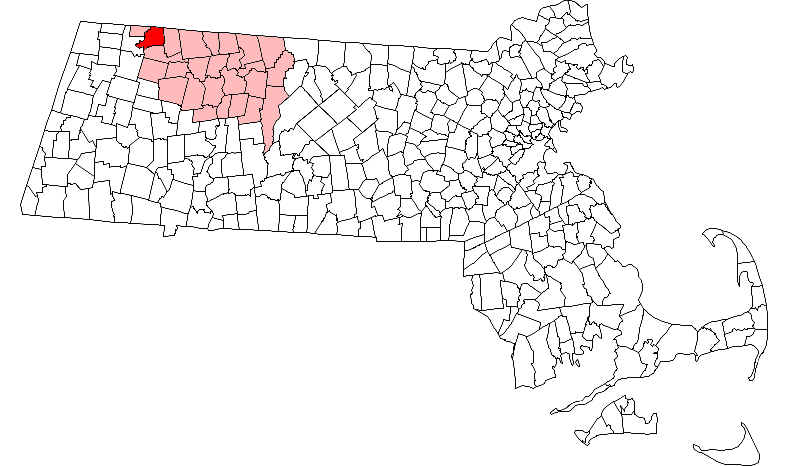
mapsize = 250px
map_caption = Location in Franklin County in Massachusetts
mapsize1 =
map_caption1 =
subdivision_type = Country
subdivision_name =United States
subdivision_type1 = State
subdivision_name1 =Massachusetts
subdivision_type2 = County
subdivision_name2 = Franklin
established_title = Settled
established_date = 1762
established_title2 = Incorporated
established_date2 = 1785
established_title3 =
established_date3 =
government_type =Open town meeting
leader_title =
leader_name =
leader_title1 =
leader_name1 =
area_magnitude =
area_total_km2 = 62.3
area_total_sq_mi = 24.1
area_land_km2 = 61.0
area_land_sq_mi = 23.6
area_water_km2 = 1.3
area_water_sq_mi = 0.5
population_as_of = 2000
settlement_type = Town
population_total = 351
population_density_km2 = 5.8
population_density_sq_mi = 14.9
elevation_m = 416
elevation_ft = 1364
timezone = Eastern
utc_offset = -5
timezone_DST = Eastern
utc_offset_DST = -4
latd = 42 |latm = 41 |lats = 36 |latNS = N
longd = 72 |longm = 54 |longs = 00 |longEW = W
website = http://www.rowe-ma.gov/
postal_code_type = ZIP code
postal_code = 01367
area_code = 413
blank_name = FIPS code
blank_info = 25-58335
blank1_name = GNIS feature ID
blank1_info = 0618174
footnotes =Rowe is a town in Franklin County,
Massachusetts ,United States . The population was 351 at the 2000 census. It is part of theSpringfield, Massachusetts Metropolitan Statistical Area.History
Rowe was the site of fishing and foraging for local Native American tribes. The area was first visited by white settlers in 1744, and was the site of a fort to guard against raids. In 1762, the town lands were purchased by the Rev. Cornelius Jones, who named it "Myrifield" after the Greek word for "thousand." The town had enough settlers by 1785 to have it incorporated as a town, renamed by the
Massachusetts General Court presumably for John Rowe, a prominent Boston merchant. The town of Rowe grew around mills on the river, but also had other industries, including sulfur, talc and soapstone mining. This was nowhere more evident than in the now abandoned settlement at the Davis Mine. In the late 1880s, with the addition of the railroad along the river, the area had become somewhat of a small resort town. But, by the advent of the 1900's, most industry had begun to dry up, leaving the town fairly rural until the 1950s. At that point, with the "baby boom" underway, Rowe became the site ofYankee Rowe Nuclear Power Station , the firstnuclear power plant in New England, near the Sherman Dam along the Vermont border. The plant was in operation from 1960 to 1992, and the plant is now completely decommissioned, with the nuclear waste set to be transported to Yucca Mountain's containment facilities upon their completion in 2020. [ [http://www.rowe-ma.gov/Pages/RoweMA_WebDocs/facts Town of Rowe, Massachusetts - A Brief Town History] ]Neighborhoods
The following are locally known neigborhood/village areas within the Rowe town borders:
* Camp Rowe coord|42.690|N|72.898|W
* Davis coord|42.683|N|72.865|W
* Monroe Bridge coord|42.722|N|72.941|W
* Rowe coord|42.693|N|72.900|W
* Zoar coord|42.653|N|72.931|WGeography
According to the
United States Census Bureau , the town has a total area of 24.1square mile s (62.3km² ), of which, 23.5 square miles (61.0 km²) of it is land and 0.5 square miles (1.3 km²) of it (2.16%) is water. Rowe lies along the northern border of Franklin County and Massachusetts, bordered by Windham County,Vermont to the north and along the western border of the county with Berkshire County. The town is bordered by Whitingham,Vermont to the north, Heath to the east, Charlemont to the south, and Florida and Monroe to the west. Rowe is located 23 miles west-northwest of Greenfield, 53 miles north-northwest of Springfield, and 112 west-northwest of Boston.Rowe lies along the eastern bank of the
Deerfield River , which is dammed near the Vermont border to form the Sherman Reservoir. The town also has two other large bodies of water, the Upper Bear Swamp Reservoir and Pelham Lake, which feeds Pelham Brook, a tributary of the river. The town is hilly, with two main ridges on either side of Pelham Brook. Near the southwest corner of town is Negus Mountain, along the western ridge, and along the eastern ridge lies Todd Mountain and Adams Mountain, the highest point in town. Much of the land southeast of Pelham Lake is part of the Pelham Lake Park, which extends to the mountains. There are also two small units of Monroe State Forest in town.Rowe is one of a handful of small towns in Massachusetts which has no state highways. (Nearly half of these towns are on
Martha's Vineyard andNantucket , with the majority of the rest in Central and Western Massachusetts.) The nearest state highways are Route 8A, which runs through neighboring Heath, and Route 2 (theMohawk Trail ), which runs through Charlemont and Florida. The nearest interstate,Interstate 91 , passes through the center of the county, near the junction of the Deerfield River and theConnecticut River . A short section of railroad tracks leading westward to theHoosac Tunnel passes through the southwest corner of town, but the town is otherwise not served by rail, bus or air service. The nearest bus and small air service is in North Adams, the nearestAmtrak service is in Pittsfield, and the nearest national air serivce can be reached atAlbany International Airport in New York.Demographics
As of the
census GR|2 of 2000, there were 351 people, 154 households, and 105 families residing in the town. By population, Rowe ranks 24th out of the 26 cities and towns in Franklin County, and 344th out of the 351 cities and towns in Massachusetts. Thepopulation density was 14.9 people per square mile (5.8/km²), which ranks 24th in the county and 345th in the Commonwealth. There were 209 housing units at an average density of 8.9/sq mi (3.4/km²). The racial makeup of the town was 99.72% White, 0.28% from other races. Hispanic or Latino of any race were 1.14% of the population.There were 154 households out of which 22.7% had children under the age of 18 living with them, 59.1% were married couples living together, 5.8% had a female householder with no husband present, and 31.8% were non-families. 26.0% of all households were made up of individuals and 11.0% had someone living alone who was 65 years of age or older. The average household size was 2.28 and the average family size was 2.75.
In the town the population was spread out with 19.7% under the age of 18, 4.3% from 18 to 24, 21.1% from 25 to 44, 36.2% from 45 to 64, and 18.8% who were 65 years of age or older. The median age was 48 years. For every 100 females there were 90.8 males. For every 100 females age 18 and over, there were 93.2 males.
The median income for a household in the town was $41,944, and the median income for a family was $53,750. Males had a median income of $32,143 versus $28,438 for females. The
per capita income for the town was $28,134. None of the families and 2.8% of the population were living below thepoverty line , including no under eighteens and 3.1% of those over 64.Government
Rowe employs the
open town meeting form of government, and is led by aboard of selectmen . The town has a police station, which also patrols neighboring Monroe, as well as a fire station, a library connected to the regional library network, and a post office, all of which are located near the Town Hall at the center of town. The nearest hospital, North Adams Regional Hospital, is located in North Adams.On the state level, Rowe is represented in the
Massachusetts House of Representatives as part of the First Berkshire district, which includes the northern portion of Berkshire County as well as several towns in northwest Franklin County. In theMassachusetts Senate , the town is part of the Berkshire, Hampshire and Franklin district, which includes all of Berkshire County and the western portions of Hampshire and Franklin Counties. [ [http://www.mass.gov/legis/city_town.htm List of Massachusetts Legislators by City and Town] ] The town is patrolled by the Second (Shelburne Falls) Station of Troop "B" of theMassachusetts State Police . [ [http://www.mass.gov/?pageID=eopsterminal&L=5&L0=Home&L1=Law+Enforcement+%26+Criminal+Justice&L2=Law+Enforcement&L3=State+Police+Troops&L4=Troop+B&sid=Eeops&b=terminalcontent&f=msp_divisions_field_services_troops_troop_b_msp_field_troop_b_station_b2&csid=Eeops Station B-2, SP Shelburne Falls] ]On the national level, Rowe is represented in the
United States House of Representatives as part ofMassachusetts's 1st congressional district , and has been represented byJohn Olver of Amherst since June 1991. Massachusetts is represented in theUnited States Senate by senior SenatorTed Kennedy and junior SenatorJohn Kerry .Education
Rowe's school system is a sub-system in the nine-town Mohawk Trail Regional School District, which serves much of western Franklin County. Town students attend the Rowe Elementary School from pre-kindergarten through sixth grades, and all students in the district attend
Mohawk Trail Regional High School in Buckland. There is a private academy in neighboring Charlemont, and other private and religious schools in nearby North Adams.The nearest community college,
Greenfield Community College , is located in Greenfield. The nearest state college isMassachusetts College of Liberal Arts in North Adams, and the nearest state university is theUniversity of Massachusetts Amherst . The nearest private college isWilliams College in Williamstown, with several others located southeast in the Northampton area.Points of interest
* Rowe Camp and Conference Center is a Unitarian Universalist organization in operation since 1924. It is a 501(c)3 non-profit, offering a variety of
summer camp options for youth, as well as adult conferences and retreats. [ [http://www.rowecenter.org/ Rowe Camp and Conference Center] ]References
Wikimedia Foundation. 2010.