- Redland City Council
Infobox Australian Place | type = lga
name = Redland City Council
state = qld
imagesize= 200
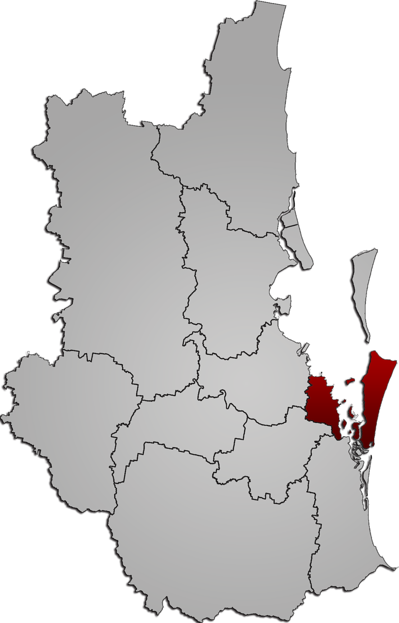
caption = Map of Redland City inSouth East Queensland
pop = 132,971 (2006)
area = 537
est =
seat = Cleveland
mayor = Melva Hobson
region =South East Queensland
logo =
url = http://www.redland.qld.gov.au/
stategov =
fedgov =
near-nw = Brisbane
near-n = "Moreton Bay "
near-ne = "Pacific Ocean "
near-w = Brisbane
near-e = "Pacific Ocean "
near-sw = Logan
near-s = Gold Coast
near-se = "Pacific Ocean "Redland City is a Local Government Area of
South East Queensland , spread along the southern coast ofMoreton Bay covering 537 square kilometres. Between the cities ofBrisbane to the north, Logan to the west, and the Gold Coast to the south, it is part of the fastest growing area in Queensland and one of the fastest growing in Australia.Ref|abs An attractive area with reasonably safe boating and a pleasant rural hinterland, theCity had an estimated population of 127,627 in 2006,Ref|abs2 four times the number of residents it had as a rural community 25 years ago. An increasing proportion of these new residents are retirees from the southern states of Australia. Fact|date=February 2008As part of the
Queensland Government 's wide-ranging local government reforms Redland Shire Council became Redland City Council on March 14, 2008. cite web
year = 2007
url = http://www.strongercouncils.qld.gov.au/Portals/0/ReformDocuments/Redland_rationale.pdf
title = Redland City Council
format = PDF
publisher = Local Government Reform Commission (Queensland)
accessdate = 2007-08-02]Geography
Although 95% of the population resides on the mainland grouped around the major centres at Capalaba, Cleveland and Victoria Point, over six thousand have chosen to live on six islands in Moreton Bay that are part of the council. These are North Stradbroke, one of the world's largest sand islands, which fronts the Coral Sea, Coochiemudlo and the
Southern Moreton Bay Islands of Karragarra, Lamb, Russell and Macleay.uburbs
Redland City has a total of 21 communities.
*Alexandra Hills
*Amity Point
*Birkdale
*Capalaba
*Cleveland
*Coochiemudlo Island
*Dunwich
*Karragarra island
*Lamb Island
*Macleay Island
*Mount Cotton
*Ormiston
*Point Lookout
*Raby Bay
*Redland Bay
*Russell Island
*Sheldon
*Thorneside
*Thornlands
*Victoria Point
*Wellington PointEconomy
Redland City has a range of industriesRef|invest_au on the mainland including food and beverage processing, white goods (Fisher & Paykel Manufacturing) and specialist manufacturing. In primary production, Redland hosts 30% of Queensland's
poultry industry production and produces 18.9% of itssweet potato es. It has a number of big plant nurseries geared to the export market and a significant cultivation of cut flowers.With the increasing proportion of retirees, retirement and
aged care facilities, professional and general services have become major employment businesses.Tourism is rapidly becoming a key industry. North Stradbroke Island, one of the world's largest sand islands is a major drawcard for visitors despite most of the south of the island being tied up insand mining leases and water catchments.Small businesses represent two thirds of the economy; nearly 16% of the concil's workforce is self-employed. Fact|date=May 2008 With the increase in population a significant part of the workforce are in the building trades constructing new homes. Fact|date=May 2008
Other industries include
local government , government department regional offices, and government services such as those associated with health and education.Local government
Redland City Council has a Mayor, and a councillor for each of its 10 divisions.Elections are held every four years and voting is compulsory.The current Mayor is
Melva Hobson .Election issues ranged over: environment and lifestyle, population growth, development area ("footprint") and rates reform. Fact|date=August 2007
History
The
Indigenous Australians of theQuandamooka have lived on and around what is now Redland City for tens of thousands of years.Europeans came to Moreton Bay with the desire to expand the British trading empire as
Australia was a good source of timber and other resources. Moreton Bay was also used as a penal settlement to take pressure off southern parts of the continent. As a result the Moreton Bay Penal Settlement was established in 1824 at Redcliffe Point, moving some months later to what is nowBrisbane .By 1842 the Moreton Bay district was opened to free
settler s, withimmigration actively encouraged. Land was offered for sale, particularly in potential farming andgrazing areas. The Redlands area became very attractive, partly because it was on or near majorwaterway s and partly because of the rich soil.tate capital?
The administrative centre of Redlands, Cleveland was established in 1851. Argument for and against the continuing transportation of convicts to Moreton Bay was raging at the time, and many thought that this town should become the port for the free settlers. [http://www.parliament.nsw.gov.au/prod/parlment/members.nsf/0/52410438F2DD804BCA256F330019281E Henry Stuart Russell] ,
Member of Parliament for the area at the time, said that GovernorSir George Gipps decided to visit Cleveland before proceeding toBrisbane to make a decision about the port but had to wade through extensive mud flats to get ashore::Floundering and flopping through such a hundred years of deep nastiness was quite enough to settle the question between Brisbane and its rival.Ref|rsc_history_since_1950ettlement spreads
Farmers and graziers began moving to other parts of the Redlands, with the first land sales in Capalaba in 1853 attracting farming and especially dairying families. Large tracts of land in the southern part of the Shire were leased for
cotton andsugar , especially aroundRedland Bay and on the southern Moreton Bay islands. By the 1870s much of the best arable land on the mainland and the islands was occupied, first by cotton growers and then by sugar plantations. Timbergetters were also active, particularly in the southern and western areas. Supplementing farming and timbergetting was a thrivingoyster operation around the southern bay.Farming evolves
By the late 1880s sugar was being replaced by
fruit crops, especiallypineapple s,banana s,custard apple s andcitrus . The soil dictated the produce: the red soil areas were best for crops; the poorer grey soiled areas, especially in the west of the district, suited dairy farmers.On the islands, Europeans and
Indigenous Australians operated very successful dugong, oyster and other fishing enterprises.In 1889 the railway came through the north of the district, terminating at Cleveland. The train also made commuting to the city possible, and many early subdivisions took place along the railway line. In addition, various businesses were established to cater for the
holiday trade.By the turn of the century the district had a solid reputation as a producer of fine fruits and vegetables, with dairy farms and animal husbandry located in the north of the Shire.
Small crop farming was the major economic activity in Redland City until well after
World War II . Just before the war, poultry became an important industry and, to a lesser extent,pig farming.Sand mining began onNorth Stradbroke Island in the early 1960s and continues to this day.Redland gets water
A major spur for the change from a rural to urban development was the building of the
Leslie Harrison Dam in 1968 on Tingalpa Creek beside the suburb ofCapalaba Ref|rsc_history_since_1950 and later supplemented by piping water from North Stradbroke Island in 1991. Abundant town water was now available so, over time, the City's farms have disappeared, replaced by subdivisions.Along with the growth have come the many services and industries required by major urban populations and accompanying businesses.
Conservation
At the same time, the Shire has become more aware of its heritage. The preservation of a range of natural areas or culturally significant sites has been undertaken including national and marine parks, reserves, wetlands, conservation areas and environmental parks.
The Shire is now recognised as the "
koala capital of Australia" due to the number of koalas within the urbanised environment and the council keeps a close eye on the numbers. There is no where else in the world where so many people consistently interact with a natural population of koalas.Russell Island real estate scam
In the late 1970s a major real estate scandal broke on the southern Moreton Bay Islands, whichat the time was not under any direct local government authority.Interest in the islands surged when the Queensland government promised that a bridge would be built to Russell Island and across to North Stradbroke.Land developers bought, subdivided and sold thousands of residential blocks, but laterhundreds of the blocks were found to be substantially underwater at high tide. The southern Moreton Bay islands were subsumed into Redlands Shire in 1973 where the disputes arising from the subdivisions continue.
The Russell Island fraud conspiracy trial over the worst of the subdivisions ended in March 1983 without a verdict.Eight people had been accused of conspiring to defraud the public by deceitfully inducing people to buy land on Russell Island between 1968 and 1979. It was the longest fraud trial in the history of British justice.Ref|russell_island_fraud
The Redland City Council has since resumed hundreds of the affected blocks.It remains under pressure from some block owners to build a bridge to Russell Island.
Native title
In 1997 the Council signed an agreement to recognize Quandamooka people's claim over areas of land and waters in Moreton Bay including the economically important
North Stradbroke Island (Minjerribah). It was the first such commitment between an Australian local council and a native title claimant to work through the many issues.ref|native_titleReferences
#Note|abs [http://www.abs.gov.au/ausstats/abs@.nsf/b06660592430724fca2568b5007b8619/30cf51a9a851f120ca256ec2007f13ba!OpenDocument Australian Bureau of Statistics] However, more uptodate projections can be found on the Redlands Planning Scheme Page 2 - Part 3 – Desired Environmental Outcomes, Division 2 – Strategic Framework. The 1500+ pages of the planning scheme can be downloaded from the [http://www.redland.qld.gov.au Redland Shire Council]
#Note|abs2 [http://www.abs.gov.au/AUSSTATS/abs@.nsf/DetailsPage/305502003?OpenDocument&tabname=Details&prodno=30550&issue=2003&num=&view=&|Australian Australian Bureau of Statistics]
#Note|invest_auInvest Australia: Redland Shire Council Profile 2002
#Note|rsc_history_to_1950 [http://www.redland.qld.gov.au/Corp/Residents+Info/History/Our+suburbs Redland Council history timelines]
#Note|russell_island_fraud"The Russell Island Land Fraud" in Grabosky, Peter (ed.) Sutton, Adam (ed.): Stains on a white collar, The Federation Press, 1989, Annandale, NSW,ISBN 1-86287-009-8.
#Note|native_title [http://www.nativetitle.edu.au/community/c_quandamooka.html Native Title study] [http://www.redland.qld.gov.au/minjerribah_nsi.cfm?doc_id=431 Current status of the process]External links
* [http://www.redland.qld.gov.au/ Redland Shire Council]
Wikimedia Foundation. 2010.