- Bannered routes of U.S. Route 71
-
U.S. Route 71
Highway system United States Numbered Highways
List • Bannered • Divided • ReplacedA total of fourteen bannered routes of U.S. Route 71 exist.
Alexandria bypass

U.S. Highway 71 Bypass
Location: Alexandria, Louisiana Bypass 71 is a controlled access highway at Alexandria, Louisiana. Its northern terminus is an interchange with Interstate 49 and U.S. Routes 71 and 165 north of Alexandria. Its southern terminus is at an interchange with Interstate 49 and U.S. Routes 71 and 167 south of Alexandria. Bypass 71 runs a total distance of approximately 6 miles (9.7 km) and is concurrent with I-49 its whole length. It is not signed along the route.
Alexandria business loop

U.S. Highway 71 BusinessLocation: Alexandria, Louisiana Waldron business loop
U.S. Highway 71B
Location: Waldron, Arkansas Business U.S. 71 in Waldron runs approximately 7 miles (11 km) beginning at U.S. 71 2½ miles north of Waldron and ending at U.S. 71 4½ miles south of Waldron. Signed locally as Main Street, it was created in 1971 after U.S. 71 was rerouted around the west side of town.
Fort Smith business loop
U.S. Highway 71BLocation: Fort Smith, Arkansas U.S. 71 Business runs approximately 13 miles (21 km) between Alma, Arkansas and Fort Smith, Arkansas Its northern terminus is at Interstate 40 and U.S. Highway 71 at Alma and its southern terminus is at Interstate 540 and U.S. 71 in south Fort Smith. Highway 71 Business passes through the towns of Alma, Van Buren and Fort Smith. One half mile south of I-40 at Alma, U.S. 71 Business intersects U.S. Highway 64 and overlaps it to downtown Fort Smith and the junction of Arkansas Highway 22.
Within the city of Fort Smith, U.S. 71 Business is commonly referred to by the names of Midland Boulevard (north of downtown), North 10th (one-way north-to-south) & North 11th Streets (one-way south-to-north) within downtown, Towson Avenue (south of downtown) and Zero Street (beginning at the intersection of U.S. Highway 271 and Arkansas Highway 255).
Northwest Arkansas business route
U.S. Highway 71BLocation: Northwest Arkansas Length: 34.27 mi[1] (55.15 km) Existed: 1971–present U.S. Route 71 Business in Fayetteville–Springdale–Rogers Metropolitan Area is a business route of U.S. Route 71 that spans 34.27 miles (55.15 km).[2][3] US 71B begins in south Fayetteville when US 71 angles west to become the Fulbright Expressway with US 62 and I-540 (Future I-49).[4] US 71B meets AR 265 (Cato Springs Rd.), AR 16 and AR 180 before entering downtown Fayetteville. US 71B becomes a main promenade through town as College Avenue passing AR 45 along the way
As College Avenue, US 71B passes the Evelyn Hills Shopping Center, Fiesta Square, Spring Creek Centre, the Northwest Arkansas Mall, and Lake Fayetteville. Entering Springdale the route crosses by the Springdale Country Club before meeting and briefly concurring with US 412. After this, US 71B continues north to meet AR 264 in Bethel Heights.
US 71B becomes Bloomington Street in Lowell as it continues north to New Hope Road, AR 94. Entering Rogers US 71B meets US 62/AR 12 becoming Walnut Street and turning east. Walnut Street continues by St. Mary's Hospital and Dixieland Mall to cross over I-540 to enter Bentonville.
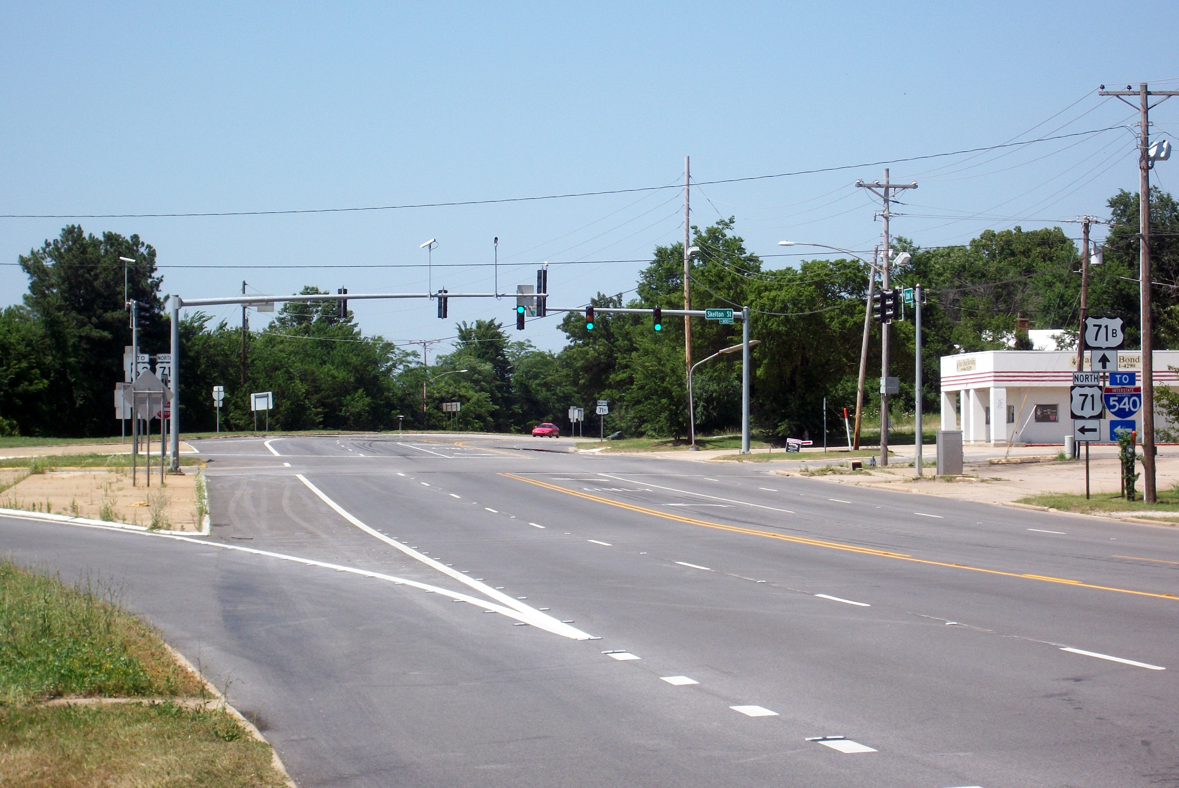
US 71B meets AR 112, AR 72, and AR 102 near the Bentonville Municipal Airport when arrowing north. Becoming Walton Boulevard, US 71B crosses Central Avenue before again meeting I-540/US 71 and terminating at Exit 93.
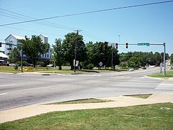
 Southern terminus of US 71B in south Fayetteville.
 US 71B intersects Martin Luther King Jr Blvd in Fayetteville at a busy intersection.
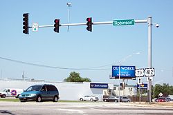 US 71B forms a brief concurrency with US 412 in Springdale.
13.28
- Major intersections
County Location Mile[2][3][1] Destinations Notes Washington Fayetteville 0.0  U.S. 71
southern terminus 1.45  Hwy. 16 (W 15th St)
2.04  Hwy. 180 west (Martin Luther King Jr. Blvd)
2.98 Dickson St. 3.14  Hwy. 45 east (E Lafayette St)
5.00 Township St. former Highway 180 6.75 To 
 I-540 / U.S. 62 / U.S. 71 (Fulbright Expy)
also access to Gregg Avenue 7.0 Joyce Blvd To I-540 / U.S. 71 / U.S. 62 (Fulbright Expy)northbound has jughandle entrance to Fulbright Expy Springdale 10.07  To U.S. 412 east (W Robinson Ave)
connector road 10.28 U.S. 412 west (S Thompson Ave)US 412 concurrency begins 10.80 U.S. 412 west (Sunset Ave)US 412 concurrency ends Benton Bethel Heights 14.30  Hwy. 264 east (Jackson Ave)
Lowell 16.29 Hwy. 264 west (W Monroe Ave)Rogers  Hwy. 94 south (W New Hope Rd)
 Hwy. 12 / Hwy. 94 north (N 8th St)
AR 12 concurrency begins, AR 94 concurrency ends Bentonville I-540 / U.S. 71 / U.S. 62 (Fulbright Expy) Hwy. 112 north (SE J St)
AR 112 concurrency south Hwy. 12 north / Hwy. 112 (SW Regional Airport Blvd)AR 12/AR 112 concurrency ends  Hwy. 204 west (Airport Rd)
to Bentonville Municipal Airport  Hwy. 102 (SW 14th St)
 Hwy. 72 west (SW 2nd St) I-540 south / U.S. 71 (Bella Vista Way)
northern terminus 1.000 mi = 1.609 km; 1.000 km = 0.621 mi Pineville–Anderson business loop
U.S. Route 71 BusinessLocation: Pineville–Anderson U.S. Route 71 Business is an alternate alignment of U.S. Route 71 in southwest Missouri. Its northern terminus is at a partial interchange with US 71 approximately 7 miles (11 km) north of Anderson. Its southern terminus is an at-grade intersection with US 71 and Wolf Den Road (also known as McDonald County Road 71-22B SW) approximately 2 miles (3.2 km) south of Pineville. In Anderson, Business 71 runs concurrently with Route 59 for approximately 6 miles (9.7 km) and Route 76 for 2 miles (3.2 km). Business 71 was originally created in 2005 running from 7 miles (11 km) north of Anderson to 2 miles (3.2 km) south of town at an at-grade intersection with US 71. In 2007, it was extended along the former US 71 in Pineville after a new freeway section was built bypassing the town.
Neosho business loop
U.S. Route 71 BusinessLocation: Neosho, Missouri U.S. Route 71 Business is a business route of U.S. Route 71. It begins two miles (3 km) northwest of Neosho, Missouri at US 71 and Route 86 and ends south of the city at US 71 and Route AA. Part of the highway overlaps Highway 86, another part overlaps Route 59. The road is a previous alignment of US 71, which has been realigned west of Neosho as a freeway.
Route 175 which ends near the north end of Business US 71 was once also labeled Business US 71, joining this route with Business US 71 in Joplin making this an even longer route.
Joplin business loop
U.S. Route 71 BusinessLocation: Joplin, Missouri Business US Highway 71 is an alternate alignment of U.S. Route 71 which begins at a junction of U.S. Route 71, Route 96, Route 171, and Route 571 in Carthage, Missouri. Its southern end is at the junction of US 71 and Route 175 about midway between Joplin and Neosho at Tipton Ford.
This particular section of Business US 71 is a relatively long one, and begins its existence as a freeway, finally becoming a non-freeway divided highway at Webb City. It is a major boulevard in Joplin where it is known as Rangeline Road, then continues south of Interstate 44 until it ends at US 71. The road was an earlier alignment of US 71 until the newer freeway was built to carry the road to the east of Joplin. At one point, Route 175 had been labeled Business US 71 and the road continued on as Business 71 in Neosho.
Cities on Business US 71 (Joplin):
- Carthage, Missouri
- Carterville, Missouri
- Webb City, Missouri
- Joplin, Missouri
- Silver Creek, Missouri
- Leawood, Missouri
- Saginaw, Missouri
- Tipton Ford, Missouri
Nevada business loop
U.S. Route 71 BusinessLocation: Nevada, Missouri Business U.S. Route 71 is a route in Nevada, Missouri, in the USA. It begins at U.S. Route 71 on the north side of the city and ends at the same highway in the east-central part of town.
Business 71 is a former alignment of US 71 through town. It begins as a set of exit/entrance ramps before becoming Osage Boulevard. It meets US 54 at Austin Blvd. and turns east. US 54 leaves the concurrency at Centennial Boulevard. while Business 71 continues west on Austin until meeting again with US 71.
This is one of the shortest alignments of the many US 71 business routes throughout western Missouri.
St. Joseph business loop
U.S. Route 71 BusinessLocation: St. Joseph, Missouri Maryville business loop
U.S. Route 71 BusinessLocation: Maryville, Missouri Business 71 is a former alignment of US 71 through Maryville, Missouri. Running a distance of approximately 5 miles (8.0 km), its southern terminus is at US 71 south of Maryville. Its northern terminus is an intersection with US 71 and US 136 north of Maryville.
Clarinda business loop
U.S. Route 71 Business
Location: Clarinda, Iowa U.S. Route 71 Business is a former alignment of US 71 through Clarinda, Iowa. It begins at the junction of U.S. Route 71 and Iowa Highway 2 in southern Clarinda. Then, it follows 16th Street (Glenn Miller Avenue) towards downtown Clarinda. At Washington Street, US 71 Business meets Iowa 2 Business, and both routes continue east, eventually leaving Clarinda. East of Clarinda, US 71 Bus./IA 2 Bus. intersect US 71. US 71 Business ends while Iowa 2 Business continues south to complete its business loop.
The entire route is in Clarinda, Page County.
Mile Destinations Notes 
 US 71 / Iowa 2
Iowa 2 Bus. westSouth end of IA 2 Bus. overlap 
US 71 / Iowa 2 Bus. eastNorth end of IA 2 Bus. overlap 1.000 mi = 1.609 km; 1.000 km = 0.621 mi
Concurrency terminus • Closed/Former • Incomplete access • UnopenedStorm Lake business loop
U.S. Route 71 BusinessLocation: Storm Lake, Iowa U.S. Route 71 Business is a former alignment of US 71 in Storm Lake, Iowa. It begins at the junction of U.S. Route 71 and Iowa Highway 7. It follows Iowa 7 into Storm Lake along Lakeshore Drive, Flindt Drive, and Milwaukee Avenue. At Lake Street, US 71 Business turns north, leaving Iowa 7, where it eventually leaves Storm Lake. Near Truesdale, US 71 Bus. turns east and rejoins US 71.
The entire route is in Buena Vista County.
Location Mile Destinations Notes Storm Lake  US 71 / Iowa 7 west
South end of IA 7 overlap Iowa 7 west (Milwaukee Avenue)North end of IA 7 overlap Truesdale US 711.000 mi = 1.609 km; 1.000 km = 0.621 mi
Concurrency terminus • Closed/Former • Incomplete access • UnopenedWillmar business loop
U.S. Highway 71 BusinessLocation: Willmar, Minnesota Former routes
Joplin alternate

U.S. Route 71 AlternateLocation: Joplin, Missouri  Former Alternate US 71 near Carthage, Missouri. This section is now a frontage road ("outer road" in Missouri) of US 71.
Alternate US 71 was a former bannered highway which provided an alternate route for US 71 between Carthage, Missouri and Neosho, Missouri, bypassing Joplin, Missouri. Both endpoints were junctions with US 71. This section of road from Fidelity to Carthage was originally Route 38, renumbered Route 38N in about 1930.
At Carthage, Alternate 71 followed what is currently Route 571 to US 71 at what is now the intersection of Route 96/571. When the freeway was built around Carthage, it ended at that the current exit of 71 at Route 96/571 & Business 71.
In 1999, the Alternate 71 designation was deleted. The section north of Interstate 44 at Fidelity was redesignated US 71, with the former US 71 being designated Business 71. South of Interstate 44, it continues as Route 59 to U.S. Route 60. From there it followed US 60 to Neosho. Other than its endpoints, only two towns were located on the former highway: Fidelity, Missouri and Diamond, Missouri.
The road was originally assigned at Optional US 71 in 1932 and changed to Alternate US 71 in 1935.
Kansas City bypass
U.S. Route 71 Bypass
Location: Kansas City, Missouri Existed: 1932–1969 U.S. Route 71 Bypass (Kansas City) was the original name for a highway that connected Harrisonville, Missouri to just south of Platte City, Missouri, where it rejoined US 71 Highway near Kansas City International Airport. When I-29 was opened in the mid-1960s, it was renumbered Route 291.
At Lee's Summit, Missouri, it connects to I-470. It remains concurrent with the Interstate, until I-470 terminates at I-70. Route 291 continues to the north after its junction with I-70. The route has been rerouted several times, and has seen improvements over the years, and continues to be a major highway in eastern Jackson County, Missouri. In Platte and Clay Counties, it also is known as Cookingham Drive, and Mid Continent Trafficway.
Platte City bypass
U.S. Route 71 BypassLocation: Platte City, Missouri References
- ^ a b "[Arkansas] State Highways 2009 (Database)." April 2010. AHTD: Planning and Research Division. |length_notes=mileage includes flyover of 1.83 miles (2.95 km) serving I-540/US 71/US 62 Database. Retrieved June 5, 2011.
- ^ a b Arkansas State Highway and Transportation Department. AHTD Washington County map Retrieved on June 24, 2009.
- ^ a b Arkansas State Highway and Transportation Department. AHTD Benton County map Retrieved on June 24, 2009.
- ^ "Interstate 49." Profile of I-49. Retrieved on June 24, 2009.
Categories:- Bannered and suffixed U.S. Highways
- U.S. Route 71


Wikimedia Foundation. 2010.