- Bethel Heights, Arkansas
Infobox Settlement
official_name = Bethel Heights, Arkansas
settlement_type =Town
imagesize =
image_caption =
image_
imagesize =
image_caption =
image_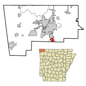
mapsize = 250px
map_caption = Location in Benton County and the state ofArkansas
mapsize1 =
map_caption1 =
subdivision_type = Country
subdivision_type1 = State
subdivision_type2 = County
subdivision_name =United States
subdivision_name1 =Arkansas
subdivision_name2 = Benton
government_type =
leader_title =
leader_name =
established_date =
area_magnitude =
area_total_km2 = 6.5
area_total_sq_mi = 2.5
area_land_km2 = 6.5
area_land_sq_mi = 2.5
area_water_km2 = 0
area_water_sq_mi = 0
elevation_ft = 1348
elevation_m = 411
population_as_of = 2000
population_footnotes =
population_total = 714
population_metro =
population_density_km2 = 109.8
population_density_sq_mi = 285.6
timezone = Central (CST)
utc_offset = -6
latd = 36 |latm = 13 |lats = 22 |latNS = N
longd = 94 |longm = 7 |longs = 40 |longEW = W
timezone_DST = CDT
utc_offset_DST = -5
postal_code_type =
postal_code =
area_code =
blank_name = FIPS code
blank_info = 05-05740
blank1_name = GNIS feature ID
blank1_info = 0076320
footnotes =
website =Bethel Heights is a town in Benton County,
Arkansas ,United States . The population was 714 at the 2000 census.Geography
Bethel Heights is located at coor dms|36|13|22|N|94|7|40|W|city (36.222843, -94.127671)GR|1.
According to the
United States Census Bureau , the town has a total area of 6.5km² (2.5 mi²), all land.Demographics
As of the
census GR|2 of 2000, there were 714 people, 251 households, and 211 families residing in the town. Thepopulation density was 109.4/km² (282.8/mi²). There were 261 housing units at an average density of 40.0/km² (103.4/mi²). The racial makeup of the town was 92.16% White, 1.54% Native American, 2.52% Asian, 1.82% from other races, and 1.96% from two or more races. 3.36% of the population were Hispanic or Latino of any race.There were 251 households out of which 42.6% had children under the age of 18 living with them, 78.1% were married couples living together, 3.2% had a female householder with no husband present, and 15.9% were non-families. 13.9% of all households were made up of individuals and 7.2% had someone living alone who was 65 years of age or older. The average household size was 2.84 and the average family size was 3.10.
In the town the population was spread out with 28.6% under the age of 18, 5.2% from 18 to 24, 31.0% from 25 to 44, 24.2% from 45 to 64, and 11.1% who were 65 years of age or older. The median age was 35 years. For every 100 females there were 103.4 males. For every 100 females age 18 and over, there were 103.2 males.
The median income for a household in the town was $48,750, and the median income for a family was $51,172. Males had a median income of $33,438 versus $26,625 for females. The
per capita income for the town was $19,001. About 1.9% of families and 4.9% of the population were below thepoverty line , including 1.8% of those under age 18 and 11.4% of those age 65 or over.References
External links
Wikimedia Foundation. 2010.