- Delia, Kansas
-
Delia, Kansas — City — Location of Delia, Kansas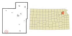
Coordinates: 39°14′22″N 95°57′52″W / 39.23944°N 95.96444°WCoordinates: 39°14′22″N 95°57′52″W / 39.23944°N 95.96444°W Country United States State Kansas County Jackson Area – Total 0.1 sq mi (0.3 km2) – Land 0.1 sq mi (0.3 km2) – Water 0.0 sq mi (0.0 km2) Elevation 974 ft (297 m) Population (2000) – Total 179 – Density 1,570.9/sq mi (606.5/km2) Time zone Central (CST) (UTC-6) – Summer (DST) CDT (UTC-5) ZIP code 66418 Area code(s) 785 FIPS code 20-17525[1] GNIS feature ID 0478447[2] Delia is a city in Jackson County, Kansas, United States. As of the 2000 census, the city had a population of 179. It is part of the Topeka, Kansas Metropolitan Statistical Area.
Contents
Geography
Delia is located at 39°14′22″N 95°57′52″W / 39.23944°N 95.96444°W (39.239321, -95.964543).[3]
According to the United States Census Bureau, the city has a total area of 0.1 square miles (0.26 km2), all land.
Demographics
Historical populations Census Pop. %± 1990 172 — 2000 179 4.1% U.S. Decennial Census As of the census[1] of 2000, there were 179 people, 53 households, and 46 families residing in the city. The population density was 1,571.0 people per square mile (628.3/km²). There were 58 housing units at an average density of 509.0 per square mile (203.6/km²). The racial makeup of the city was 86.03% White, 12.85% Native American, and 1.12% from two or more races. Hispanic or Latino of any race were 0.56% of the population.
There were 53 households out of which 47.2% had children under the age of 18 living with them, 73.6% were married couples living together, 7.5% had a female householder with no husband present, and 13.2% were non-families. 13.2% of all households were made up of individuals and 5.7% had someone living alone who was 65 years of age or older. The average household size was 3.38 and the average family size was 3.72.
In the city the population was spread out with 38.5% under the age of 18, 6.7% from 18 to 24, 24.0% from 25 to 44, 20.1% from 45 to 64, and 10.6% who were 65 years of age or older. The median age was 30 years. For every 100 females there were 113.1 males. For every 100 females age 18 and over, there were 103.7 males.
The median income for a household in the city was $36,667, and the median income for a family was $37,250. Males had a median income of $29,375 versus $43,750 for females. The per capita income for the city was $14,665. About 11.7% of families and 12.8% of the population and 11.7% of families were below the poverty line, including 17.1% of those under the age of 18 and 24.0% of those 65 and older.
Notable people
- David Bawden, cedevacantist claimant to the papacy
References
- ^ a b "American FactFinder". United States Census Bureau. http://factfinder.census.gov. Retrieved 2008-01-31.
- ^ "US Board on Geographic Names". United States Geological Survey. 2007-10-25. http://geonames.usgs.gov. Retrieved 2008-01-31.
- ^ "US Gazetteer files: 2010, 2000, and 1990". United States Census Bureau. 2011-02-12. http://www.census.gov/geo/www/gazetteer/gazette.html. Retrieved 2011-04-23.
Municipalities and communities of Jackson County, Kansas Cities 
Townships Unincorporated
communitiesBirmingham | Larkinburg
Indian reservations Kickapoo Indian Reservation of Kansas‡ | Prairie Band Potawatomi Indian Reservation‡
Footnotes ‡This populated place also has portions in an adjacent county or counties
Categories:- Cities in Kansas
- Populated places in Jackson County, Kansas
- Topeka metropolitan area


Wikimedia Foundation. 2010.