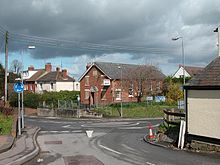
- Chiseldon
-
Coordinates: 51°30′51″N 1°44′05″W / 51.514125°N 1.734796°W
Chiseldon 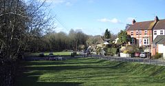
Chiseldon Green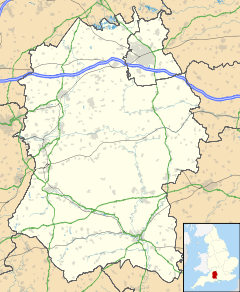
 Chiseldon
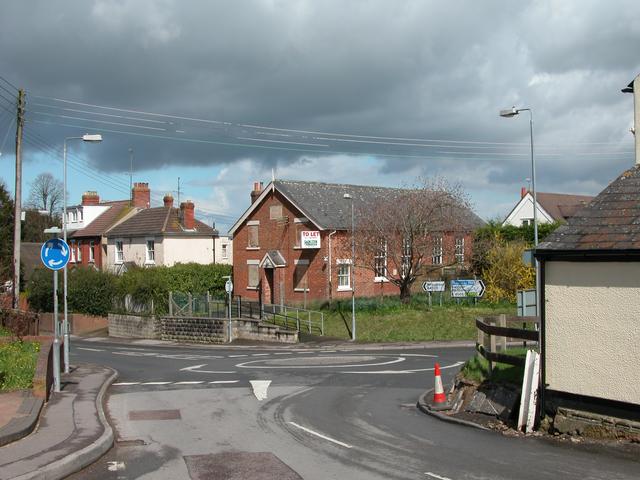
Chiseldon shown within WiltshirePopulation 2,599 (2001 Census) OS grid reference SU185795 Parish Chiseldon Shire county Wiltshire Region South West Country England Sovereign state United Kingdom Post town SWINDON Postcode district SN4 Dialling code 01793 Police Wiltshire Fire Wiltshire Ambulance Great Western EU Parliament South West England UK Parliament South Swindon List of places: UK • England • Wiltshire Chiseldon is a village in the borough of Swindon, Wiltshire, England.
The village lies on the edge of the Marlborough Downs, a mile south of junction 15 of the M4 motorway, on the A346 between Swindon and Marlborough. The hamlets of Draycot Foliat, Hodson, Badbury and Liddington are nearby, and the village of Wroughton is around two miles to the west.
The village houses a school - Chiseldon Primary School which currently has some 158 pupils enrolled, most of them from the village itself. The Holy Cross Church is also located in Chiseldon. The Church, was built in the thirteenth century along with other local churches in Ogbourne St. George and Ogbourne St. Andrew. The village has a surgery, as well as two Hotels, an Esso Petrol Station, two shops (one housing a Post office) and various other businesses. The engineering consultancy firm Halcrow Group Limited, soon to be CH2MHill, operates from Burderop Park, located in the parish.
There are two pubs in the village, The Patriots Arms and the Plough Inn. There is also the Social Club. The Elm Tree Pub has now closed down; this was originally a thatched beer house and was constructed in 1845[citation needed] . The pub was named after the elm tree which was located on the village green until the 1970s.
Chiseldon telephone exchange serves 1048 residential and 39 non-residential properties.
Contents
History
Settlements in the area date back to prehistoric and Roman times, but Chiseldon itself was started by the Saxons. The village was included in the Domesday Book and was called Chiseldene at the time. At one point the nearby hamlet Draycot Foliat was larger than Chiseldon. Chiseldon lies on one of the country's oldest highways, the Icknield Way, although this section of the road is more commonly known as The Ridgeway.
The Midland and South Western Junction Railway line was constructed in 1881 and ran through the centre of the village until 1961, with a station that linked the village directly to Swindon Town station to the north and Marlborough to the south.
During World War II there was an American army camp near the village. Remaining houses now known as Ridgeway View.
Religion
Most of the population are members of the Church of England[citation needed] but other denominations of Christianity are present. Holy Cross Church of England parish church has a dwindling regular attendance but many more attend on special occasions. There is a small congregation of Methodists in the village. The Methodists had a 19th century church in the village, but sold it in 2006 due to low finances, low attendance, and regulations requiring the Methodist church to comply with the Disability Discrimination Act by building a ramp, which the church could not afford.[citation needed] Holy Cross parish now lets the Methodists use the church hall for services. The two groups co-operate on occasions, such as a joint service in 2007 to commemorate the abolition of slavery.
Some villagers adhere to other major religions, but they are limited to a few families.[citation needed] Holy Cross parish is in the Church of England Diocese of Salisbury, unlike the rest of the borough of Swindon, which is within the Diocese of Bristol, but like the rest of Wiltshire.
The Parish
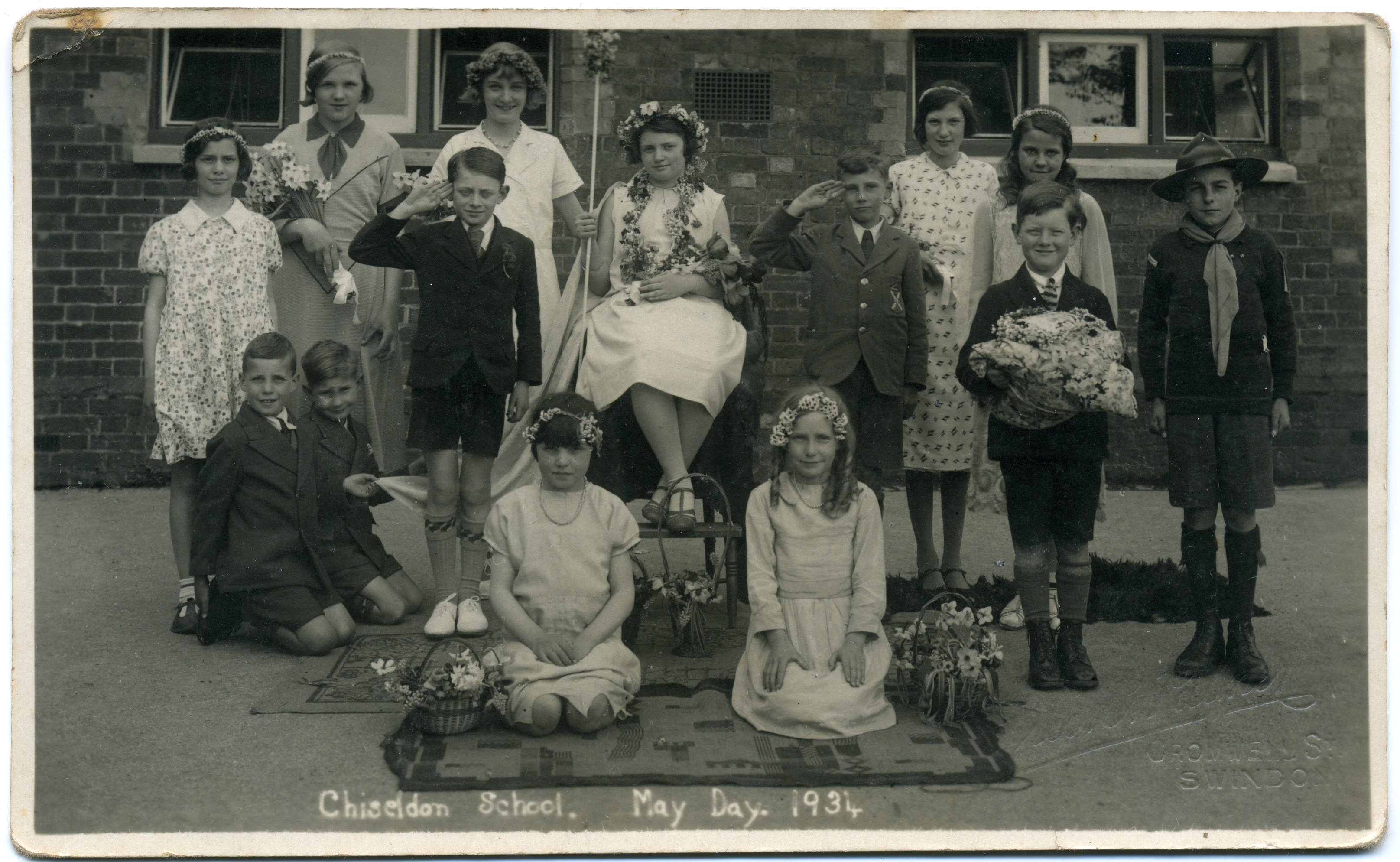
 May Day at Chiseldon School 1934, by Fred C Palmer
The Parish of Chiseldon encompasses not only the village but also the neighboring hamlets of Coate, Draycot Foliat and Hodson. Draycot Foliat once had its own Church and Parish in the Mediæval period, but in 1571 the Bishop of Salisbury ordered the Church in Draycot to be demolished, as neither parish could sustain their own rectors any longer. As Chiseldon was the larger, Draycot was incorporated into its Parish, and the materials from the Church in Draycot were used to repair the church in Chiseldon.
Local government
As well as having its own elected parish council, Chiseldon also falls within the area of the Borough of Swindon unitary authority, which is responsible for all significant local government functions.
Local businesses
 Oddfellows Hall
Local shops declined in the 20th century, like in many other villages, due to more people shopping in larger towns (Swindon) rather than in the village. Current local shops include Chaplins (a small newsagency), a hairdresser and a small supermarket (that offers many commodities and is larger than Chaplins or any other store in Chiseldon). The store was an old army barracks later converted into a shop. Until recently it was a SPAR convenience store but is now part of the 'Premier' chain, named Meadow Stores. Previous local businesses included a chip shop, which was run by a coal miner, whose customers apparently used to find traces of coal in their chips[citation needed]. Many other non-shop businesses survive. There also used to be a small village post office which was renamed the 'Penny Black' in 2007. It closed and the post office services are now offered in Meadow Stores.
External links
- Church web site
- Chiseldon FC Online
- Chiseldon Village weather
- Chiseldon Bells
- Chiseldon Domesday Book Record
- British History Online - Chiseldon
- Chiseldon Parish Council
- Station House Surgery
Ceremonial county of Wiltshire Unitary authorities Swindon • Wiltshire CouncilMajor settlements Amesbury • Bradford on Avon • Calne • Chippenham • Corsham • Cricklade • Devizes • Highworth • Larkhill • Ludgershall • Malmesbury • Marlborough • Mere • Melksham • Royal Wootton Bassett • Salisbury • Swindon • Tidworth • Tisbury • Trowbridge • Warminster • Westbury • Wilton
See also: List of civil parishes in WiltshireRivers Topics Flag • Grade I listed buildings • History • Lords Lieutenant • Deputy Lieutenants • High Sheriffs • Parliamentary constituencies • Local elections • Places • MuseumsCategories:- Villages in Wiltshire
- M4 corridor
- Civil parishes in Wiltshire
- Swindon (borough)


Wikimedia Foundation. 2010.