- Niederkumbd
-
Niederkumbd 

 NiederkumbdLocation of Niederkumbd within Rhein-Hunsrück-Kreis district
Coordinates 50°0′52″N 7°32′10″E / 50.01444°N 7.53611°ECoordinates: 50°0′52″N 7°32′10″E / 50.01444°N 7.53611°E Administration Country Germany State Rhineland-Palatinate District Rhein-Hunsrück-Kreis Municipal assoc. Simmern Mayor Günter Hackländer Basic statistics Area 2.27 km2 (0.88 sq mi) Elevation 404 m (1326 ft) Population 313 (31 December 2010)[1] - Density 138 /km2 (357 /sq mi) Other information Time zone CET/CEST (UTC+1/+2) Licence plate SIM Postal code 55469 Area code 06761 Website www.niederkumbd.de  Niederkumbd seen from the southeast
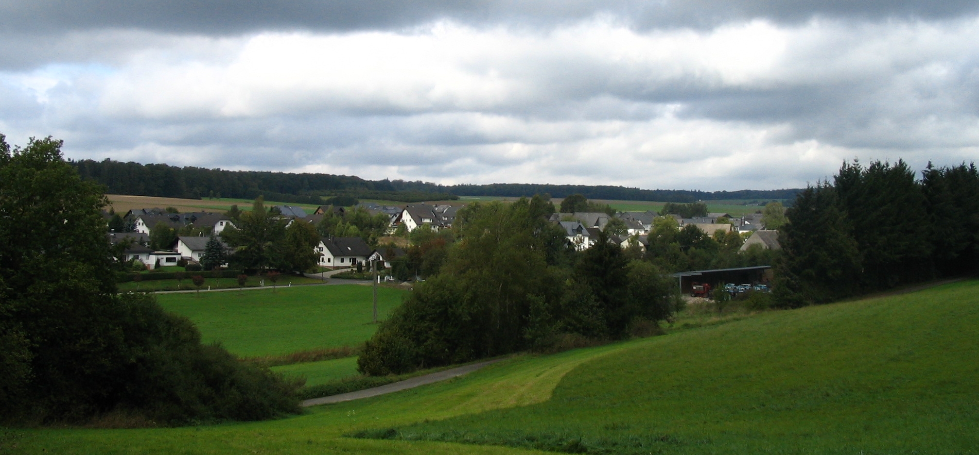
Niederkumbd (until 1936 Niederchumbd) is an Ortsgemeinde – a municipality belonging to a Verbandsgemeinde, a kind of collective municipality – in the Rhein-Hunsrück-Kreis (district) in Rhineland-Palatinate, Germany. It belongs to the Verbandsgemeinde of Simmern, whose seat is in the like-named town.
Contents
Geography
Location
The municipality lies in the Hunsrück, roughly 4 km north of Simmern, and is characterized by agriculture. The municipal area measures 2.27 km².
History
In 1310, Niederkumbd had its first documentary mention. At that time, the village was called Hasencomede and was closely tied to the Cistercian convent at Klosterkumbd. In the Middle Ages, there was a local noble family that bore the same name. Disagreements between the County of Sponheim and the Counts Palatine led in 1368 to a feud around Niederkumbd. Thereafter, the Count of Sponheim had to acknowledge Comital Palatine authority over the village. Beginning in 1410, Niederkumbd belonged to the Duchy of Simmern, which introduced the Reformation in 1556. Later, the Count Palatine of the Rhine became the landholder once again. Beginning in 1794, Niederkumbd lay under French rule. In 1814 it was assigned to the Kingdom of Prussia at the Congress of Vienna. Since 1946, it has been part of the then newly founded state of Rhineland-Palatinate.
Politics
Municipal council
The council is made up of 8 council members, who were elected by majority vote at the municipal election held on 7 June 2009, and the honorary mayor as chairman[2].
Mayor
Niederkumbd’s mayor is Günter Hackländer[3].
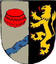
Coat of arms
The municipality’s arms might be described thus: Per pale argent an urn gules above a bend sinister wavy abased, the end in base enhanced, azure, and sable a lion rampant Or armed and langued of the second.
Culture and sightseeing
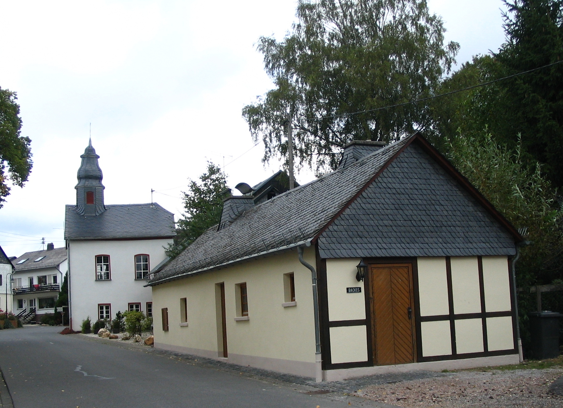
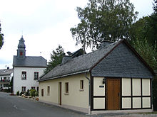 Simmerner Straße: old bakehouse and Evangelical chapel
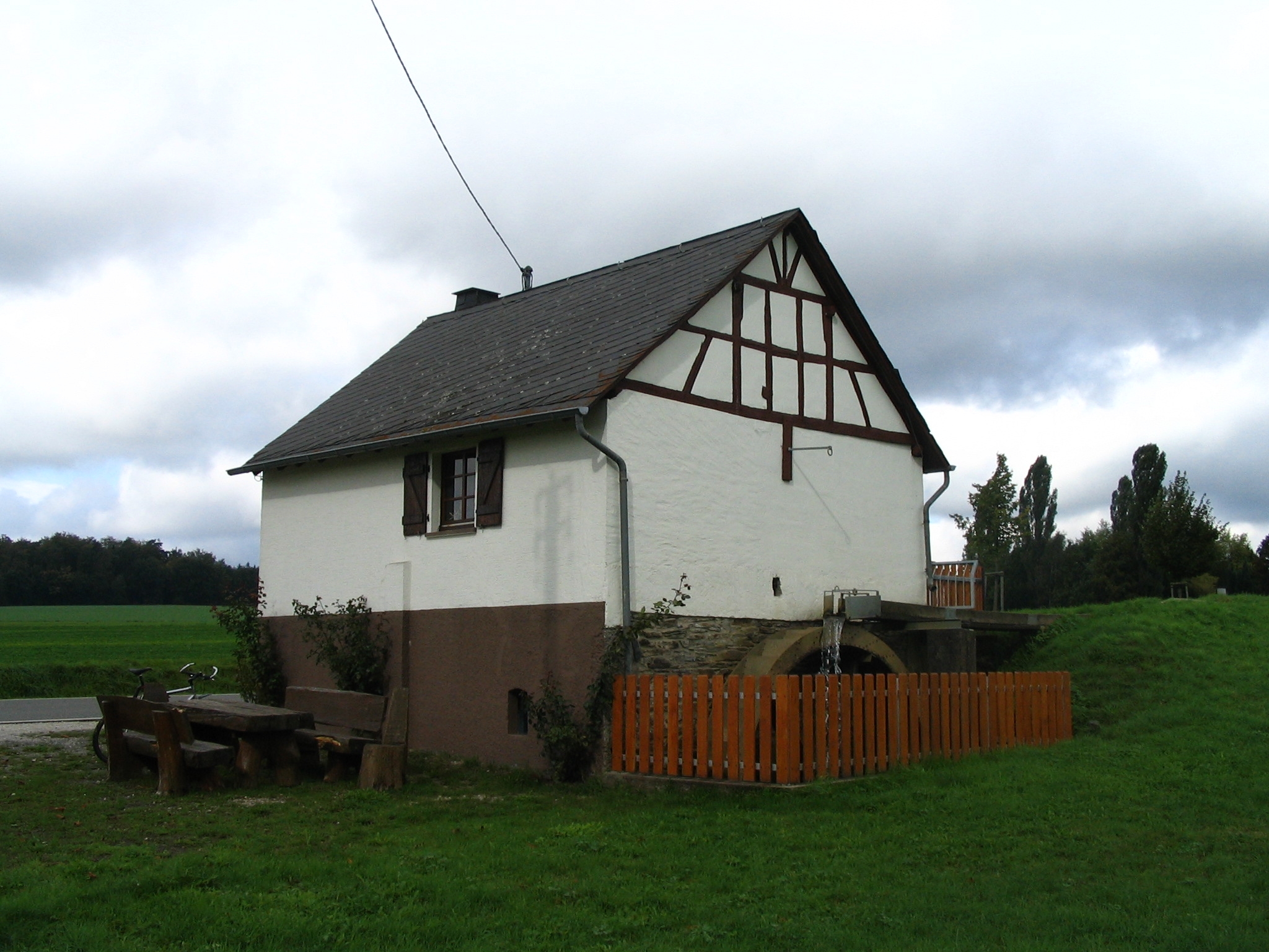
 Historic watermill, built in 1848 by Peter Paul Auler and associates
Buildings
The following are listed buildings or sites in Rhineland-Palatinate’s Directory of Cultural Monuments:[4]
- Simmerner Straße – fountain; cast-iron basin with relief, cast-iron pump, Stromberg New Ironworks, marked 1887
- Simmerner Straße 24 – old bakehouse, one-floor plastered building, 19th century
- Simmerner Straße 28, Evangelical chapel – timber-frame building, partly solid, 1807-1812
Other sites
Niederkumbd also has an historic watermill from 1848.
References
- ^ "Bevölkerung der Gemeinden am 31.12.2010" (in German). Statistisches Landesamt Rheinland-Pfalz. 31 December 2010. http://www.statistik.rlp.de/fileadmin/dokumente/berichte/A1033_201022_hj_G.pdf.
- ^ Municipal election results for Niederkumbd
- ^ Niederkumbd’s mayor
- ^ Directory of Cultural Monuments in Rhein-Hunsrück district
External links
- Municipality’s official webpage (German)
- This article incorporates information from the German Wikipedia.
Categories:- Municipalities in Rhineland-Palatinate
- Rhein-Hunsrück geography stubs


Wikimedia Foundation. 2010.