- Metzenhausen
-
Metzenhausen 
Coordinates 49°58′17″N 7°21′44″E / 49.97139°N 7.36222°ECoordinates: 49°58′17″N 7°21′44″E / 49.97139°N 7.36222°E Administration Country Germany State Rhineland-Palatinate District Rhein-Hunsrück-Kreis Municipal assoc. Kirchberg Mayor Werner Nick Basic statistics Area 3.09 km2 (1.19 sq mi) Elevation 425 m (1394 ft) Population 125 (31 December 2010)[1] - Density 40 /km2 (105 /sq mi) Other information Time zone CET/CEST (UTC+1/+2) Licence plate SIM Postal code 55481 Area code 06763 Metzenhausen is an Ortsgemeinde – a municipality belonging to a Verbandsgemeinde, a kind of collective municipality – in the Rhein-Hunsrück-Kreis (district) in Rhineland-Palatinate, Germany. It belongs to the Verbandsgemeinde of Kirchberg, whose seat is in the like-named town.
Contents
Geography
Location
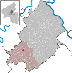
The municipality lies in the central Hunsrück roughly 4 km northwest of Kirchberg and 7 km northeast of Frankfurt-Hahn Airport. The municipal area measures 309 ha, of which 121 ha is wooded[2].
History
The village got its name from a noble family. It was in 1278 that Conrad von Mentzenhusin (Metzenhausen) was mentioned. The best known representative of this Metzenhausen noble family, that lived in the village for just under 500 years, was Johann III of Metzenhausen, who from 1531 to 1540 was Archbishop of Trier. In 1317, Metzenhausen was raised to quasi-parish by Count Emich von Sponheim, who was also the pastor at Kirchberg. He equipped the chapel with properties at Todenroth and Lampenrode (a now vanished village). Beginning in 1794, Metzenhausen lay under French rule. In 1815 it was assigned to the Kingdom of Prussia at the Congress of Vienna. Since 1946, it has been part of the then newly founded state of Rhineland-Palatinate.
Politics
Municipal council
The council is made up of 6 council members, who were elected by majority vote at the municipal election held on 7 June 2009, and the honorary mayor as chairman[3].
Mayor
Metzenhausen’s mayor is Werner Nick, and his deputy is Kurt Kilb[4].
Coat of arms
The German blazon reads: Das Wappen zeigt in von Gold und Blau in sechs Reihen geschachtem Schild einen schwarzen Pfahl, belegt mit silbernem Doppelhaken.
The municipality’s arms might in English heraldic language be described thus: Chequy Or and azure, a pale sable charged with a cramp palewise argent.
The “chequy” pattern is drawn from the arms formerly borne by the Counts of Sponheim[5].
Culture and sightseeing
Buildings
The following are listed buildings or sites in Rhineland-Palatinate’s Directory of Cultural Monuments:[6]
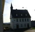
- Catholic Church of the Assumption of Mary (Kirche Mariä Himmelfahrt), Hauptstraße – Late Gothic aisleless church, essentially from the 16th century, nave converted possibly in the 17th century, extensive repairs in 1829-1831, sacristy, 1854; whole complex of buildings with graveyard (see also below)
- Backesweg 2 – timber-frame house, partly solid or slated, 18th century, barn 20th century; whole complex of buildings
- Mühlenweg 2 – so-called Heerehaus; building with hipped mansard roof, early 18th century
- Brühltaler Mühle, in the Brühltal (valley) between Metzenhausen and Todenroth – small watermill with complete works, latter half of the 19th century
Chapel
Worth seeing is the Chapel of the Assumption of Mary from the 15th century, whose quire was built in the Gothic style. It also has stained glass windows depicting Archbishop of Trier Johann III of Metzenhausen.
References
- ^ "Bevölkerung der Gemeinden am 31.12.2010" (in German). Statistisches Landesamt Rheinland-Pfalz. 31 December 2010. http://www.statistik.rlp.de/fileadmin/dokumente/berichte/A1033_201022_hj_G.pdf.
- ^ Metzenhausen’s area
- ^ Municipal election results for Metzenhausen
- ^ Metzenhausen’s council
- ^ Description and explanation of Metzenhausen’s arms
- ^ Directory of Cultural Monuments in Rhein-Hunsrück district
External links
- This article incorporates information from the German Wikipedia.
Categories:- Municipalities in Rhineland-Palatinate
- Rhein-Hunsrück geography stubs
Wikimedia Foundation. 2010.


