- Mühlpfad
-
Mühlpfad 

 MühlpfadLocation of Mühlpfad within Rhein-Hunsrück-Kreis district
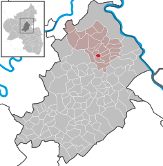
Coordinates 50°7′21″N 7°33′24″E / 50.1225°N 7.55667°ECoordinates: 50°7′21″N 7°33′24″E / 50.1225°N 7.55667°E Administration Country Germany State Rhineland-Palatinate District Rhein-Hunsrück-Kreis Municipal assoc. Emmelshausen Mayor Florian Kneip Basic statistics Area 1.39 km2 (0.54 sq mi) Elevation 440 m (1444 ft) Population 68 (31 December 2010)[1] - Density 49 /km2 (127 /sq mi) Other information Time zone CET/CEST (UTC+1/+2) Licence plate SIM Postal code 56291 Area code 06746 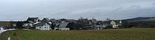 Mühlpfad seen from the east
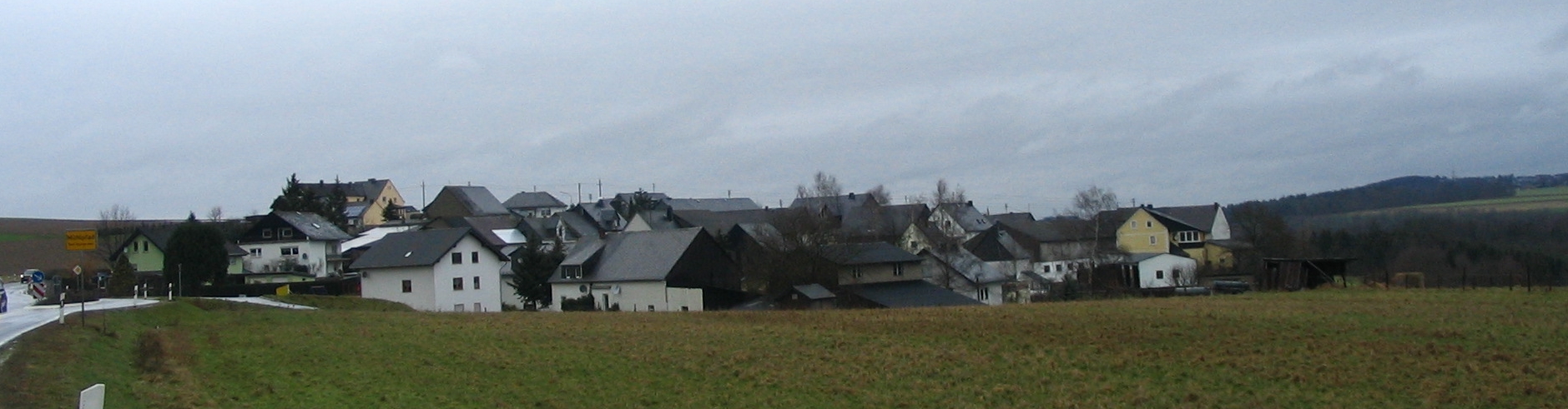
Mühlpfad is an Ortsgemeinde – a municipality belonging to a Verbandsgemeinde, a kind of collective municipality – in the Rhein-Hunsrück-Kreis (district) in Rhineland-Palatinate, Germany. It belongs to the Verbandsgemeinde of Emmelshausen, whose seat is in the like-named town. With a population of roughly 70 inhabitants, Mühlpfad is the district’s smallest municipality. It has nonetheless managed to avoid being amalgamated with any of its neighbours.
Contents
Geography
Location
The municipality lies in the eastern Hunsrück 7 km south of Emmelshausen, right at the beginning of the Baybach valley. The municipal area measures 139 ha.
Politics
Municipal council
The council is made up of 6 council members, who were elected by majority vote at the municipal election held on 7 June 2009, and the honorary mayor as chairman[2].
Mayor
Mühlpfad’s mayor is Florian Kneip[3].
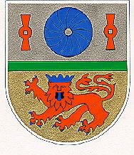
Coat of arms
The German blazon reads: Geteilt durch einen grünen Leistenstab, oben in Silber ein blauer Mühlstein, begleitet rechts und links von einem roten senkrechtstehenden Mühleisen; unten in Gold ein blau gekrönter, -bewehrter und -gezungter, herschauender roter Löwe.
The municipality’s arms might in English heraldic language be described thus: Per fess a barrulet vert between argent a millstone azure between two millrynds palewise gules, the whole in fess, and Or a lion passant guardant, tail forked, of the fourth, armed, langued and crowned of the third.
The charges in the silver field, together with the barrulet (thin horizontal stripe, much thinner than a fess) stand as canting charges for the municipality’s name. The millstone (Mühlstein in German) and the millrynds (Mühleisen in German) are meant to suggest the German word Mühle (“mill”), or its stem Mühl—, as it appears in both those words, while the barrulet is meant to look like a path (Pfad in German). Thus, it is a rebus of sorts: Mühl— + Pfad = Mühlpfad. The lion in the gold field refers to the village’s former allegiance to the Lower County of Katzenelnbogen[4].
Culture and sightseeing
Regular events
In remembrance of Saint Wendelin, the kermis is held on the second weekend in July[5].
Economy and infrastructure
Transport
Running by the village only a few kilometres away are Bundesstraße 327, or the Hunsrückhöhenstraße (“Hunsrück Heights Road”, a scenic road across the Hunsrück built originally as a military road on Hermann Göring’s orders) and the Autobahn A 61. Both the Rhine and the Moselle also lie quite nearby[6].
References
- ^ "Bevölkerung der Gemeinden am 31.12.2010" (in German). Statistisches Landesamt Rheinland-Pfalz. 31 December 2010. http://www.statistik.rlp.de/fileadmin/dokumente/berichte/A1033_201022_hj_G.pdf.
- ^ Municipal election results for Mühlpfad
- ^ Mühlpfad’s mayor
- ^ Description and explanation of Mühlpfad’s arms
- ^ Events in Mühlpfad
- ^ Mühlpfad’s transport links
External links
Mühlpfad in the collective municipality’s webpages (German)
- This article incorporates information from the German Wikipedia.
Categories:- Municipalities in Rhineland-Palatinate
- Rhein-Hunsrück geography stubs


Wikimedia Foundation. 2010.