- North Judson, Indiana
-
North Judson, Indiana — Town — Location of North Judson in the state of Indiana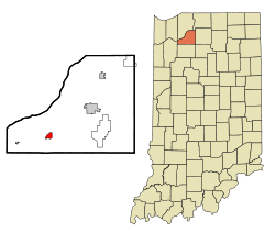
Coordinates: 41°13′1″N 86°46′33″W / 41.21694°N 86.77583°WCoordinates: 41°13′1″N 86°46′33″W / 41.21694°N 86.77583°W Country United States State Indiana County Starke Township Wayne Area - Total 0.9 sq mi (2.4 km2) - Land 0.9 sq mi (2.4 km2) - Water 0.0 sq mi (0.0 km2) Elevation 712 ft (217 m) Population (2000) - Total 1,675 - Density 1,820.1/sq mi (703.0/km2) Time zone Central (CST) (UTC-6) - Summer (DST) CDT (UTC-5) ZIP code 46366 Area code(s) 574 FIPS code 18-54900[1] GNIS feature ID 0440268[2] North Judson is a town in Wayne Township, Starke County, Indiana, United States. The population was 1,675 at the 2000 census. The town owns and is the headquarters of the Chesapeake and Indiana Railroad.
Contents
History
The area now known as North Judson was originally Brantwood, a town platted on October 1, 1859 less than a mile northwest of the current town. The town post office was established on September 24, 1860 as North Judson after Adrian Judson, one of the promoters of the Great Chicago and Eastern Railway (originally the Chicago and Cincinnati Railroad and later part of the Pittsburgh, Cincinnati, Chicago and St. Louis Railroad) which had just been laid through the town. The North was likely added to eliminate confusion with downstate Judson, Indiana.[3] The town of North Judson proper was later laid out in 1866 and incorporated in 1888.[4] In 1881, the Indiana, Illinois and Iowa Railroad and Chicago and Atlantic Railroad were each laid through the town.[5] Today, the town is situated at the intersection of State Road 10 and State Road 39.
Geography
North Judson is located at 41°13′1″N 86°46′33″W / 41.21694°N 86.77583°W (41.217078, −86.775930)[6]. According to the United States Census Bureau, the town has a total area of 0.9 square miles (2.3 km2), all of it land.
Demographics
As of the census[1] of 2000, there were 1,675 people, 648 households, and 425 families residing in the town. The population density was 1,820.1 people per square mile (703.0/km²). There were 704 housing units at an average density of 765.0/sq mi (295.5/km²). The racial makeup of the town was 97.01% White, 0.06% African American, 0.12% Native American, 0.06% Asian, 1.97% from other races, and 0.78% from two or more races. Hispanic or Latino of any race were 6.39% of the population.
There were 648 households out of which 34.7% had children under the age of 18 living with them, 49.7% were married couples living together, 12.3% had a female householder with no husband present, and 34.4% were non-families. 31.5% of all households were made up of individuals and 15.9% had someone living alone who was 65 years of age or older. The average household size was 2.58 and the average family size was 3.27.
In the town the population was spread out with 31.1% under the age of 18, 8.1% from 18 to 24, 29.0% from 25 to 44, 16.2% from 45 to 64, and 15.6% who were 65 years of age or older. The median age was 33 years. For every 100 females there were 85.7 males. For every 100 females age 18 and over, there were 86.4 males.
The median income for a household in the town was $29,779, and the median income for a family was $39,792. Males had a median income of $31,071 versus $21,467 for females. The per capita income for the town was $13,052. About 10.5% of families and 12.7% of the population were below the poverty line, including 12.3% of those under age 18 and 15.2% of those age 65 or over.
Culture
The town hosts the annual Mint Festival over Father's Day weekend in celebration of the history of mint farming in the area. Musicians perform live throughout the weekend on a stage at Norwayne Field, a Works Progress Administration-built park situated north at the intersection of SRs 10 and 39. Additionally, North Judson is home to the Hoosier Valley Railroad Museum, a memorial to American railroad culture that offers old-fashioned train rides on Saturdays. A shorter ride reaches English Lake, at the Kankakee and Yellow Rivers' confluence; a longer takes the rider to LaCrosse, IN, before returning to the museum.
Ten miles to the east, Bass Lake, a popular resort, offers summer relaxation opportunities to visitors and locals alike. Just south of the lake, the Melody Drive-in shows movies on two screens.
The community of North Judson is also a strong supporter of its high school North Judson-San Pierre, and the athletic teams the Blue Jays field, particularly in football, and basketball both boys and girls. The Blue Jays have had a longtime football rivalry with the Knox High School Redskins for many years, and it's one of the biggest high school sports event each season.
Notable native
- Henry F. Schricker, 36th and 38th Governor of Indiana
Notes
- ^ a b "American FactFinder". United States Census Bureau. http://factfinder.census.gov. Retrieved 2008-01-31.
- ^ "US Board on Geographic Names". United States Geological Survey. 2007-10-25. http://geonames.usgs.gov. Retrieved 2008-01-31.
- ^ Baker, Ronald L.; Marvin Carmony (1995). Indiana Place Names. Bloomington: Indiana University Press. p. 119. ISBN 0-253-28340-X.
- ^ North Judson-Wayne Twp. Public Library, Local History
- ^ Railroad History of North Judson and the HVRM
- ^ "US Gazetteer files: 2010, 2000, and 1990". United States Census Bureau. 2011-02-12. http://www.census.gov/geo/www/gazetteer/gazette.html. Retrieved 2011-04-23.
External links
Municipalities and communities of Starke County, Indiana County seat: Knox City 
Towns Hamlet | North Judson
Townships California | Center | Davis | Jackson | North Bend | Oregon | Railroad | Washington | Wayne
Unincorporated
communitiesAldine | Bass Lake | Bass Station | Brems | English Lake | Grovertown | Indian Hill | Koontz Lake‡ | Lomax | Oak Grove | Ober | Ora | San Pierre | Toto | Winona
Footnotes ‡This populated place also has portions in an adjacent county or counties
Categories:- Populated places in Starke County, Indiana
- Towns in Indiana
- Northwest Indiana

Wikimedia Foundation. 2010.