- North Bend Township, Starke County, Indiana
-
North Bend Township — Township — Location in Starke County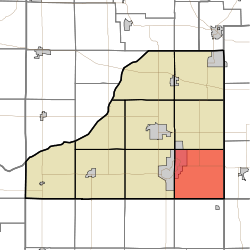
Coordinates: 41°12′50″N 86°31′38″W / 41.21389°N 86.52722°WCoordinates: 41°12′50″N 86°31′38″W / 41.21389°N 86.52722°W Country  United States
State  Indiana
County Starke Government - Type Indiana township Area - Total 36.26 sq mi (93.92 km2) - Land 35.54 sq mi (92.04 km2) - Water 0.72 sq mi (1.88 km2) 2% Elevation 732 ft (223 m) Population (2000) - Total 1,294 - Density 36.4/sq mi (14.1/km2) ZIP codes 46511, 46534, 46960, 46968 GNIS feature ID 0453679[1] North Bend Township is one of nine townships in Starke County, Indiana, USA. As of the 2000 census, its population was 1,294.[2]
Contents
Geography
According to the United States Census Bureau, North Bend Township covers an area of 36.26 square miles (93.9 km2); of this, 35.54 square miles (92.0 km2) (98 percent) is land and 0.72 square miles (1.9 km2) (2 percent) is water.
Cities, towns, villages
- Bass Lake (east half)
Unincorporated towns
- Ora at 41°10′26″N 86°33′11″W / 41.1739304°N 86.5530654°W
- Winona at 41°14′10″N 86°34′10″W / 41.2361527°N 86.5694557°W
(This list is based on USGS data and may include former settlements.)
Adjacent townships
- Washington Township (north)
- Union Township, Marshall County (east)
- Aubbeenaubbee Township, Fulton County (southeast)
- Tippecanoe Township, Pulaski County (south)
- Franklin Township, Pulaski County (southwest)
- California Township (west)
- Center Township (northwest)
Cemeteries
The township contains these three cemeteries: North Bend, North Union and Ora.
Airports and landing strips
- Bennett Strip Airport
Lakes
- Black Lake
- Hartz Lake
- Langenbaum Lake
Major highways
School districts
- Culver Community Schools Corporation
Political districts
- Indiana's 2nd congressional district
- State House District 17
- State Senate District 5
References
- United States Census Bureau 2008 TIGER/Line Shapefiles
- United States Board on Geographic Names (GNIS)
- IndianaMap
- ^ "North Bend Township". Geographic Names Information System, U.S. Geological Survey. http://geonames.usgs.gov/pls/gnispublic/f?p=gnispq:3:::NO::P3_FID:0453679. Retrieved 2009-07-05.
- ^ United States Census Bureau American FactFinder
External links
Municipalities and communities of Starke County, Indiana County seat: Knox City 
Towns Townships California | Center | Davis | Jackson | North Bend | Oregon | Railroad | Washington | Wayne
Unincorporated
communitiesAldine | Bass Lake | Bass Station | Brems | English Lake | Grovertown | Indian Hill | Koontz Lake‡ | Lomax | Oak Grove | Ober | Ora | San Pierre | Toto | Winona
Footnotes ‡This populated place also has portions in an adjacent county or counties
Categories:- Townships in Starke County, Indiana


Wikimedia Foundation. 2010.