- Cynthiana, Indiana
-
Town of Cynthiana, Indiana — Town — Location in the state of Indiana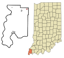
Coordinates: 38°11′17″N 87°42′24″W / 38.18806°N 87.70667°WCoordinates: 38°11′17″N 87°42′24″W / 38.18806°N 87.70667°W Country United States State Indiana County Posey Township Smith Area – Total 0.4 sq mi (1.0 km2) – Land 0.4 sq mi (1.0 km2) – Water 0.0 sq mi (0.0 km2) Elevation 472 ft (144 m) Population (2010) – Total 545 – Density 1,732.4/sq mi (668.9/km2) Time zone CST (UTC-6) – Summer (DST) CDT (UTC-5) ZIP code 47612 Area code(s) 812 FIPS code 18-16534[1] GNIS feature ID 0433272[2] Cynthiana is a town in Smith Township, Posey County, Indiana, United States. The population was 545 at the 2010 census. It was founded in 1817 and named for Cynthiana, Kentucky, where the first settlers had come from.
Contents
Geography
Cynthiana is located at 38°11′17″N 87°42′24″W / 38.18806°N 87.70667°W (38.188006, -87.706730)[3].
According to the United States Census Bureau, the town has a total area of 0.4 square miles (1.0 km2), all of it land.
Demographics
As of the census[1] of 2000, there were 693 people, 265 households, and 195 families residing in the town. The population density was 1,725.1 people per square mile (668.9/km²). There were 286 housing units at an average density of 711.9 per square mile (276.1/km²). The racial makeup of the town was 98.56% White, 0.43% Native American, 0.29% Asian, and 0.72% from two or more races.
There were 265 households out of which 34.0% had children under the age of 18 living with them, 64.2% were married couples living together, 7.5% had a female householder with no husband present, and 26.4% were non-families. 24.5% of all households were made up of individuals and 12.5% had someone living alone who was 65 years of age or older. The average household size was 2.62 and the average family size was 3.11.
In the town the population was spread out with 27.7% under the age of 18, 7.1% from 18 to 24, 29.7% from 25 to 44, 22.4% from 45 to 64, and 13.1% who were 65 years of age or older. The median age was 36 years. For every 100 females there were 96.3 males. For every 100 females age 18 and over, there were 97.2 males.
The median income for a household in the town was $37,589, and the median income for a family was $42,000. Males had a median income of $35,286 versus $20,583 for females. The per capita income for the town was $15,313. About 5.3% of families and 9.7% of the population were below the poverty line, including 11.9% of those under age 18 and 18.5% of those age 65 or over.
Highways
 Interstate 64
 Indiana State Road 68
 Indiana State Road 65
References
- ^ a b "American FactFinder". United States Census Bureau. http://factfinder.census.gov. Retrieved 2008-01-31.
- ^ "US Board on Geographic Names". United States Geological Survey. 2007-10-25. http://geonames.usgs.gov. Retrieved 2008-01-31.
- ^ "US Gazetteer files: 2010, 2000, and 1990". United States Census Bureau. 2011-02-12. http://www.census.gov/geo/www/gazetteer/gazette.html. Retrieved 2011-04-23.
Municipalities and communities of Posey County, Indiana City 
Towns Cynthiana | Griffin | New Harmony | Poseyville
Townships Unincorporated
communitiesBlairsville | Caborn | Farmersville | Hovey | Savah | St Phillip | St Wendel | Stewartsville | Solitude | Upton | Wadesville | West Franklin
Categories:- Populated places in Posey County, Indiana
- Towns in Indiana
- Evansville metropolitan area
- Communities of Southwestern Indiana
- Populated places established in 1817

Wikimedia Foundation. 2010.