- Downey, Idaho
-
Downey, Idaho — City — Location in Bannock County and the state of Idaho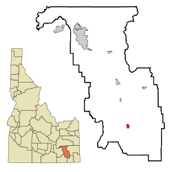
Coordinates: 42°25′46″N 112°7′21″W / 42.42944°N 112.1225°WCoordinates: 42°25′46″N 112°7′21″W / 42.42944°N 112.1225°W Country United States State Idaho County Bannock Area – Total 1.0 sq mi (2.5 km2) – Land 1.0 sq mi (2.5 km2) – Water 0.0 sq mi (0.0 km2) Elevation 4,865 ft (1,483 m) Population (2000) – Total 613 – Density 622.8/sq mi (240.5/km2) Time zone Mountain (MST) (UTC-7) – Summer (DST) MDT (UTC-6) ZIP code 83234 Area code(s) 208 FIPS code 16-22600 GNIS feature ID 0396415 Downey is a city in Bannock County, Idaho, United States. It is part of the 'Pocatello, Idaho Metropolitan Statistical Area'. The population was 613 at the 2000 census.
Contents
Geography
Downey is located at 42°25′46″N 112°7′21″W / 42.42944°N 112.1225°W (42.429312, -112.122397),[1] at 4,860 feet (1,480 m) in Marsh Valley. It lies on the route of U.S. Highway 91.
According to the United States Census Bureau, the city has a total area of 1.0 square mile (2.6 km2), all of it land.
Demographics
As of the census[2] of 2000, there were 613 people, 233 households, and 165 families residing in the city. The population density was 622.8 people per square mile (241.5/km²). There were 264 housing units at an average density of 268.2 per square mile (104.0/km²). The racial makeup of the city was 97.39% White, 0.49% Native American, 0.16% Asian, 0.49% Pacific Islander, 1.31% from other races, and 0.16% from two or more races. Hispanic or Latino of any race were 1.63% of the population.
There were 233 households out of which 32.2% had children under the age of 18 living with them, 61.8% were married couples living together, 6.0% had a female householder with no husband present, and 28.8% were non-families. 27.0% of all households were made up of individuals and 18.9% had someone living alone who was 65 years of age or older. The average household size was 2.63 and the average family size was 3.23.
In the city the population was spread out with 30.5% under the age of 18, 5.9% from 18 to 24, 22.2% from 25 to 44, 17.0% from 45 to 64, and 24.5% who were 65 years of age or older. The median age was 39 years. For every 100 females there were 97.1 males. For every 100 females age 18 and over, there were 94.5 males.
The median income for a household in the city was $26,667, and the median income for a family was $34,432. Males had a median income of $30,781 versus $20,500 for females. The per capita income for the city was $11,908. About 12.7% of families and 18.6% of the population were below the poverty line, including 25.7% of those under age 18 and 14.6% of those age 65 or over.
References
- ^ "US Gazetteer files: 2010, 2000, and 1990". United States Census Bureau. 2011-02-12. http://www.census.gov/geo/www/gazetteer/gazette.html. Retrieved 2011-04-23.
- ^ "American FactFinder". United States Census Bureau. http://factfinder.census.gov. Retrieved 2008-01-31.
External links
Municipalities and communities of Bannock County, Idaho Cities 
CDPs Fort Hall‡ | Tyhee
Unincorporated
communitySwanlake
Indian reservation Categories:- Populated places in Bannock County, Idaho
- Cities in Idaho
- Pocatello metropolitan area

Wikimedia Foundation. 2010.