- Fort Hall, Idaho
Infobox Settlement
official_name = Fort Hall, Idaho
settlement_type = CDP
nickname =
motto =
imagesize =
image_caption =
image_
imagesize =
image_caption =
image_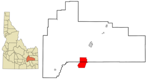
mapsize = 250px
map_caption = Location of Fort Hall, Idaho
mapsize1 =
map_caption1 =subdivision_type = Country
subdivision_name =United States
subdivision_type1 = State
subdivision_name1 =Idaho
subdivision_type2 = Counties
subdivision_name2 = Bannock, Bingham
government_footnotes =
government_type =
leader_title =
leader_name =
leader_title1 =
leader_name1 =
established_title =
established_date =area_footnotes =
unit_pref = Imperial
area_magnitude =
area_total_km2 = 91.1
area_land_km2 = 91.1
area_water_km2 = 0.0
area_total_sq_mi = 35.2
area_land_sq_mi = 35.2
area_water_sq_mi = 0.0population_as_of = 2000
population_footnotes =
population_total = 3193
population_density_km2 = 35.1
population_density_sq_mi = 90.8timezone = Mountain (MST)
utc_offset = -7
timezone_DST = MDT
utc_offset_DST = -6
elevation_footnotes =
elevation_m = 1354
elevation_ft = 4442
latd = 43 |latm = 1 |lats = 7 |latNS = N
longd = 112 |longm = 26 |longs = 54 |longEW = Wpostal_code_type =
ZIP code
postal_code = 83203
area_code = 208
blank_name = FIPS code
blank_info = 16-28360
blank1_name = GNIS feature ID
blank1_info = 0396503
website =
footnotes =Fort Hall is a
census-designated place (CDP) located in northern Bannock County, and southern Bingham County, in southeasternIdaho . It is located on theFort Hall Indian Reservation along theSnake River north of Pocatello, near the site of the originalFort Hall in theOregon Country . The population was 3,193 at the 2000 census.Tbe Bannock County portion of Fort Hall is part of the 'Pocatello, Idaho Metropolitan Statistical Area', while the Bingham County portion is part of the '
Blackfoot, Idaho Micropolitan Statistical Area '.Geography
Fort Hall is located at coor dms|43|1|7|N|112|26|54|W|city (43.018506, -112.448301)GR|1.
According to the
United States Census Bureau , the CDP has a total area of 35.2square mile s (91.1km² ), all of it land.Demographics
As of the
census GR|2 of 2000, there were 3,193 people, 969 households, and 781 families residing in the CDP. Thepopulation density was 90.8 people per square mile (35.1/km²). There were 1,088 housing units at an average density of 30.9/sq mi (11.9/km²). The racial makeup of the CDP was 30.22% White, 0.03% African American, 65.39% Native American, 0.31% Asian, 0.03% Pacific Islander, 2.25% from other races, and 1.75% from two or more races. Hispanic or Latino of any race were 7.61% of the population.There were 969 households out of which 42.2% had children under the age of 18 living with them, 49.6% were married couples living together, 22.5% had a female householder with no husband present, and 19.3% were non-families. 16.3% of all households were made up of individuals and 4.4% had someone living alone who was 65 years of age or older. The average household size was 3.26 and the average family size was 3.63.
In the CDP the population was spread out with 34.7% under the age of 18, 11.3% from 18 to 24, 28.2% from 25 to 44, 18.5% from 45 to 64, and 7.3% who were 65 years of age or older. The median age was 28 years. For every 100 females there were 94.7 males. For every 100 females age 18 and over, there were 92.3 males.
The median income for a household in the CDP was $30,313, and the median income for a family was $32,256. Males had a median income of $27,310 versus $21,544 for females. The
per capita income for the CDP was $10,563. About 22.6% of families and 27.2% of the population were below thepoverty line , including 32.5% of those under age 18 and 26.9% of those age 65 or over.References
External links
Wikimedia Foundation. 2010.