- Clarkesville, Georgia
-
Clarkesville, Georgia — City — Location in Habersham County and the state of Georgia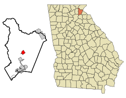
Coordinates: 34°36′38″N 83°31′30″W / 34.61056°N 83.525°WCoordinates: 34°36′38″N 83°31′30″W / 34.61056°N 83.525°W Country United States State Georgia County Habersham Area - Total 1.9 sq mi (4.8 km2) - Land 1.9 sq mi (4.8 km2) - Water 0 sq mi (0 km2) Elevation 1,355 ft (413 m) Population (2000) - Total 1,248 - Density 656.8/sq mi (260/km2) Time zone Eastern (EST) (UTC-5) - Summer (DST) EDT (UTC-4) ZIP code 30523 Area code(s) 706 FIPS code 13-16460[1] GNIS feature ID 0355174[2] Clarkesville is a city located in the center of Habersham County, Georgia. It is also the county seat.
Contents
Geography
Clarkesville is located at 34°36′38″N 83°31′30″W / 34.61056°N 83.525°W (34.610521, -83.525056)[3].
According to the United States Census Bureau, the city has a total area of 1.9 square miles (4.9 km2), all of it land.
Demographics
As of the census[1] of 2000, there were 1,248 people, 580 households, and 335 families residing in the city. The population density was 670.6 people per square mile (259.1/km²). There were 639 housing units at an average density of 343.3 per square mile (132.6/km²). The racial makeup of the city was 90.06% White, 7.77% African American, 0.16% Native American, 0.72% Asian, 0.32% from other races, and 0.96% from two or more races. Hispanic or Latino of any race were 1.36% of the population.
There were 580 households out of which 20.9% had children under the age of 18 living with them, 42.1% were married couples living together, 13.8% had a female householder with no husband present, and 42.2% were non-families. 39.0% of all households were made up of individuals and 23.6% had someone living alone who was 65 years of age or older. The average household size was 2.06 and the average family size was 2.72.
In the city the population was spread out with 19.1% under the age of 18, 7.9% from 18 to 24, 25.0% from 25 to 44, 20.8% from 45 to 64, and 27.2% who were 65 years of age or older. The median age was 44 years. For every 100 females there were 80.9 males. For every 100 females age 18 and over, there were 80.0 males.
The median income for a household in the city was $27,880, and the median income for a family was $39,148. Males had a median income of $26,316 versus $23,977 for females. The per capita income for the city was $20,265. About 9.9% of families and 14.9% of the population were below the poverty line, including 19.8% of those under age 18 and 16.6% of those age 65 or over.
Education
Habersham County School District
The Habersham County School District holds grades pre-school to grade twelve, that consists of eight elementary schools, three middle schools, and two high schools.[4] The district has 367 full-time teachers and over 5,955 students.[5]
Government
The Current City Mayor is Terry Greene.
People
- Red Barron, football and baseball player
- Johnny Mize, baseball player
References
- ^ a b "American FactFinder". United States Census Bureau. http://factfinder.census.gov. Retrieved 2008-01-31.
- ^ "US Board on Geographic Names". United States Geological Survey. 2007-10-25. http://geonames.usgs.gov. Retrieved 2008-01-31.
- ^ "US Gazetteer files: 2010, 2000, and 1990". United States Census Bureau. 2011-02-12. http://www.census.gov/geo/www/gazetteer/gazette.html. Retrieved 2011-04-23.
- ^ Georgia Board of Education, Retrieved June 11, 2010.
- ^ School Stats, Retrieved June 11, 2010.
John Bell- Musician Widepsread Panic
External links
Municipalities and communities of Habersham County, Georgia County seat: Clarkesville Cities 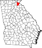
Towns Alto‡ | Mount Airy | Tallulah Falls‡
CDP Unincorporated
communitiesBatesville | Hollywood
Footnotes ‡This populated place also has portions in an adjacent county or counties
Categories:- Cities in Georgia (U.S. state)
- Populated places in Habersham County, Georgia
- County seats in Georgia (U.S. state)


Wikimedia Foundation. 2010.