- Georgia State Route 17
Infobox road
state=GA
type=
route=17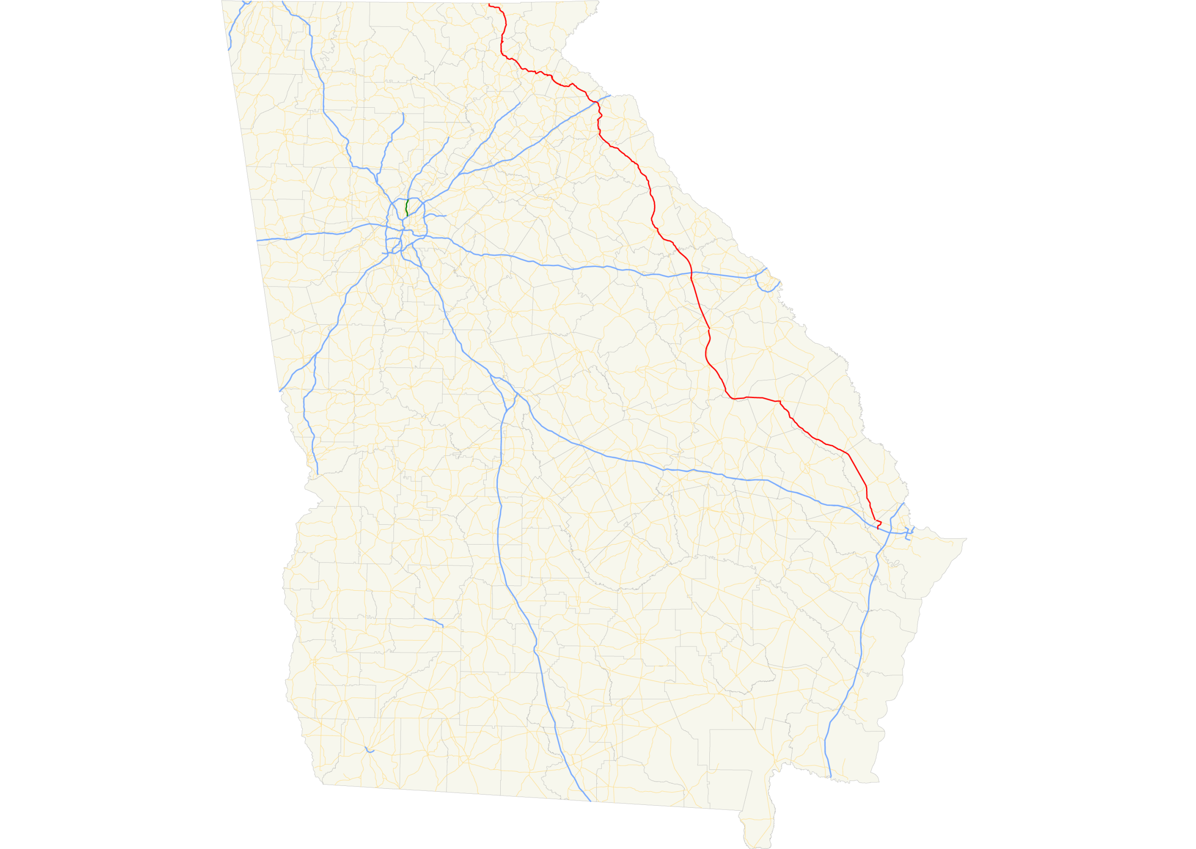
length_mi=300
length_ref= [http://www.dot.state.ga.us/DOT/plan-prog/transportation_data/400reports/2002/dpp444_2002.pdf]
length_round=0
established=
direction_a=South
direction_b=North
starting_terminus=
junction=
ending_terminus= border
previous_route=16
next_route=18State Route 17 is a north-south route located in the
U.S. state of Georgia. The route runs from its southern terminus at I-16 south of Bloomingdale north to theNorth Carolina border north of Hiawassee.Routing
S.R. 17 begins at exit 152 on I-16, the westernmost exit for I-16 in Chatham County. S.R. 17 runs north to Bloomingdale, where it begins a concurrency with U.S. 80/S.R. 26 westward. After entering Effingham County, S.R. 17 departs U.S. 80/S.R. 26, and continues northwest, parallelling the
Ogeechee River through rural parts of Effingham, Screven, and Jenkins Counties before arriving in Millen. After a short concurrency with S.R. 23 and S.R. 67 in Millen, S.R. 17 continues west, then northwest, still parallel to the Ogeechee River, to Louisville. S.R. 17 overlaps U.S. 1/U.S. 221/S.R. 4 from Louisville north to Wrens. In Wrens, S.R. 17 departs and continues to the northwest to Thomson. In Thomson S.R. 17 overlaps U.S. 78/S.R. 10 north to Washington. From Washington, S.R. 17 departs the concurrency with U.S. 78/S.R. 10 and continues north into the mountains of northeast Georgia, first passing through Elberton and Royston, and intersectingInterstate 85 in Lavonia. Southeast of Toccoa, the route turns to a westerly direction to Clarkesville, overlapping U.S. 123/S.R. 365 in the process. Outside of Clarkesville, the continues northwest, passing through the historic Nachoochee Valley. S.R. 17 then begins a concurrency with S.R. 75. The routes travel north through the tourist town of Helen. The two routes continue north overUnicoi Gap , then descend into theHiawassee River valley. East of the town ofHiawassee, Georgia , the routes begin a concurrency with U.S. 76/S.R. 2. In Hiawassee, S.R. 75 departs to the north. A few miles to the west, S.R. 17 departs U.S. 76/S.R. 2, and begins a short concurrency to the north with S.R. 515 until they both reach their northern terminus at the North Carolina border. The road continues into North Carolina asNorth Carolina Highway 69 .Banner Routes
State Route 17 has four banner routes:
* State Route 17 Alternate. S.R. 17 Alternate runs west from its parent route in Clarkesville to meet it again southeast of Toccoa. The route follows a former alignment of S.R. 17.
* State Route 17 Business
* State Route 17 Bypass
* State Route 17 Connector
Wikimedia Foundation. 2010.