- Hiawassee, Georgia
Infobox Settlement
official_name = Hiawassee, Georgia
other_name =
native_name =
nickname =
settlement_type =Town
motto =
imagesize =
image_caption =
flag_size =
image_
seal_size =
image_shield =
shield_size =
image_blank_emblem =
blank_emblem_type =
blank_emblem_size =
imagesize =
image_caption =
flag_size =
image_
seal_size =
image_shield =
shield_size =
image_blank_emblem =
blank_emblem_type =
blank_emblem_size =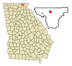
mapsize = 250px
map_caption = Location in Towns County and the state of Georgia
mapsize1 =
map_caption1 =
image_dot_
dot_mapsize =
dot_map_caption =
dot_x =
dot_y =
pushpin_
pushpin_label_position =
pushpin_map_caption =
pushpin_mapsize =
subdivision_type = Country
subdivision_name =United States
subdivision_type1 = State
subdivision_name1 = Georgia
subdivision_type2 = County
subdivision_name2 = Towns
subdivision_type3 =
subdivision_name3 =
subdivision_type4 =
subdivision_name4 =
government_footnotes =
government_type =
leader_title =
leader_name =
leader_title1 =
leader_name1 =
leader_title2 =
leader_name2 =
leader_title3 =
leader_name3 =
leader_title4 =
leader_name4 =
established_title =
established_date =
established_title2 =
established_date2 =
established_title3 =
established_date3 =
area_magnitude =
unit_pref = Imperial
area_footnotes =
area_total_km2 = 5.6
area_land_km2 = 4.4
area_water_km2 = 1.2
area_total_sq_mi = 2.2
area_land_sq_mi = 1.7
area_water_sq_mi = 0.5
area_water_percent =
area_urban_km2 =
area_urban_sq_mi =
area_metro_km2 =
area_metro_sq_mi =
area_blank1_title =
area_blank1_km2 =
area_blank1_sq_mi =
population_as_of = 2000
population_footnotes =
population_note =
population_total = 808
population_density_km2 = 144.3
population_density_sq_mi = 367.3
population_metro =
population_density_metro_km2 =
population_density_metro_sq_mi =
population_urban =
population_density_urban_km2 =
population_density_urban_sq_mi =
population_blank1_title =
population_blank1 =
population_density_blank1_km2 =
population_density_blank1_sq_mi =
timezone = Eastern (EST)
utc_offset = -5
timezone_DST = EDT
utc_offset_DST = -4
latd = 34 |latm = 56 |lats = 58 |latNS = N
longd = 83 |longm = 45 |longs = 18 |longEW = W
elevation_footnotes =
elevation_m = 601
elevation_ft = 1972
postal_code_type =ZIP code
postal_code = 30546
area_code = 706
blank_name = FIPS code
blank_info = 13-38124GR|2
blank1_name = GNIS feature ID
blank1_info = 0328122GR|3
website =
footnotes =Hiawassee is a town in Towns County, Georgia,
United States . The population was 808 at the 2000 census. The city is thecounty seat of Towns CountyGR|6.Geography
Hiawassee is located at coor dms|34|56|58|N|83|45|18|W|city (34.949428, -83.755078)GR|1.
According to the
United States Census Bureau , the town has a total area of 2.2 square miles (5.6 km²), of which, 1.7 square miles (4.4 km²) of it is land and 0.5 square miles (1.2 km²) of it (21.86%) is water.Hiawassee is approximately 2000 feet (609 m) above sea levelGR|3.
Demographics
As of the
census GR|2 of 2000, there were 808 people, 355 households, and 203 families residing in the town. Thepopulation density was 479.5 people per square mile (184.6/km²). There were 527 housing units at an average density of 312.7/sq mi (120.4/km²). The racial makeup of the town was 97.40% White, 0.25% African American, 0.12% Native American, 1.73% Asian, 0.37% from other races, and 0.12% from two or more races. Hispanic or Latino of any race were 1.61% of the population.There were 355 households out of which 14.1% had children under the age of 18 living with them, 45.6% were married couples living together, 10.1% had a female householder with no husband present, and 42.8% were non-families. 40.3% of all households were made up of individuals and 24.2% had someone living alone who was 65 years of age or older. The average household size was 1.86 and the average family size was 2.39.
In the town the population was spread out with 10.0% under the age of 18, 5.4% from 18 to 24, 13.1% from 25 to 44, 25.1% from 45 to 64, and 46.3% who were 65 years of age or older. The median age was 62 years. For every 100 females there were 70.5 males. For every 100 females age 18 and over, there were 65.6 males.
The median income for a household in the town was $26,615, and the median income for a family was $31,458. Males had a median income of $28,929 versus $22,917 for females. The
per capita income for the town was $19,957. About 12.6% of families and 16.0% of the population were below thepoverty line , including 28.3% of those under age 18 and 10.2% of those age 65 or over.Points of interest
*
Fred Hamilton Rhododendron Garden
*Georgia Mountain Fairgrounds
* Lake ChatugeReferences
External links
Wikimedia Foundation. 2010.