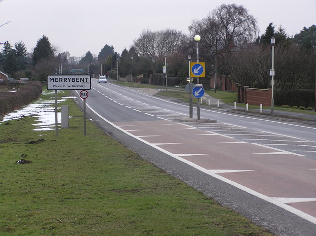
- Merrybent
-
Coordinates: 54°31′31″N 1°37′34″W / 54.52521°N 1.62607°W
Merrybent 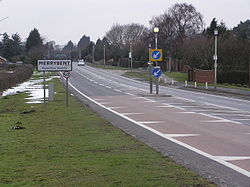
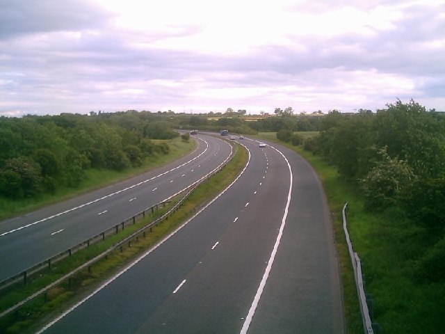
Merrybent on the A67 road
 Merrybent
Merrybent shown within County DurhamOS grid reference NZ240140 Unitary authority Darlington Ceremonial county County Durham Region North East Country England Sovereign state United Kingdom Post town DARLINGTON Postcode district DL2 Dialling code 01325 Police Durham Fire County Durham and Darlington Ambulance North East EU Parliament North East England UK Parliament Sedgefield List of places: UK • England • County Durham Merrybent is a linear village in the civil parish of Low Coniscliffe and Merrybent in County Durham, in England. It is situated on the A67 road to the west of Darlington, a short distance to the north of the River Tees and the Teesdale Way. At the beginning of the 20th century there were hardly any buildings here, and its main feature at that time was Merrybent Nurseries with its many glasshouses. The nursery was cut through by the A1 road in the 1960s; at this point it runs on the trackbed of the old Merrybent railway.[1][2] The village is now a settlement of modern housing.
Contents
Geography
This is a linear village arranged in a north-west to south-east alignment on the A67 road where it crosses the Motorway A1, 1 mile (1.6 km) west of the edge of Darlington. Although the A1 is part of the landscape, there is no access to it from the A67. The underlying geology is glacial clay with areas of gravel, sand, peat and alluvium, and outcrops of magnesian and carboniferous limestone.[1]
History
Road and rail
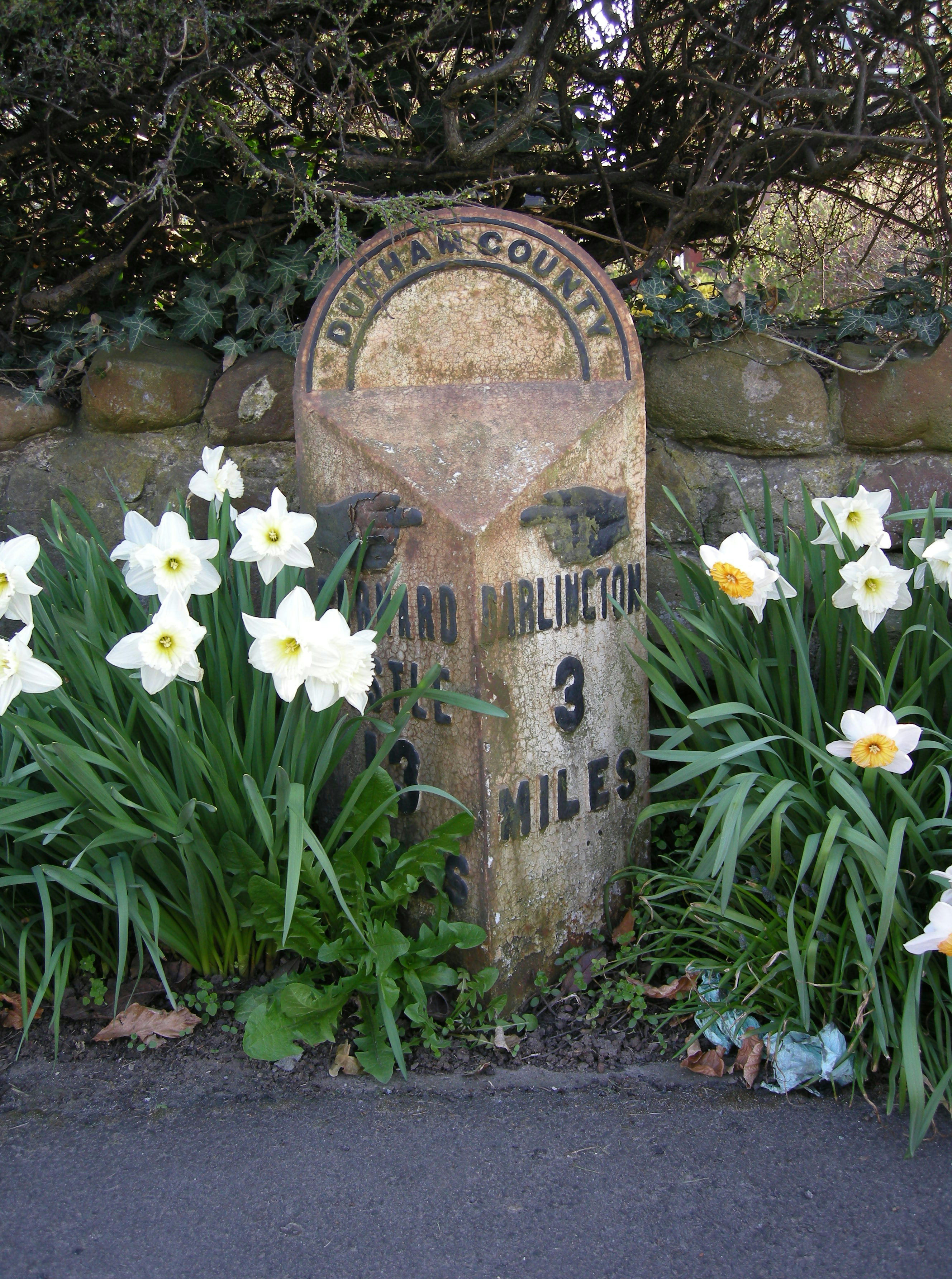
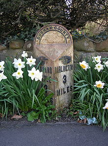 Merrybent milepost
The late 19th century milepost is listed. It is on the south side of the road in front of number 12, near the east end of the village, and was possibly associated with a previous turnpike road. It is triangular in plan, of cast iron with raised black-painted letters on a white-painted background. It says Durham County on the back, Barnard Castle 13 miles with hand pointing west, and Darlington 3 miles with hand pointing east.[3][4]
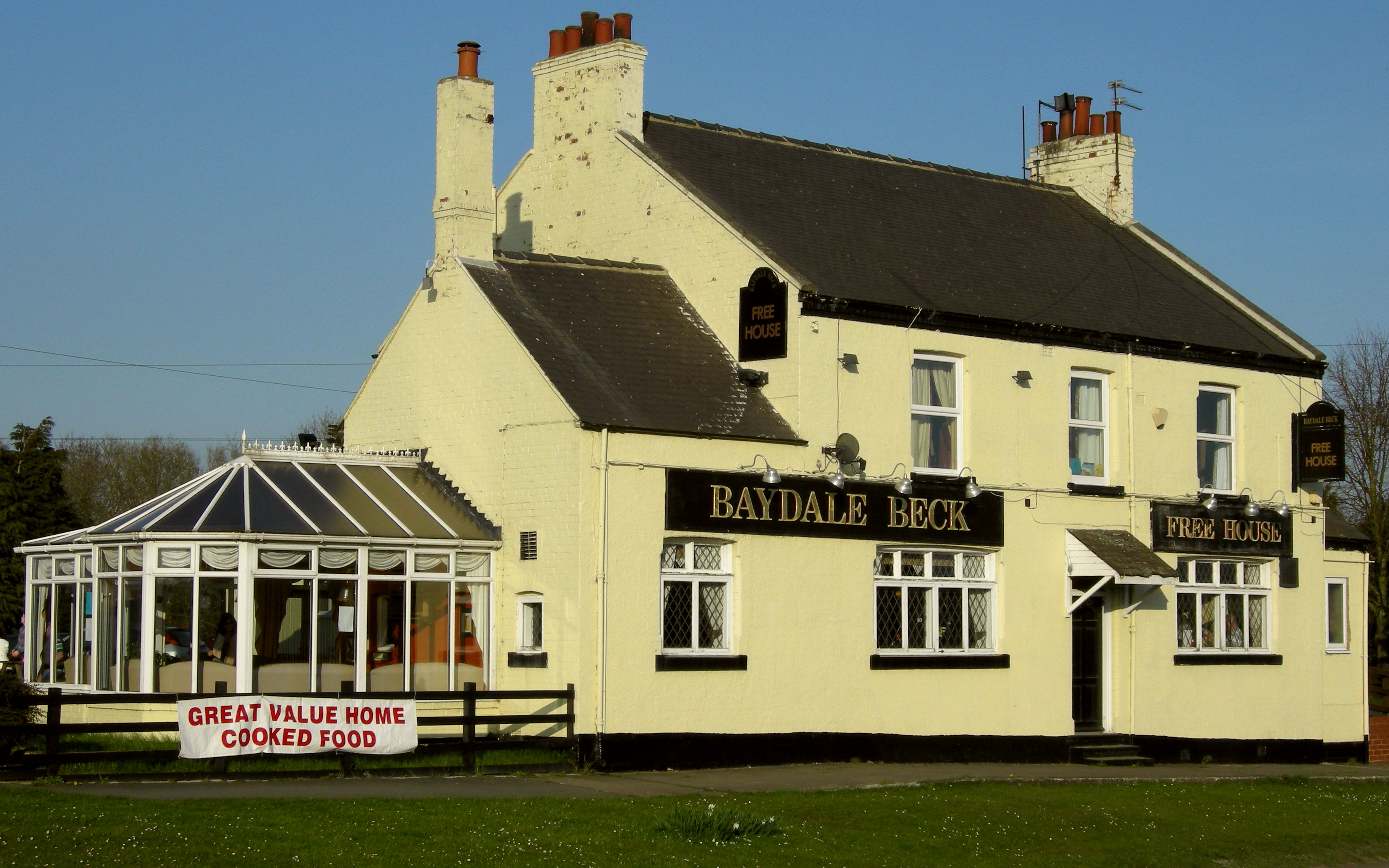
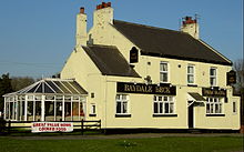 Baydale Beck pub
In 1870 the Merrybent and Darlington Railway was built as a branch line which left the Darlington and Barnard Castle Railway at Merrybent to carry stone from various quarries; it ran from Archdeacon Newton to Barton quarry in North Yorkshire.[1] It was closed in 1878 when the company went bankrupt, but the line and quarries were re-opened by North Eastern Railway in 1890.[2][5] The railway was abandoned in 1938, and later dismantled.[1]
The A1, built 1963−1965,[6] now follows the old rail trackbed as far as Barton quarries.[2][5] The A1 was first proposed in 1929 but postponed due to the 1930s recession and World War II.[7] After the Merrybent railway was abandoned, the road plan was associated with the Darlington bypass as a motorway in 1949, and was moved eastwards onto the old trackway in 1950. After various planning adjustments, construction of this stretch of the A1 started officially by Dowsett Engineering Ltd. of Gateshead on 6 May 1963.[1] Peak production occurred in 1964, involving up to 800 men, and the road was opened on 14 May, 1965 at a final cost of £6.5 million.[7] Because the road followed the rail trackway, the only property affected on this part of the A1, apart from the station house at Barton, was the glasshouses at Merrybent Nurseries.[1]
Settlement
The Ordnance Survey map of 1912−1913 shows the area almost without buildings.[8] During World War II there were landgirls from the Women's Land Army working at Merrybent Nurseries. There were 56 glasshouses owned by the Co-operative Society; the girls grew tomatoes, controlled the rats, and were billeted in Darlington.[9]
Merrybent today
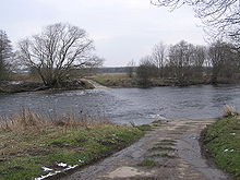
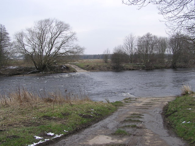
The present village was built mostly in the 20th century, and in 2008−2009 new houses cost £95−320k.[10] A strategic greenfield building site was identified on fields at the south-east of Merrybent by Darlington Borough Council in 2009.[11] There is no school here, but the village is on the Barnard Castle School bus route.[12] The Teesdale Way passes along the north bank of the meandering River Tees to the south of the village.[13]
References
- ^ a b c d e f "The motorway archive". Region: North East A1(M) & A66(M). The Darlington By-Pass motorway (J56 to J59). Motorway Archive Trust. http://www.motorwayarchive.ihtservices.co.uk/a1durdarl.htm. Retrieved 8 April 2010.
- ^ a b c Lloyd, Chris (15 June 2005). "Encyclopedia.com". Echo memories: End of the line at Merrybent.. Northern Echo. http://www.encyclopedia.com/doc/1P2-10278095.html. Retrieved 7 April 2010.
- ^ "Keys to the past". Milepost in front of number 12 (cedar ridge); Listed building (Merrybent). DCC. 2010. http://www.keystothepast.info/durhamcc/K2P.nsf/K2PDetail?readform&PRN=D11566. Retrieved 7 April 2010.
- ^ Lloyd, Chris (27 October 2009). "Northern Echo". Existence proved of the yeti of mileys. http://www.thenorthernecho.co.uk/features/blogs/staff/echomemories/4704898.Existence_proved_of_the_yeti_of_mileys/. Retrieved 7 April 2010.
- ^ a b "History of railways in County Durham". Iron railways. 4 October 2009. http://sites.google.com/site/waggonways/history-durham. Retrieved 7 April 2010.
- ^ Lloyd, Chris (2 December 2009). "The Northern Echo". The Motorway Achievement: Building the Network in the North-East of England, by FA Sims. http://www.thenorthernecho.co.uk/history/books/4773185.Read_all_about_it/. Retrieved 7 April 2010.
- ^ a b Lloyd, Chris (12 October 2009). "The Northern Echo". Darlington: Of policemen, motorways and town centre street names. Newsquest Media Group. http://www.thenorthernecho.co.uk/features/blogs/staff/echomemories/4676881.Of_policemen_and_motorways/. Retrieved 8 April 2010.
- ^ "Francis Frith". Old maps of Merrybent. 2010. http://www.francisfrith.com/merrybent/maps/. Retrieved 7 April 2010.
- ^ Yeadon, Hazel (30 December 2005). "BBC". WW2 people's war. http://www.bbc.co.uk/ww2peopleswar/stories/80/a8132780.shtml. Retrieved 7 April 2010.
- ^ "House prices". Merrybent Drive Merrybent Darlington DL2. 2010. http://www.houseprices.co.uk/merrybent-drive-merrybent-darlington-dl2/. Retrieved 7 April 2010.
- ^ "Darlington Borough Council". Strategic housing land availability assessment: Merrybent and High Coniscliffe. DBC. September 2009. http://www.darlington.gov.uk/dar_public/documents/Development%20and%20Environment/Development%20and%20Regeneration/Planning%20Services/Policy/SHLAA/dec09/Appendix_3f.pdf. Retrieved 8 April 2010.
- ^ "Barnard Castle coeducational and day boarding school". Bus routes for day pupils. 2010. http://www.barnardcastleschool.org.uk/admissions-bus-routes.asp. Retrieved 7 April 2010.
- ^ "Walks around the borough of Darlington". No. 5: Coniscliffe Moor and Teesdale Way (leaflet). Darlington Borough Council. 2 August 1999. http://www.darlington.gov.uk/dar_public/documents/Development%20and%20Environment/Countryside/coniscliffemoorandteesdaleway.pdf. Retrieved 8 April 2010.
External links

High Coniscliffe Archdeacon Newton Branksome and Mowden
DARLINGTONRiver Tees / Cliffe 
Hummersknott
DARLINGTON Merrybent

River Tees / Manfield River Tees / Howden Hill
CleasbyLow Coniscliffe Categories:- Villages in County Durham
- Darlington (borough)
- Locations in the Tees Valley


Wikimedia Foundation. 2010.