- Sarasota Springs, Florida
-
Sarasota Springs, Florida — CDP — Location in Sarasota County and the state of Florida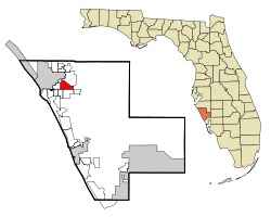
Coordinates: 27°18′36″N 82°28′42″W / 27.31°N 82.47833°WCoordinates: 27°18′36″N 82°28′42″W / 27.31°N 82.47833°W Country  United States
State  Florida
County Sarasota Area - Total 3.6 sq mi (9.4 km2) - Land 3.6 sq mi (9.4 km2) - Water 0 sq mi (0 km2) Elevation 23 ft (7 m) Population (2000) - Total 15,875 - Density 4,409.7/sq mi (1,688.8/km2) Time zone Eastern (EST) (UTC-5) - Summer (DST) EDT (UTC-4) FIPS code 12-64325[1] GNIS feature ID 1867200[2] Sarasota Springs is a census-designated place (CDP) in Sarasota County, Florida, United States. The population was 15,875 at the 2000 census. It is part of the Bradenton–Sarasota–Venice Metropolitan Statistical Area.
Geography
Sarasota Springs is located at 27°18′36″N 82°28′42″W / 27.31°N 82.47833°W (27.309924, -82.478383)[3].
According to the United States Census Bureau, the CDP has a total area of 3.6 square miles (9.3 km2), all of it land.
Demographics
Historical populations Census Pop. %± 1970 4,405 — 1980 13,860 214.6% 1990 16,088 16.1% 2000 15,875 −1.3% source: [4] As of the census[1] of 2000, there were 15,875 people, 6,611 households, and 4,469 families residing in the CDP. The population density was 4,389.6 people per square mile (1,693.2/km²). There were 7,101 housing units at an average density of 1,963.5/sq mi (757.4/km²). The racial makeup of the CDP was 95.65% White, 0.73% African American, 0.23% Native American, 0.74% Asian, 0.03% Pacific Islander, 1.28% from other races, and 1.34% from two or more races. Hispanic or Latino of any race were 4.78% of the population.
There were 6,611 households out of which 28.4% had children under the age of 18 living with them, 53.2% were married couples living together, 11.1% had a female householder with no husband present, and 32.4% were non-families. 25.5% of all households were made up of individuals and 12.7% had someone living alone who was 65 years of age or older. The average household size was 2.40 and the average family size was 2.87.
In the CDP the population was spread out with 22.5% under the age of 18, 5.7% from 18 to 24, 28.5% from 25 to 44, 24.9% from 45 to 64, and 18.4% who were 65 years of age or older. The median age was 41 years. For every 100 females there were 92.3 males. For every 100 females age 18 and over, there were 87.2 males.
The median income for a household in the CDP was $41,981, and the median income for a family was $50,131. Males had a median income of $31,418 versus $25,227 for females. The per capita income for the CDP was $22,427. About 5.2% of families and 6.9% of the population were below the poverty line, including 10.9% of those under age 18 and 1.8% of those age 65 or over.
References
- ^ a b "American FactFinder". United States Census Bureau. http://factfinder.census.gov. Retrieved 2008-01-31.
- ^ "US Board on Geographic Names". United States Geological Survey. 2007-10-25. http://geonames.usgs.gov. Retrieved 2008-01-31.
- ^ "US Gazetteer files: 2010, 2000, and 1990". United States Census Bureau. 2011-02-12. http://www.census.gov/geo/www/gazetteer/gazette.html. Retrieved 2011-04-23.
- ^ "CENSUS OF POPULATION AND HOUSING (1790-2000)". U.S. Census Bureau. http://www.census.gov/prod/www/abs/decennial/index.html. Retrieved 2010-07-17.
Municipalities and communities of Sarasota County, Florida Cities North Port | Sarasota | Venice

Town CDPs Bee Ridge | Desoto Lakes | Englewood‡ | Fruitville | Gulf Gate Estates | Kensington Park | Lake Sarasota | Laurel | The Meadows | Nokomis | North Sarasota | Osprey | Plantation | Ridge Wood Heights | Sarasota Springs | Siesta Key | Southgate | South Gate Ridge | South Sarasota | South Venice | Vamo | Venice Gardens | Warm Mineral Springs
Unincorporated
communityFootnotes ‡This populated place also has portions in an adjacent county or counties
Categories:- Census-designated places in Sarasota County, Florida
- Bradenton–Sarasota–Venice metropolitan area


Wikimedia Foundation. 2010.