- Guerneville, California
Infobox Settlement
official_name = Guerneville, California
other_name = "Stumptown"
native_name =
nickname =
settlement_type = CDP
motto =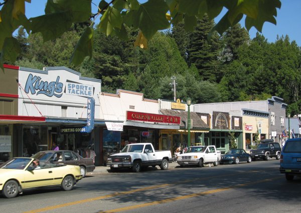
imagesize = 275px
image_caption = downtown area along Main Street
flag_size =
image_
seal_size =
image_shield =
shield_size =
image_blank_emblem =
blank_emblem_type =
blank_emblem_size =
flag_size =
image_
seal_size =
image_shield =
shield_size =
image_blank_emblem =
blank_emblem_type =
blank_emblem_size =
mapsize = 250x200px
map_caption = Location in Sonoma County and the state ofCalifornia
mapsize1 =
map_caption1 =
image_dot_
dot_mapsize =
dot_map_caption =
dot_x =
dot_y =
pushpin_
pushpin_label_position =
pushpin_map_caption =
pushpin_mapsize =
subdivision_type = Country
subdivision_name =United States
subdivision_type1 = State
subdivision_name1 =California
subdivision_type2 = County
subdivision_name2 = Sonoma
subdivision_type3 =
subdivision_name3 =
subdivision_type4 =
subdivision_name4 =
government_footnotes =
government_type =
leader_title =
leader_name =
leader_title1 =
leader_name1 =
leader_title2 =
leader_name2 =
leader_title3 =
leader_name3 =
leader_title4 =
leader_name4 =
established_title =
established_date =
established_title2 =
established_date2 =
established_title3 =
established_date3 =
area_magnitude =
unit_pref =
area_footnotes = GR|2
area_total_km2 = 8.9
area_land_km2 = 8.5
area_water_km2 = 0.4
area_total_sq_mi = 3.44
area_land_sq_mi = 3.29
area_water_sq_mi = 0.16
area_water_percent = 4.7
area_urban_km2 =
area_urban_sq_mi =
area_metro_km2 =
area_metro_sq_mi =
area_blank1_title =
area_blank1_km2 =
area_blank1_sq_mi =
population_as_of = 2000
population_footnotes = GR|2
population_note =
population_total = 2441
population_density_sq_mi = 743
population_metro =
population_density_metro_sq_mi =
population_urban =
population_density_urban_sq_mi =
population_blank1_title =
population_blank1 =
population_density_blank1_sq_mi =
timezone = PST
utc_offset = -8
timezone_DST = PDT
utc_offset_DST = -7
latd = 38 |latm = 30 |lats = 23 |latNS = N
longd = 122 |longm = 59 |longs = 27 |longEW = W
elevation_footnotes = gnis|277527|Guerneville]
elevation_m = 18
elevation_ft = 59
postal_code_type =ZIP code
postal_code = 95446
area_code = 707
blank_name = FIPS code
blank_info = 06-31470
blank1_name = GNIS feature ID
blank1_info = 277527
website =
footnotes =Guerneville (IPA-en|ˈɡɜrnvɪl or (two syllables) "gurn-vill") is a
census-designated place inSonoma County, California , USA. As of the 2000 census, its population was 2,441.GR|2 Guerneville is a popular family destination, gay resort [http://gaytravel.about.com/od/restaurants/gr/Applewood_Inn.htm Applewood Restaurant - Gay Russian River] , About.com, by Amdrew Collins, access date July 31, 2008] [http://www.russianriver.com/gayrussianriver.html Gay Russian River] , access date July 31, 2008] [http://www.guerneville-online.com/gaytravel.htm Gay Travel] , access date July 31, 2008] , and camping center in theRussian River Valley . It was founded by the Guerne family four generations ago in the 1850s.History
Guerneville is built adjacent to the Russian River. Redwoods grew in the riverbed with such vigor that just a few centuries ago, the valley had the greatest biomass density on the planet, according to local lore. The local Pomo Indians used the area as a summer camp and called it "Ceola" (IPA-en|ˈsiːoʊleɪ or "cee-oh-lay") which meant "shady place." Except for a large, beautiful stand of truly ancient trees preserved in the Fife Creek watershed, now the centerpiece of Armstrong Woods Park, many of the trees were logged in the 1800s, giving rise to the first English name for the place - "Stumptown." The annual town parade still commemorates the old place name by calling itself "Stumptown Days." The present name Guerneville was introduced to honor Swiss immigrant George Guerne, a local businessman of the 1800s who owned the town's sawmill. The extensive redwood forests on the surrounding mountains are less than 200 years old, having been replacement plantings for the much of the logging done in the 1800s.
The area became popular with vacationers from San Francisco in the late 1800s. The
Northwestern Pacific Railroad provided access to the town from its origin in southernMarin County , just north ofSan Francisco at the mouth ofSan Francisco Bay . Even with the demise of train service in the late 1930s, the area's resorts remained popular with vacationers who came by automobile through the 1950s. A local movie theater, the River, was built near the beach and showed double features throughout the 1950s and 1960s. The coming of jet airplane travel in the 1960s marked a period of decline for many of the older resorts. Winter floods in 1964 caused a further decline in business conditions. Many housing units that were once summer-only cottages began to be used year-round by low-income households, and illegal drug use became more prevalent throughout the region. However, a renaissance took place in the late 1970s as large numbers ofgay men andlesbians from San Francisco identified the area as a prime recreational destination for weekends. Many older resorts gained a new lease on life with the new visitors, and in general, the town's businesses began to thrive again. Modern Guerneville continues to exude small-town charm, from its plaza in the town center with permanent chess tables, to small shops, and a public beach area in the heart of town along the Russian River that is used for fishing, swimming, boating, and sunbathing. Just as in the past, the river is open to the public, and features free admission, free parking, boat and umbrella rentals, and concession stands with a variety of food items for sale.Gay life
The town is a vacation destination for people from the
San Francisco Bay Area and since the legalization of gay marriage in California has been attempting to capitalize on gay honeymoon business in its off season. [http://www.topix.com/news/gay/2008/06/wooing-same-sex-weddings-in-guerneville Wooing same sex weddings in Guerneville] , Topix, June 3, 2008 access date July 31, 2008]The town hosts the annual
Lazy Bear Weekend , from late July to early August, a gay bear charity event for theLGBT community. [http://www.castrobear.com/LazyBearWeekend/index.html CastroBear] , access date July 31, 2008] [http://www.russianriver.com/ Lazy Bear Weekend at the Russian River 2008] , access date July 31, 2008]Local politics
The liberality of the town is generally consistent with most of western Sonoma County politics.
Redevelopment in the town of Guerneville has been a controversial issue. This rural, unincorporated town was declared blighted by County Supervisors, who proposed certain changes. Likewise, in the neighboring town of Monte Rio a waste-water sewer project is opposed by many, and there is a belief among some people that the two projects are inter-related and that both could possibly harm the environment.
In the media
Guerneville's older metal truss bridge can be filmed from the newer bridge, and made an appearance in the movie [http://www.imdb.com/title/tt0140397/ "Mumford"] as a location for people to walk and talk in idyllic settings.
The Russian River area occasionally appears in local and/or national news due to significant winter flooding, the worst of which occurred in 1986. Long-term residents treat floods as a major headache, but a reasonable price paid for living in a beautiful place. Because much of the housing is elevated, thanks in large part to FEMA grants, floods no longer have the impact they once did and recovery for most residents and businesses is much faster than in earlier times. The effects of floods are mitigated by the extensive upstream
floodplain storage capacity of theLaguna de Santa Rosa .Bohemian Grove
Bohemian Grove , a private club, has extensive land holdings in the area, which are used for summer retreats involving many high-ranking members of the business and government communities. The club has stirred a level of opposition in the community.Geography
Guerneville is located in western Sonoma County, along the Russian River on State Route 116, between Monte Rio to the west and Forestville to the east. It is at coor dms|38|30|23|N|122|59|27|W|city (38.506349, -122.990834)GR|1.
The CDP has a total area of convert|3.44|sqmi|km2|1|abbr=on. Of that, convert|3.29|sqmi|km2|1|abbr=on is land and convert|0.16|sqmi|km2|1|abbr=on (4.7%) is water.GR|2
Climate
Guerneville has cool, very wet winters and warm, relatively dry summers. Although rainfall is rare during the summer months, fog often comes up the river from the Pacific Ocean, producing enough condensation to create "
fog drip ," which sustains the numerous redwood trees, ferns, and other vegetation.The
National Weather Service reports that Guerneville has an average annual rainfall of convert|49.15|in|mm. Measurable precipiation occurs on an average of 73 days each year. The wettest year was 1970 with convert|70.20|in|mm and the dryest year was 1949 with convert|31.34|in|mm. The most rainfall in one month was 29.08 in January 1970. The most rainfall in 24 hours was convert|8.40|in|mm on February 8, 1960.Although no official temperature records exist for Guerneville, the nearby town of Graton has average January temperatures ranging from convert|35.7|°F|°C|abbr=on. to convert|56.1|°F|°C|abbr=on and July temperatures from convert|48.4|°F|°C|abbr=on to convert|83.5|°F|°C|abbr=on. There are an average of 28.7 days annually with highs of 90 °F (32 °C) or higher and 44.7 days annually with lows of 32 °F (0 °C) or lower. The record high temperature was convert|113|°F|°C|abbr=on on July 14, 1972, and the record low temperature was convert|14|°F|°C|abbr=on on December 22, 1990. Other nearby cooperative National Weather Service stations are in Occidental, Cazadero, and Fort Ross. [ [http://www.wrcc.dri.edu/summary/Climsmcca.html Central California ] ]
Demographics
As of the
census GR|2 of 2000, there were 2,441 people, 1,097 households, and 523 families residing in the CDP. Thepopulation density was 743/sq mi (287/km²). There were 1,463 housing units at an average density of 445/sq mi (172/km²). The racial makeup of the CDP was 87.42% White, 0.70% African American, 1.07% Native American, 0.61% Asian, 0.20% Pacific Islander, 4.51% from other races, and 5.49% from two or more races. Hispanic or Latino of any race were 14.54% of the population.There were 1,097 households out of which 22.0% had children under the age of 18 living with them, 28.4% were married couples living together, 14.1% had a female householder with no husband present, and 52.3% were non-families. 34.8% of all households were made up of individuals and 8.5% had someone living alone who was 65 years of age or older. The average household size was 2.17 and the average family size was 2.86.
In the CDP the population was spread out with 19.7% under the age of 18, 7.5% from 18 to 24, 30.2% from 25 to 44, 32.3% from 45 to 64, and 10.4% who were 65 years of age or older. The median age was 42 years. For every 100 females there were 108.5 males. For every 100 females age 18 and over, there were 109.3 males.
The median income for a household in the CDP was $37,266, and the median income for a family was $45,875. Males had a median income of $32,350 versus $31,429 for females. The
per capita income for the CDP was $22,793. About 13.5% of families and 13.1% of the population were below thepoverty line , including 25.6% of those under age 18 and 5.4% of those age 65 or over.As of 2000 90% of people from Guerneville speak primarily English while 10% do not of these, 6% speak Spanish, 1% speak Russian, 1% speak French, 1% speak German, 1% speak Portuguese, less than 1% speak "other west germanic languages", Tagalog and Thai respectively. [http://www.mla.org/cgi-shl/docstudio/docs.pl?map_data_primary MLA Data Center] , access date July 31, 2008]
Politics
In the state legislature Guerneville is located in the 2nd Senate District, represented by Democrat
Pat Wiggins , and in the 1st Assembly District, represented by Democrat Patty Berg. Federally, Guerneville is located inCalifornia's 6th congressional district .References
External links
* [http://www.guerneville-online.com/ Official website]
* [http://www.sonomalibrary.org/branches/Guerneville.html Guerneville library]
* [http://www.russianriver.com/ Area chamber of commerce]
* [http://www.gayrussianriver.com/barsanddining.html Gay Russian River]
* [http://www.city-data.com/city/Guerneville-California.html City Data profile] - statistics and photo gallery
Wikimedia Foundation. 2010.