- Dardanelle, Arkansas
-
Dardanelle, Arkansas — City — Historic downtown Dardanelle Feb-09 Location in Yell County and the state of Arkansas
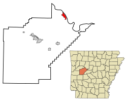
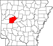
Coordinates: 35°13′21″N 93°9′37″W / 35.2225°N 93.16028°WCoordinates: 35°13′21″N 93°9′37″W / 35.2225°N 93.16028°W Country United States State Arkansas County Yell Area – Total 3.1 sq mi (7.9 km2) – Land 3.1 sq mi (7.9 km2) – Water 0 sq mi (0 km2) Elevation 331 ft (101 m) Population (2000) – Total 4,228 – Density 1,363.9/sq mi (535.2/km2) Time zone Central (CST) (UTC-6) – Summer (DST) CDT (UTC-5) ZIP code 72834 Area code(s) 479 FIPS code 05-17380 GNIS feature ID 0079131 Dardanelle is a city in Yell County, Arkansas, United States. The population was 4,228 at the 2000 census. Along with Danville, it is one of two county seats for Yell County.[1] It is located near Lake Dardanelle.
Dardanelle is part of the Russellville Micropolitan Statistical Area.
Contents
Geography
Dardanelle is located at 35°13′21″N 93°9′37″W / 35.2225°N 93.16028°W (35.222539, -93.160408)[2].
According to the United States Census Bureau, the city has a total area of 3.1 square miles (8.0 km2), all land.
Demographics
As of the census[3] of 2000, there were 4,228 people, 1,605 households, and 1,078 families residing in the city. The population density was 1,382.0 people per square mile (533.5/km²). There were 1,747 housing units at an average density of 571.0 per square mile (220.4/km²). The racial makeup of the city was 75.24% White, 4.64% Black or African American, 0.54% Native American, 0.43% Asian, 0.09% Pacific Islander, 16.65% from other races, and 2.41% from two or more races. 21.48% of the population were Hispanic or Latino of any race.
In the city the population was spread out with 25.4% under the age of 18, 9.9% from 18 to 24, 28.5% from 25 to 44, 19.7% from 45 to 64, and 16.5% who were 65 years of age or older. The median age was 35 years. For every 100 females there were 92.7 males. For every 100 females age 18 and over, there were 86.6 males.The median income for a household in the city was $25,727, and the median income for a family was $30,457. Males had a median income of $21,138 versus $17,370 for females. The per capita income for the city was $14,583. About 14.9% of families and 19.6% of the population were below the poverty line, including 26.5% of those under age 18 and 14.0% of those age 65 or over.
According to Dardanelle city Census 2010 results, the population of the area was approximately 4,745 people. From 2000 to 2010, the Dardanelle city population growth percentage was 12.2% (or from 4,228 people to 4,745 people). 28.7% of the Dardanelle city residents were under 18 years of age. Census 2010 race data for Dardanelle city include the racial breakdown percentages of 3.6% black, 0.5% Asian and 36.1% Hispanic. Also, there were 1,877 housing units in Dardanelle city, 89.5% of which were occupied housing units There were 1,605 households out of which 32.8% had children under the age of 18 living with them, 47.9% were married couples living together, 14.1% had a female householder with no husband present, and 32.8% were non-families. 29.2% of all households were made up of individuals and 15.3% had someone living alone who was 65 years of age or older. The average household size was 2.56 and the average family size was 3.12.
History
Dardanelle is one of the oldest cities in the state of Arkansas. Officially incorporated in 1855, Dardanelle celebrated its 150th Anniversary in 2005. However, the area had been settled for years before that, first being established as a river town in the mid-18th Century. It is Yell County's dual county seat, sharing that title with Danville.
The Treaty of Council Oaks was signed on June 24, 1823 on what is now Front Street beneath two huge, old oak trees (102 feet high and 400–500 years old). Under orders of President James Monroe, U.S. Army Colonel David Brearly and Arkansas territorial secretary Robert Crittendon met with Chief Black Fox and several Cherokee leaders to determine boundaries. As a result of the treaty, the Cherokees gave up all of their land in Arkansas south of the Arkansas River. One of the two trees was destroyed in the early 1990s in a flood, but the other is still standing tall. The site is now a city park.
Due to its location on the banks of the Arkansas River, Dardanelle was one of Arkansas's leading towns in the 19th century. Hundreds of barges, boats, and other vessels traveled by the town annually. Approximately halfway between the state's two largest cities of Little Rock and Fort Smith, Dardanelle was a transportation and business hub.
Dardanelle has a history of being one of the state's leading immigration centers that continues to this day. Vast numbers of Czech and German families, including Ballouns, Vodrazkas, Staneks, and Pfeiffers, came to the town in the late 18th and early 19th centuries, and their impact can still be felt today. Currently, Dardanelle has one of the highest percentage of Hispanics in the state, with over 21% of the town's population being Hispanic.
Merritt Park opened in the late 1990s on the west side of town. It is a large, state-of-the-art park featuring outstanding baseball facilities, a playground, soccer fields, basketball courts, and a walking/jogging trail. The adjacent Dardanelle Community Center opened around the same time, and provides multiple services for the community.
Dardanelle's downtown area is currently under a drastic revitalization. After falling into decay for a number of years, Front Street on the River is once again a thriving place. Daly's Downtown (now Front Street Grill) and Savanah's have anchored this rejuvenation. The Bank of Dardanelle (now River Town Bank), which now has ten locations across the state, first opened on Front Street many years ago. The Dardanelle Post-Dispatch, the oldest weekly newspaper in the state, have their offices there. Millyn's and a number of other businesses can be found there, too. Beautiful views of the river, historic buildings, and a thriving restaurant scene makes Front Street one of the premier places to go in the Arkansas River Valley.
Other main commercial areas in the city include Union Street, Quay Street, and 2nd Street. A Wal-Mart Supercenter opened in October 2005, replacing the old Wal-Mart Express.
Dardanelle is well-known for its local restaurants. Daly's Downtown (now Front Street Grill), and Savannah's can be found on Front Street. Catfish 'N was ranked by "USA Today" as one of the best restaurants in America. Dari Delite is a favorite hangout among the teenage crowd. A plethora of Mexican restaurants, such as Tarasco's Mexican Restaurant, El Parian and Casa de Sol can be found, showcasing the city's vibrant Hispanic culture.
Transportation
Though Dardanelle is no longer one of Arkansas's largest cities, it still plays a prominent role in state affairs. The Port of Dardanelle is one of the busiest in Arkansas.
In the late 19th century, a pontoon bridge between Dardanelle and Russellville replaced ferry service. Spanning 2,208 feet, it was the longest pontoon bridge ever constructed across a moving body of water. The bridge was completely washed out four times in its 30 years of existence.
The Dardanelle Lock & Dam, constructed in the 1960s as a part of the McClellan-Kerr Navigation System, led to the formation of Lake Dardanelle and helps regulate river traffic on the Arkansas River.
The Dardanelle and Russellville Railroad, or "D&R" as it is known locally, is one of few remaining short-line railroads in the state. It connects Dardanelle with its larger neighbor on the north bank of the river.
Highways 7, 22, 27, and 28 can be found ending or going through Dardanelle. Dardanelle is halfway between the Buffalo River to the north and Hot Springs to the south on Scenic Byway 7.
Attractions
A number of attractions can be found in Dardanelle or its surrounding area, including:
- Lake Dardanelle
- Mount Nebo and Mount Nebo State Park
- Holla Bend National Wildlife Refuge
- The Lion's Den Golf Course
- The Yell County Courthouse (on the National Register of Historic Places)
- Dana Merritt Park
- Veterans' Memorial Riverfront Park
- Council Oaks Park and Historic Site
- Dardanelle Rock
Notable residents and trivia
- Jim R. Caldwell (born 1936), first Republican to serve in the Arkansas State Senate since Reconstruction, 1969–1978
- Pro golfer John Daly lived in Dardanelle as a child; he currently owns a home near Dardanelle and owns the Lion's Den Golf Course.
- The childhood home of the former director of FEMA, James Lee Witt.
- Dardanelle is mentioned in the famous 1921 blues song "Arkansas Blues" (written by Anton Lada and Spencer Williams.
- In the 1968 novel True Grit, by Charles Portis, the lead character Mattie Ross talks about being from a farm in Yell County, near Dardanelle. The novel has spawned two films of the same name, one released in 1969 and another in 2010.
- Simon Sades, television preacher and charity worker.
- Rae Lynne Bailey
- Haley Deeds
- Alexis Newman
References
- ^ "Find a County". National Association of Counties. http://www.naco.org/Counties/Pages/FindACounty.aspx. Retrieved 2011-06-07.
- ^ "US Gazetteer files: 2010, 2000, and 1990". United States Census Bureau. 2011-02-12. http://www.census.gov/geo/www/gazetteer/gazette.html. Retrieved 2011-04-23.
- ^ "American FactFinder". United States Census Bureau. http://factfinder.census.gov. Retrieved 2008-01-31.
External links
Municipalities and communities of Yell County, Arkansas Cities Belleville | Danville | Dardanelle | Havana | Ola | Plainview
Town Unincorporated
communitiesCategories:- Populated places in Yell County, Arkansas
- Cities in Arkansas
- County seats in Arkansas
- Russellville micropolitan area
- Populated places established in 1855


Wikimedia Foundation. 2010.