Mellingen, Germany

Mellingen, Germany
Mellingen
Coat of arms of Mellingen
Mellingen is located in Germany
{{{alt}}}
Mellingen
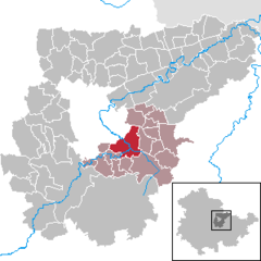
Coordinates 50°56′37″N 11°23′36″E / 50.94361°N 11.39333°E / 50.94361; 11.39333Coordinates: 50°56′37″N 11°23′36″E / 50.94361°N 11.39333°E / 50.94361; 11.39333
Administration
Country Germany
State Thuringia
District Weimarer Land
Municipal assoc. Mellingen
Mayor Renate Schwarz
Basic statistics
Area 14.41 km2 (5.56 sq mi)
Elevation 230 m  (755 ft)
Population 1,240 (31 December 2010)[1]
 - Density 86 /km2 (223 /sq mi)
Other information
Time zone CET/CEST (UTC+1/+2)
Licence plate AP
Postal code 99441
Area code 036453
Website www.mellingen-online.de

Mellingen is a municipality in the Weimarer Land district of Thuringia, Germany.

References


Wikimedia Foundation. 2010.

Игры ⚽ Нужен реферат?

Look at other dictionaries:

  • Mellingen — For the town in Thuringia, see Mellingen, Germany. Mellingen Mellingen village Country Switzerland …   Wikipedia

  • Mellingen (Verwaltungsgemeinschaft) — Mellingen is a Verwaltungsgemeinschaft in the district Weimarer Land in Thuringia, Germany. The seat of the Verwaltungsgemeinschaft is in Mellingen. The Verwaltungsgemeinschaft Mellingen consists of the following municipalities: Buchfart… …   Wikipedia

  • Magdala, Germany — Magdala …   Wikipedia

  • Area codes in Germany — see also Telephone numbering in Germany for further codes including service numbers, cell phones etc. Area codes in Germany (German Vorwahl ) have two to five digits, not counting the leading zero. The leading zero must be dialed when calling… …   Wikipedia

  • Liste der Kirchen in Weimar und dem Kreis Weimarer Land — Diese Liste enthält Kirchengebäude im Landkreis Weimarer Land und der Stadt Weimar in Thüringen. Allgemeines Der Landkreis Weimarer Land zählt 8 Städte, davon sind 4 Mitglied einer Verwaltungsgemeinschaft 1 erfüllende Gemeinde für 12 Gemeinden 1… …   Deutsch Wikipedia

  • Döbritschen — Döbritschen …   Wikipedia

  • Mechelroda — Mechelroda …   Wikipedia

  • Oettern — Oettern …   Wikipedia

  • Reuss River — Infobox River river name = Reuss River image size = caption = origin = mouth = Aar at Gebenstorf basin countries = Switzerland length = 158 km elevation = mouth elevation = discharge = watershed = 3425 km²The Reuss is a river in Switzerland. With …   Wikipedia

  • Swiss peasant war of 1653 — Infobox Military Conflict conflict=Swiss peasant war of 1653 partof= caption= date=January ndash; June 1653 place=Cantons of Lucerne, Berne, Solothurn, Basel, and the Aargau, in the Old Swiss Confederacy casus=Popular revolt territory=… …   Wikipedia

Share the article and excerpts

Direct link
Do a right-click on the link above
and select “Copy Link”