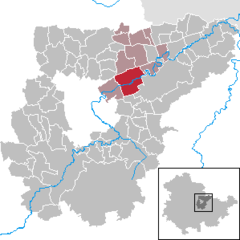
Oßmannstedt — Oßmannstedt, Dorf im Großherzogtum Sachsen Weimar, Verwaltungsbezirk 11 (Apolda), bei Weimar und an der Staatsbahnlinie Bebra Weißenfels, hat eine evang. Kirche, eine Dampfziegelei, Kalkbrennerei, Dampfmolkerei und (1905) 738 Einw. Das Gut… … Meyers Großes Konversations-Lexikon
Oßmannstedt — Oßmannstedt, Dorf in S. Weimar, an der Ilm, (1900) 701 E.; hier Grabstätte Wielands … Kleines Konversations-Lexikon
Oßmannstedt — Wappen Deutschlandkarte … Deutsch Wikipedia
Frauengrab von Oßmannstedt — Das Frauengrab von Oßmannstedt bei Oßmannstedt im Landkreis Weimarer Land in Thüringen wurde im Jahre 1965 gefunden. Es lag an einer alten Furt der Ilm. Erinnerungsstein an den Grabfund von Oßmannstedt, mit Darstellung der Adlerfibel … Deutsch Wikipedia
Liste der Kulturdenkmale in Oßmannstedt — In der Liste der Kulturdenkmale in Oßmannstedt sind alle Kulturdenkmale der thüringischen Gemeinde Oßmannstedt (Landkreis Weimarer Land) und ihrer Ortsteile aufgelistet (Stand: 23. März 2009). Oßmannstedt Wielandgut Einzeldenkmale Kirche … Deutsch Wikipedia
Christoph Martin Wieland — Porträt Wielands von Ferdinand Jagemann, 1805 Christoph Martin Wieland (* 5. September 1733 in Oberholzheim bei Laupheim; † 20. Januar 1813 in Weimar) war ein deutscher Dichter, Übersetzer un … Deutsch Wikipedia
Sophie Brentano — Sophie Brentano, eigentlich Marie Sophie Therese Brentano, (* 15. August 1776 in Ehrenbreitstein; † 19. September 1800 auf dem Gut von Christoph Martin Wieland in Oßmannstedt) war die älteste Tochter des wohlhabenden Frankfurter/lombardischen… … Deutsch Wikipedia
Liste der Kirchen in Weimar und dem Kreis Weimarer Land — Diese Liste enthält Kirchengebäude im Landkreis Weimarer Land und der Stadt Weimar in Thüringen. Allgemeines Der Landkreis Weimarer Land zählt 8 Städte, davon sind 4 Mitglied einer Verwaltungsgemeinschaft 1 erfüllende Gemeinde für 12 Gemeinden 1… … Deutsch Wikipedia
Eustachius von Harras — Eustachius I. von Harras (* um 1500; † Herbst 1561) war der letzte des Adelsgeschlechts derer von Harras zu Lichtenwalde. Eustachius von Harras übernahm 1534 die Geschäfte seines Vaters Georg II. von Harras auf Schloss Lichtenwalde (Sachsen), als … Deutsch Wikipedia
Heinrich Graf von Bünau — (* 2. Juni 1697 in Weißenfels; † 7. April 1762 in Oßmannstedt) war ein deutscher Staatsmann und Historiker. Inhaltsverzeichnis 1 Leben 2 Forschungsstand 3 Werke 4 Literatur … Deutsch Wikipedia


