- Muhu
-

Muhu (German: Mohn/Moon; in Estonian also called Muhumaa), is an island in the Baltic Sea. With an area of 198 km² it is the third largest island belonging to Estonia, after Saaremaa and Hiiumaa.
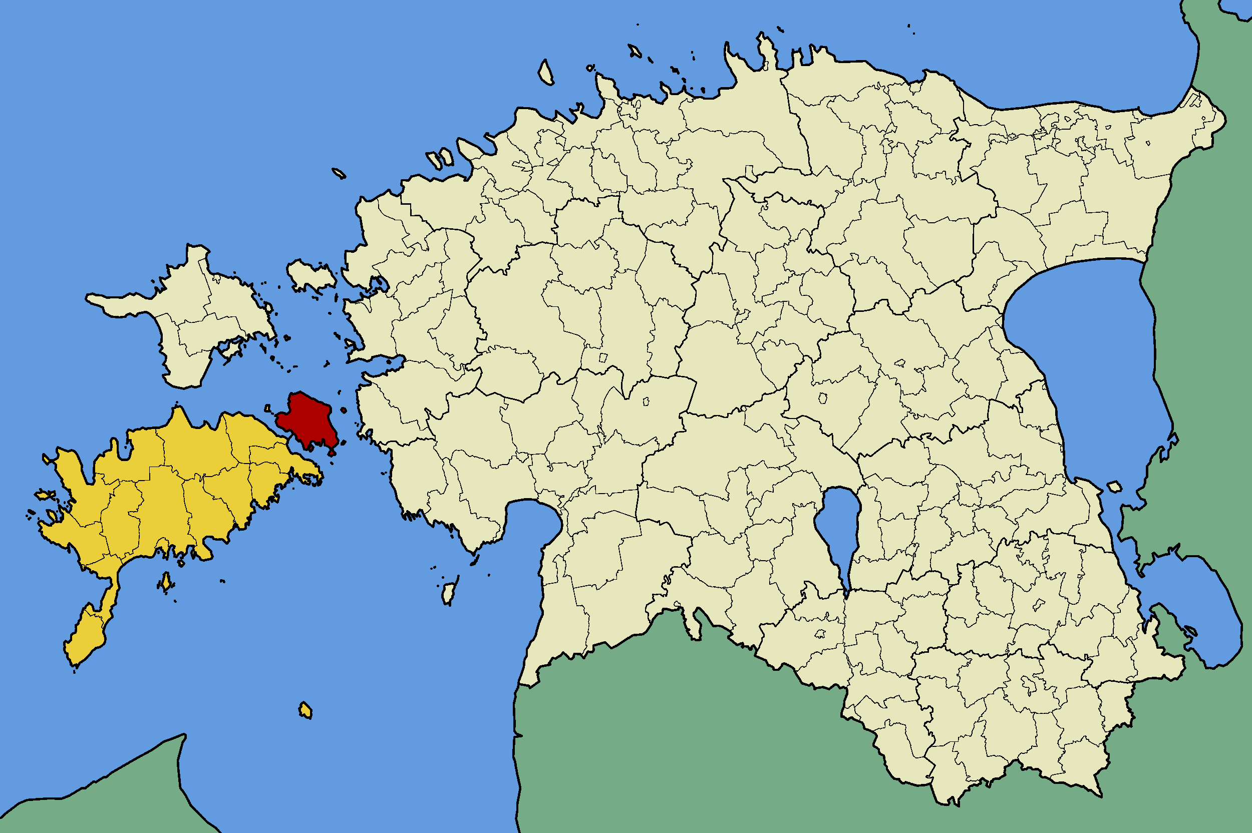
Together with neighbouring smaller islands of Kesselaid, Viirelaid, Võilaid and Suurlaid it forms Muhu Parish (Estonian: Muhu vald), the rural municipality within Saare County. The municipality has a population of 1,697 (as of 19 April 2010) and covers an area of 206.12 km². The population density is 8.8 inhabitants per km².
Most important villages in Muhu are Kuivastu, Liiva (where the school can be found) and Koguva.
The island is divided from mainland Estonia by the Suur Strait (Moonsund) and from Saaremaa by the Väike Strait. It is linked by ferry to Virtsu in the mainland, and to Saaremaa by a causeway, the Väinatamm. In winter an ice road connects the island to the mainland.
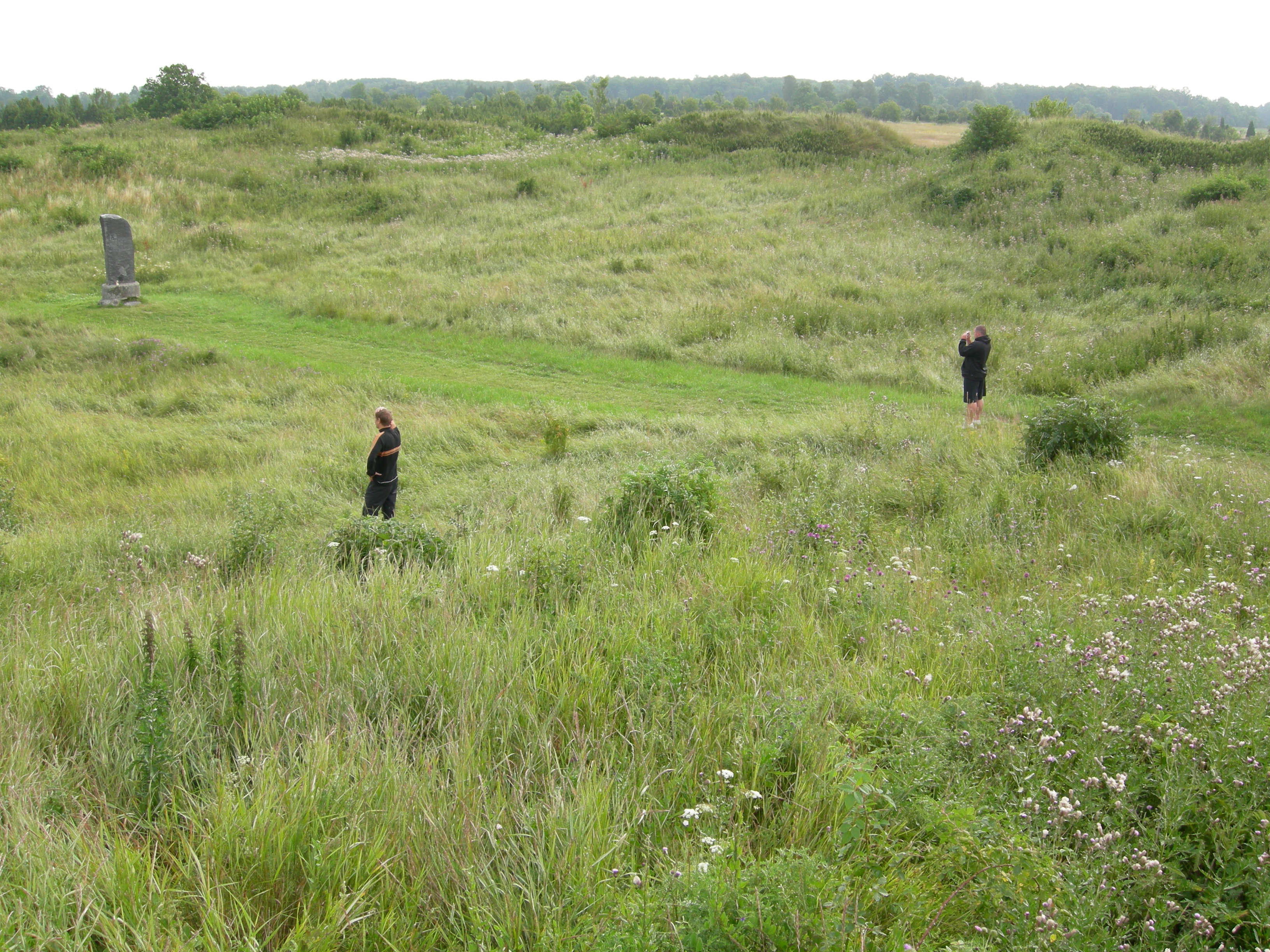
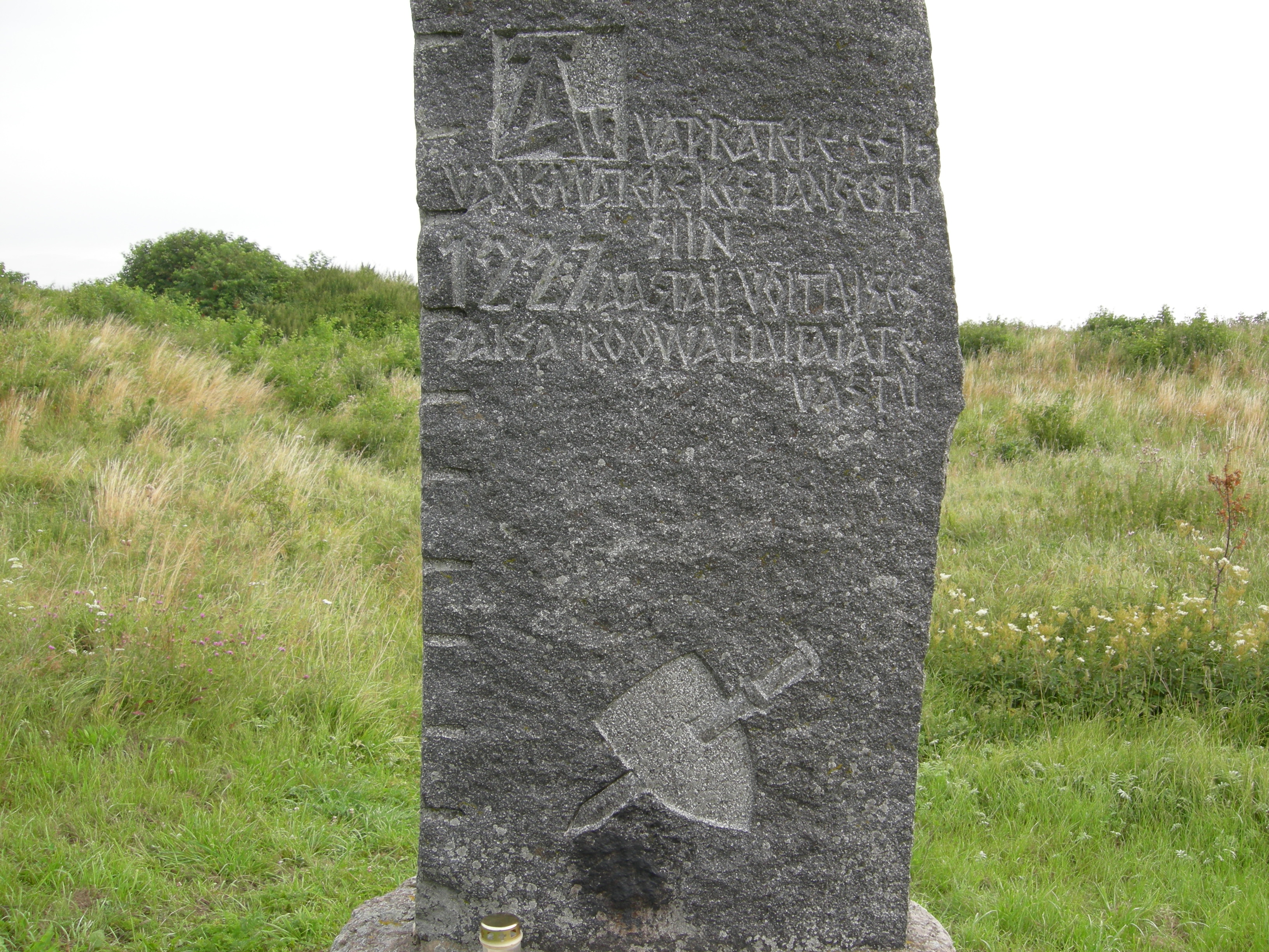
In January 1227, an army of the Livonian Brothers of the Sword with Letts, Germans of Riga and native Livonians (20,000 men commanded by William of Modena) crossed on sea ice from the mainland and attacked the island of Saaremaa to reduce the last holdout of pagan Estonians. The Estonians surrendered on Muhu at a circular stronghold called Mona, the earthworks of which are still preserved near the causeway between the islands. This ended the Estonian Crusade.
Muhu is also famous for having the only still-working windmills in the whole country of Estonia, and for the Battle of Moon Sound in September-October 1917 between Russian and German naval forces (and three daring British submarines).
Contents
Villages of Muhu Parish
Aljava - Hellamaa - Igaküla - Kallaste - Kantsi - Kapi - Kesse - Koguva - Kuivastu - Külasema - Laheküla - Lalli - Leeskopa - Lehtmetsa - Lepiku - Levalõpme - Liiva - Linnuse - Lõetsa - Mäla - Mõega - Mõisaküla - Nautse - Nõmmküla - Nurme - Oina - Pädaste - Päelda - Paenase - Pallasmaa - Pärase - Piiri - Põitse - Raegma - Rannaküla - Rässa - Raugi - Rebaski - Ridasi - Rinsi - Rootsivere - Simisti - Soonda - Suuremõisa - Tamse - Tupenurme - Tusti - Vahtraste - Vanamõisa - Viira - Võiküla - Võlla
Gallery
-
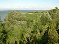
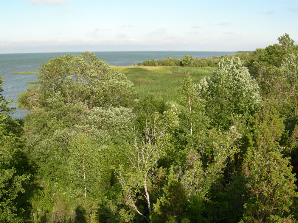
Northern coast of Muhu, Estonia. July 26, 2007.
-

Muhu Stronghold, site of the native Estonian surrender to crusaders in 1227.
-
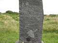
Monument in the center of the Muhu Stronghold.
-

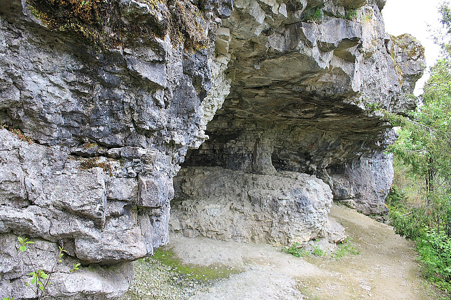
Üügu cliffs
-

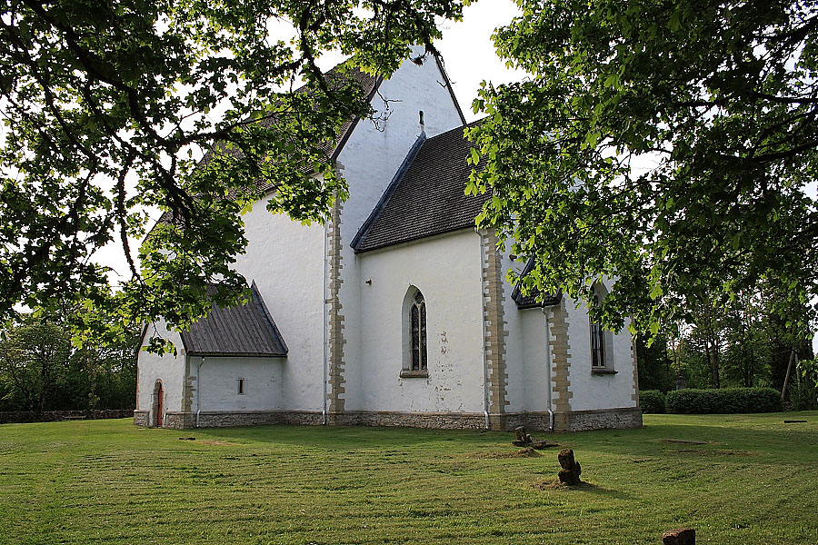
St.Caherine's Church
-
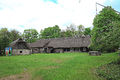
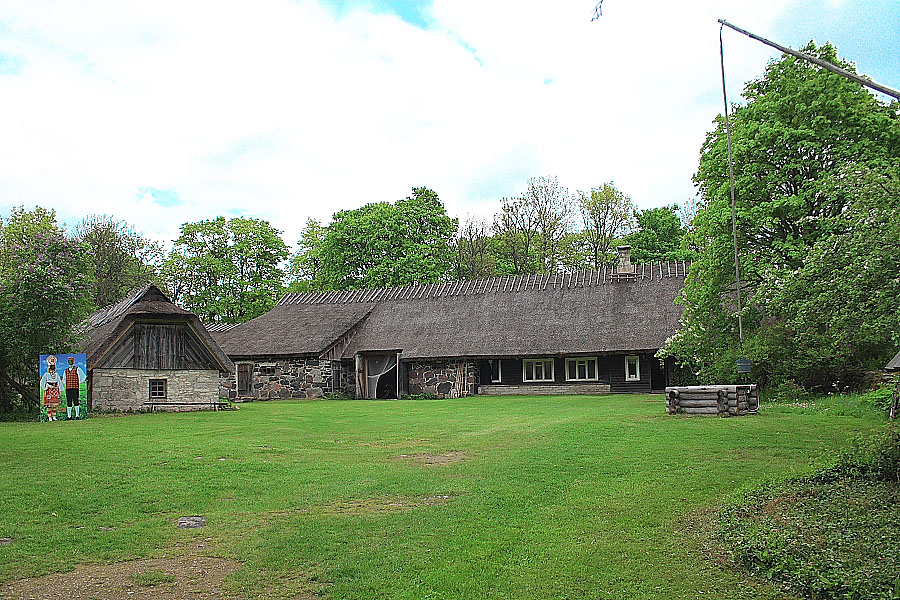
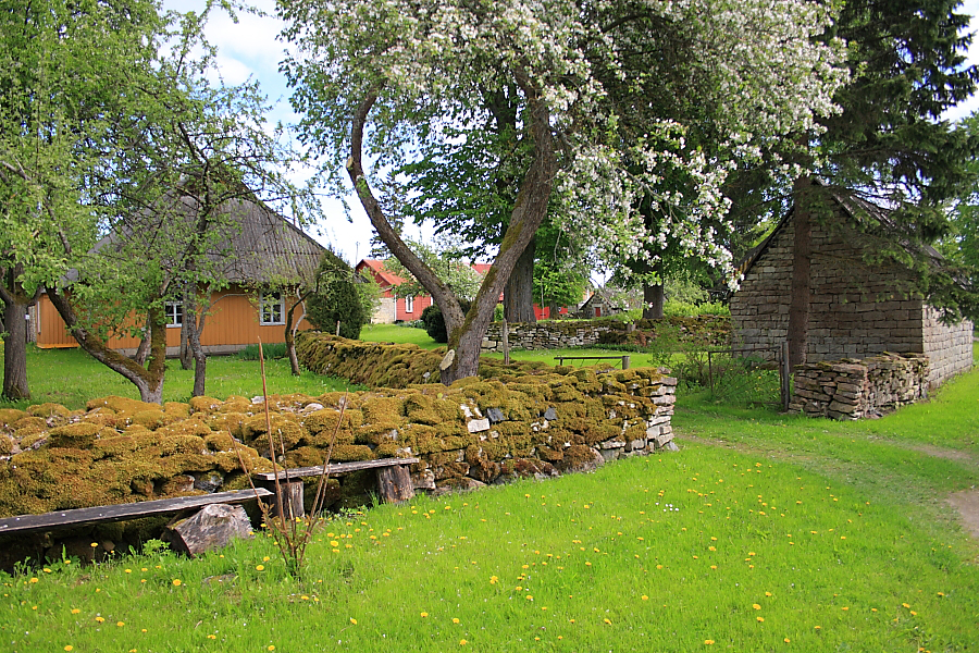
Muhu museum
-
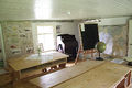
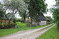
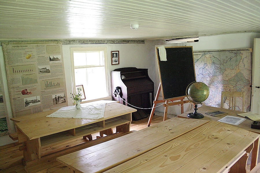
Old village school
-
In Moega village
See also
- Municipalities of Estonia
- List of municipalities of Estonia
- List of islands of Estonia
External links
 Municipalities of Saare County
Urban municipality 
Rural municipalities Islands of Estonia Abruka · Adralaid · Aegna · Ahelaid · Aherahu · Ahessäär · Ahtra · Aksi · Allirahu · Allu · Alumine Vaika · Anekäbrud · Ankrurahu · Annilaid · Antsulaiud · Anulaid · Auklaid · Eerikukivi · Eerikulaid · Elmrahu · Esirahu · Gretagrund · Hanemaa · Hanerahu · Hanikatsi laid · Hara · Harilaid (islet) · Harilaid (peninsula) · Hellamaa rahu · Hiiumaa · Härjakare · Härjamaa · Hobulaid · Hõralaid · Hülgelaid · Hülgerahu · Imutilaid · Innarahu · Juksirahu · Kadakalaid · Kaevatsi · Kahtla · Kajakarahu · Käkimaa · Käkirahu · Kakralaid · Kakrarahu · Karirahu · Kassari · Kasselaid · Keri · Keskmine Vaika · Kesselaid · Kihnu · Kitselaid · Koerakuiv · Kõinastu laid · Koipsi · Kõrgelaid · Kõrksaar · Kõverlaid · Kreenholm · Kriimi laid · Kräsuli · Kuivarahu · Külalaid · Kullilaid · Kullipank · Kumari · Kungli · Kunnatilaid · Kuradisäär · Kurgurahu · Külalaid · Küllisäär · Laasirahu · Laidu · Läkumätas · Langekare · Leemetikare · Liia · Liisi · Liivakari · Linnusitamaa · Loonalaid · Luigerahu · Maakrirahu · Manilaid · Mardirahu · Maturahu · Mihklirahu · Mohni · Mondelaid · Muhu · Munaderahu · Munasaar · Mustarahu · Mustpank · Mustpank (Vaika) · Nabralaid · Naissaar · Naistekivi maa · Ninalaid · Noogimaa · Nootamaa · Nosurahu · Öakse · Oitma · Ojurahu · Öörahu · Orikalaid · Osmussaar · Paelaid · Pakri Islands · Pakulaid · Papilaid · Papirahu · Pasilaid · Pedassaar · Pihanasu · Pihlakare · Pihlalaid · Piirissaar · Pikknasv · Piskumadal · Prangli · Puhtulaid · Puningalaid · Põdvalaid · Põiksäär · Pühadekare · Rammu · Rannasitik · Riinurahu · Ristlaid · Rohurahu · Rohusi saar · Rooglaid · Ruhnu · Rukkirahu · Rusulaid · Saare ots · Saaremaa · Saarnaki laid · Salava · Sangelaid · Seasaar · Selglaid · Sepasitik · Sillalaid · Sipelgarahu · Sitakare · Sokulaid · Sorgu · Suuregi laid · Suurepoldi · Suurlaid · Suur-Pakri · Suurrahu · Sõmeri · Taguküla laid · Tarja · Tauksi · Telve · Tiirloo · Tondirahu · Tondisaar · Täkulaid · Täkunasv · Udrikulaid · Uhtju saar · Uhtju saared · Ulkkarri · Umalakotid · Ülemine Vaika · Umblu · Urverahu · Uuluti laid · Uus-Nootamaa · Vahase · Vahelmisrahu · Vaika saared · Väike-Pakri · Väike-Tulpe · Vaindloo · Valgerahu · Vareslaid (Käina) · Vareslaid (Väinameri) · Varesrahu · Vasikalaid · Vesiloo · Vesitükimaa · Viirelaid · Vilsandi · Vissulaid · Vohilaid · Vormsi · Võilaid · Võiste · Võnnu · Võrgukare ·
Inhabited islands in the Baltic Sea Denmark Estonia Finland Archipelago Sea Islands (Åland Islands) · Hailuoto · Kimitoön · Laajasalo · Lauttasaari · Replot · SuomenlinnaGermany Poland Russia Sweden Categories:- Muhu Parish
- Islands of Estonia
-
Wikimedia Foundation. 2010.