- Lolland
Geobox Settlement
name = Lolland
native_name = | other_name=
category = Island
image_size = 290
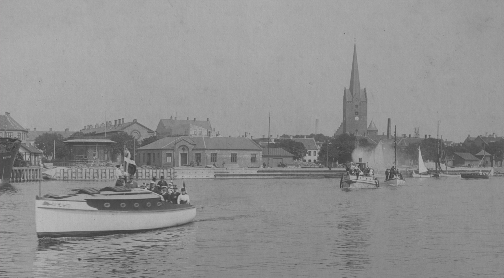
image_caption = Boats at Lolland Island, port of Nakskov 1914-1920
| flag_size =
symbol = | symbol_size = 90px
country = Denmark | state=
region =Region Sjælland
district =Lolland municipality ,Guldborgsund municipality
district_type = Municipality | district_label=
part_type = | part_count =
part = | part1 =
area = 1243
area_round = 0
location =
lat_d = 54 | lat_m = 50 | lat_s = 0 | lat_NS= N
long_d= 11 | long_m= 9 | long_s= 0 | long_EW= E
elevation =
population_as_of = 2006
population = 68224
population_density=
established_type =
established =
established1_type =
mayor =
timezone = CET
utc_offset = +1
timezone_DST = CEST
utc_offset_DST= +2
postal_code =
postal_code_type = Postal codes
area_code =
area_code_type=
free_type = | free=
free1_type = | free1=
map_size =
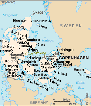
map_caption = Lolland Island (lower center) in Denmark
map_locator =
map_locator_x = 47.5
map_locator_y = 88.5
website =Lolland (formerly spelled "Lohland") is the fourth largest
island ofDenmark , with an area of some 1,243square kilometers (480 sq. miles). Located in theBaltic sea , it is part ofRegion Sjælland (County of Sealand).The highest peak of the entire isle is 25 m (82 ft) high and was an important spot for the communication highway for the Germans during
World War II . The peak is just outside the village ofHorslunde . Historically, sugar beets have been grown there.The largest town of Lolland is
Nakskov , with 15,500 residents. Other towns worth noting areMaribo (6,000 residents),Sakskøbing (3,500 residents), andRødby (2,500 residents).The governments of Denmark and Germany plan to connect Lolland with the German island
Fehmarn , by a futureFehmarn Belt bridge . Route E47 fromCopenhagen crosses theGuldborgsund strait between Lolland and Falster via a modern tunnel, but the motorway currently terminates at Rødbyhavn where a ferry carries vehicles to Fehmarn. Two older bridges also span the strait between Lolland and Falster, theFrederick IX Bridge and Guldborgsund bridge at the northern end of the strait.Since
January 1 2007 Lolland has been administered by two municipalities, "Lolland" covering the western two thirds, and "Guldborgsund" uniting the eastern third with the neighbouring islandFalster .ee also
* Nearby islands:
Fejø ,Femø ,Askø ,Vejrø .
*Hydrogen energy plant in Denmark Notes
References
* Tageo.com, "VESTSJAELLAND DENMARK Geography Population" (coordinates), 2007, webpage: [http://www.tageo.com/index-e-da-v-14.htm Tageo-index] .
* Denmark Postal codes, webpage: [http://www.postnumre.dk/ Postnumre-DK] .
* Tele.dk Denmark detailed road map, webpage: [http://home6.inet.tele.dk/vlh/danmark.jpgTele-DK-Danmark] .External links
* [http://www.lollandfalster-links.dk/main/main_map.htm Map of Lolland and Falster]
Wikimedia Foundation. 2010.