- Moundville, Alabama
-
Town of Moundville [1] — Town — Location in Hale County and the state of Alabama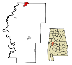
Coordinates: 32°59′55″N 87°37′34″W / 32.99861°N 87.62611°W Country United States State Alabama Counties Hale, Tuscaloosa Area – Total 3.9 sq mi (10.3 km2) – Land 3.9 sq mi (10.2 km2) – Water 0 sq mi (0.1 km2) Elevation 161 ft (49 m) Population (2000) – Total 1,809 – Density 463.8/sq mi (175.6/km2) Time zone Central (CST) (UTC-6) – Summer (DST) CDT (UTC-5) ZIP code 35474 Area code(s) 205 FIPS code 01-51648 GNIS feature ID 0160145 Moundville is a town in Hale and Tuscaloosa Counties in the U.S. state of Alabama. At the 2000 census the population was 1,809. It is part of the Tuscaloosa Metropolitan Statistical Area. Moundville is known for its quintessential southern landscapes and Indian Mounds.
Contents
Geography
Moundville is located at 32°59′55″N 87°37′34″W / 32.99861°N 87.62611°W (32.998521, -87.626006)[2].
According to the U.S. Census Bureau, the town has a total area of 4.0 square miles (10.3 km²), of which 3.9 square miles (10.2 km²) is land and 0.04 square mile (0.1 km²) (1.00%) is water.
Demographics
As of the census[3] of 2000, there were 1,809 people, 809 total housing units with 688 being occupied households, and 479 families residing in the town. The population density was 458.7 people per square mile (177.3/km²). There were 780 housing units at an average density of 197.8 per square mile (76.4/km²). The racial makeup of the town was 61.30% White, 35.16% Black or African American, 0.66% Native American, 0.94% Asian, 0.83% from other races, and 1.11% from two or more races. 1.55% of the population were Hispanic or Latino of any race.
There were 688 households out of which 35.9% had children under the age of 18 living with them, 45.3% were married couples living together, 19.0% had a female householder with no husband present, and 30.4% were non-families. 27.6% of all households were made up of individuals and 10.9% had someone living alone who was 65 years of age or older. The average household size was 2.53 and the average family size was 3.08.
In the town the population was spread out with 29.47% under the age of 19, 6.63% from 20 to 24, 27.7% from 25 to 44, 20.67% from 45 to 64, and 15.54% who were 65 years of age or older. The median age was 35.9 years. For every 100 females there were 90.4 males. For every 100 females age 18 and over, there were 83.4 males.
The median income for a household in the town was $31,944, and the median income for a family was $36,000. Males had a median income of $30,625 versus $25,231 for females. The per capita income for the town was $13,014. About 21.2% of families and 20.9% of the population were below the poverty line, including 24.6% of those under age 18 and 16.7% of those age 65 or over.
Moundville Archaeological Park
The Moundville Archaeological Park is a National Historic Landmark. The 320-acre (1.3 km2) park contains 26 prehistoric, Mississippian culture-era Native American earthwork mounds, burial sites and artifacts.
The largest Native American mounds are located near the Black Warrior River. Mounds get smaller as they get farther from the river. This might be an indication of the relative ranks of the people who built and maintained the mounds.
A palisade was built around 3 sides of the center of Moundville, surrounding the mounds, a plaza, and residential areas. This palisade was rebuilt at least 6 times during the town's occupation.
Transportation
Airport
Moundville Airport is a privately owned, public-use airport located two nautical miles (2.3 mi, 3.7 km) south of the central business district of Moundville.
References
- ^ Code of Alabama 1975, Title 11, Chapter 40, Section 11-40-1
- ^ "US Gazetteer files: 2010, 2000, and 1990". United States Census Bureau. 2011-02-12. http://www.census.gov/geo/www/gazetteer/gazette.html. Retrieved 2011-04-23.
- ^ "American FactFinder". United States Census Bureau. http://factfinder.census.gov. Retrieved 2008-01-31.
External links
Coordinates: 32°59′55″N 87°37′34″W / 32.998521°N 87.626006°W
Municipalities and communities of Hale County, Alabama City 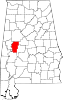
Towns Unincorporated
communitiesGallion | Prairieville | Sawyerville
Ghost town Arcola
Footnotes ‡This populated place also has portions in an adjacent county or counties
Municipalities and communities of Tuscaloosa County, Alabama Cities 
Towns CDP Unincorporated
communitiesFootnotes ‡This populated place also has portions in an adjacent county or counties
Categories:- Populated places in Hale County, Alabama
- Populated places in Tuscaloosa County, Alabama
- Towns in Alabama
- Tuscaloosa metropolitan area


Wikimedia Foundation. 2010.