- Moorreesburg
-
Moorreesburg — Town — Location of the town in Western Cape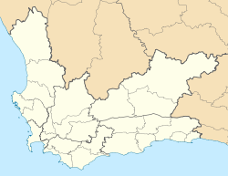
 MoorreesburgLocation of the town in South Africa
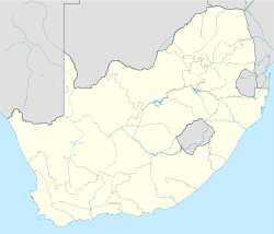 Moorreesburg
Coordinates: 33°09′S 18°40′E / 33.15°S 18.667°E Country  South Africa
Province Western Cape District municipality West Coast District Municipality Local municipality Swartland Local Municipality Area[1] - Total 21.4 km2 (8.3 sq mi) Population (2001)[1] - Total 8,574 - Density 400.7/km2 (1,037.7/sq mi) Time zone SAST (UTC+2) Moorreesburg is a rural town in the Western Cape province of South Africa. It falls within the Swartland Local Municipality, which is part of the West Coast District Municipality. It lies just off the N7 national road, about 90 kilometres north of Cape Town. The town was established in 1890.[citation needed]
References
- ^ a b "Main Place 'Moorreesburg'". Census 2001. http://census.adrianfrith.com/place/10510. Retrieved 1 April 2011.

Matzikama • Cederberg • Bergrivier • Saldanha Bay • Swartland
Cities and towns Abbotsdale • Aurora • Bitterfontein • Chatsworth • Citrusdal • Clanwilliam • Darling • Doringbaai • Dwarskersbos • Ebenhaeser • Eendekuil • Elands Bay • Goedverwacht • Graafwater • Grotto Bay • Hopefield • Jacobsbaai • Jakkalsfontein • Kalbaskraal • Klawer • Koekenaap • Koringberg • Lamberts Bay • Langebaan • Langebaanweg • Lutzville • Malmesbury • Moorreesburg • Paternoster • Piketberg • Porterville • Redelinghuys • Riebeek-Kasteel • Riebeek West • Saldanha • St Helena Bay • Strandfontein • Vanrhynsdorp • Velddrif • Vredenburg • Vredendal • Wupperthal • Yzerfontein
Coordinates: 33°09′S 18°40′E / 33.15°S 18.667°E
Categories:- 1890 establishments
- Populated places in the West Coast District Municipality
- Western Cape geography stubs


Wikimedia Foundation. 2010.