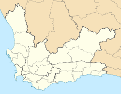
- Chatsworth, Western Cape
-
Chatsworth Chatsworth shown within the Western Cape Coordinates: 33°32′46″S 18°34′58″E / 33.54611°S 18.58278°ECoordinates: 33°32′46″S 18°34′58″E / 33.54611°S 18.58278°E Country  South Africa
Province Western Cape District municipality West Coast Local municipality Swartland Time zone SAST (UTC+2) Chatsworth is a settlement in West Coast District Municipality in the Western Cape province of South Africa.
Matzikama • Cederberg • Bergrivier • Saldanha Bay • Swartland
Cities and towns Abbotsdale • Aurora • Bitterfontein • Chatsworth • Citrusdal • Clanwilliam • Darling • Doringbaai • Dwarskersbos • Ebenhaeser • Eendekuil • Elands Bay • Goedverwacht • Graafwater • Grotto Bay • Hopefield • Jacobsbaai • Jakkalsfontein • Kalbaskraal • Klawer • Koekenaap • Koringberg • Lamberts Bay • Langebaan • Langebaanweg • Lutzville • Malmesbury • Moorreesburg • Paternoster • Piketberg • Porterville • Redelinghuys • Riebeek-Kasteel • Riebeek West • Saldanha • St Helena Bay • Strandfontein • Vanrhynsdorp • Velddrif • Vredenburg • Vredendal • Wupperthal • Yzerfontein
Categories:- Western Cape geography stubs
- Populated places in the West Coast District Municipality
Wikimedia Foundation. 2010.


