- Porterville, Western Cape
-
Porterville, Western Cape A collection of images from Porterville, Western Cape, South Africa. Top left: main church. Top right: A 'China Shop' located in the town. Left center: Historic town house on the main street. Bottom: A view of the town's main road.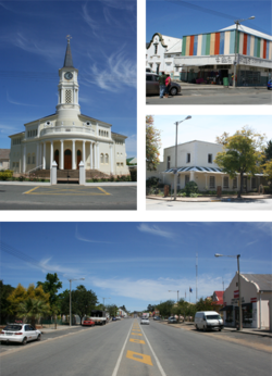 Location in the Western Cape
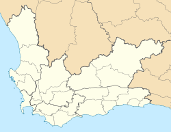
 Porterville, Western CapeLocation of the town in South Africa
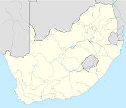 Porterville, Western Cape
Coordinates: 33°00′S 18°59′E / 33°S 18.983°ECoordinates: 33°00′S 18°59′E / 33°S 18.983°E Country  South Africa
Province Western Cape District municipality West Coast District Municipality Local municipality Bergrivier Local Municipality Population – Total 12,000 Time zone SAST (UTC+2) Postal code 6810, 6811, 6812 Porterville is a town in the Western Cape province in South Africa. It is situated 140 km north of Cape Town on R44 road at the base of the Olifants River mountains. Agriculture in the area is dominated by wheat production.
The town was established in 1863 and named after William Porter, Attorney General of the Cape Colony. The population is around 12000.[1]
References
- ^ "Porterville". Cape Town Routes Unlimited. http://www.tourismcapetown.co.za/index.php?cityhome+97015. Retrieved 2008-12-29.[dead link]

Matzikama • Cederberg • Bergrivier • Saldanha Bay • Swartland
Cities and towns Abbotsdale • Aurora • Bitterfontein • Chatsworth • Citrusdal • Clanwilliam • Darling • Doringbaai • Dwarskersbos • Ebenhaeser • Eendekuil • Elands Bay • Goedverwacht • Graafwater • Grotto Bay • Hopefield • Jacobsbaai • Jakkalsfontein • Kalbaskraal • Klawer • Koekenaap • Koringberg • Lamberts Bay • Langebaan • Langebaanweg • Lutzville • Malmesbury • Moorreesburg • Paternoster • Piketberg • Porterville • Redelinghuys • Riebeek-Kasteel • Riebeek West • Saldanha • St Helena Bay • Strandfontein • Vanrhynsdorp • Velddrif • Vredenburg • Vredendal • Wupperthal • Yzerfontein
Categories:- Populated places established in 1863
- Populated places in the West Coast District Municipality
- Western Cape geography stubs


Wikimedia Foundation. 2010.