- Nether Heyford
-
Coordinates: 52°13′38″N 1°01′48″W / 52.227221°N 1.030054°W
Nether Heyford 
Nether Heyford Church of St Peter and St Paul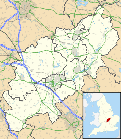
 Nether Heyford
Nether Heyford shown within NorthamptonshirePopulation 1,507 (2001 Census)
2009 est.1,539[1]OS grid reference SP659587 Parish Nether Heyford CP District South Northamptonshire district Shire county Northamptonshire Region East Midlands Country England Sovereign state United Kingdom Post town NORTHAMPTON Postcode district NN7 Dialling code 01327 Police Northamptonshire Fire Northamptonshire Ambulance East Midlands EU Parliament East Midlands UK Parliament Daventry List of places: UK • England • Northamptonshire Nether Heyford is an English village 6 miles (9.7 km) west of Northampton off the A45 road, in the shire county of Northamptonshire[2], known as "Northants". It is 1 mile (1.6 km) by road to the M1 London to Yorkshire motorway junction 16, 72 miles (116 km) north of London and 38 miles (61 km) southeast of Birmingham. The village of Upper Heyford is about 0.5 miles (0.8 km) to the north of the village close to the A45 road and is also part of Nether Heyford Parish.
 Grand Union canal near Nether Heyford
Contents
Facilities
It has one of the largest village greens in the country, two pubs; The Foresters Arms and The Olde Sun, two churches; one Baptist, a purpose-built youth club, park, village hall, hairdressers, butchers and a local shop. The extensive playing fields have a cricket club; Heyford CC, a football club; Heyford Athletic, tennis courts, a bowls club and a skate ramp. The Grand Union Canal also passes through the village.
Governance
The village has its own Parish Council[3] consisting of 11 members elected every four years.
Notable former residents
Simon Thomas - Former Blue Peter presenter
Alan Carr - Comedian and Entertainer. Played for Nether Heyford FC as a child.
Anil Kumble - Indian cricket legend lived in the village while playing for Northamptonshire CCC.Notable buildings
The local church is dedicated to St Peter and St Paul and parts are 13th century[4]. There is a monument to Sir Walter Mauntell (died 1467) and Sir Richard Morgan (died 1556).
The Bliss Charity Primary School has about 148 pupils. It was endowed with income from lands in the will of William Bliss, a wine merchant living in Southwark, who died in 1674. William had been born and brought up in Nether Heyford, later moving to London. In his will, William left £400 to the village, £100 for a schoolhouse and £300 to buy land, the rent from which would pay for the schoolmaster and upkeep of the school.
The former rectory is Gothic and ca.1870[4].
The Manor House is early 18th century[4].
Roman villas
The parish is the site of two Roman villas, firstly at Whitehall Farm[5] west of the village near the A5 road which closely follows the route of the Roman Road known as Watling Street which ran from London to Holyhead in North Wales. The nearest Roman towns were Lactodorum, modern name Towcester, about 8 miles (13 km) south, and Bannaventa at Whilton Lodge, near Norton about 3 miles (4.8 km) north. Excavations on the site in 2009 found eight 1,400-year-old skeletons in a burial ground could be German mercenaries hired by wealthy land owners to protect their property. Investigations are on-going[6][7].
A second site east of the village in Horestone meadow was first discovered in 1699[4]. It had part of a fine floor mosaic, plaster wall fragments and various pottery. In 1821 the building was estimated to be around 100 feet long.
The area of west Northamptonshire is rich in Romano-British archaeology with another villa site and museum at Piddington. The villa site is on a hillside with panoramic view eastwards over the upper valley of the River Nene before it enters the town of Northampton. The whereabouts of the artefacts is not known.
West Coast Main Line
The West Coast Main Line running high speed Pendolino trains from London Euston to Manchester and Glasgow south west of the village. Stowe Hill tunnel on the line between the village and Weedon runs under the A5 road to the west.
1915 and 1951 accidents
The village was near the site of two train derailments in which a total of 25 people died:
Main article: Weedon rail crashesReferences
- ^ SNC (2009). South Northamptonshire Council Year Book 2009-2010. Towcester NN12 7FA. pp. 39.
- ^ "Northamptonshire County Council website". http://www.northamptonshire.gov.uk/. Retrieved 2008-11-20.
- ^ "Neither Heyford village website including details of the Parish Council". http://www.northantsvillages.org.uk/nether%20heyford/index.html. Retrieved 2008-11-20.
- ^ a b c d Pevsner, Nikolaus (1961). The Buildings of England – Northamptonshire. London and New Haven: Yale University Press. pp. 311. ISBN 978-0-300-09632-3.
- ^ "Whitehall Farm Roman villa at Nether Heyford". http://www.whitehallvilla.co.uk/htmlfiles/start_here.html. Retrieved 20 November 2008.
- ^ "1,400 year old skeletons found in Northamptonshire". http://www.northamptonchron.co.uk/news/1400-year-old-skeletons-found.5252233.jp. Retrieved 11 May 2009.
- ^ "Archaeologists launch new dig on Roman site". http://www.northamptonchron.co.uk/news/Archaeologists-launch-new-dig-on.5260335.jp. Retrieved 13 May 2009.
External links
 Media related to Nether Heyford at Wikimedia Commons
Settlements on the River Nene, Source– Wash Yelvertoft · Badby · Newnham · Dodford · Everdon · Weedon · Flore · Nether Heyford · Northampton · Wellingborough · Little Irchester · Thrapston · Aldwincle · Peterborough · Whittlesey · Benwick · Wisbech · Sutton BridgeCategories:- Villages in Northamptonshire
- Roman villas in Northamptonshire


Wikimedia Foundation. 2010.