- Dodford, Northamptonshire
-
Coordinates: 52°14′N 1°06′W / 52.23°N 1.10°W
Dodford 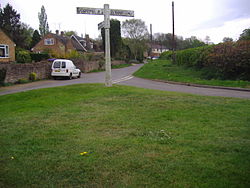
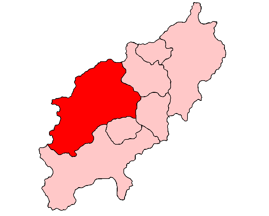
Dodford within Daventry District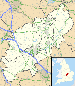
 Dodford
Dodford shown within NorthamptonshirePopulation 160 (2001 Census) OS grid reference SP613605 - London 73.6 District Daventry Shire county Northamptonshire Region East Midlands Country England Sovereign state United Kingdom Post town DAVENTRY Postcode district NN7 Dialling code 01327 Police Northamptonshire Fire Northamptonshire Ambulance East Midlands EU Parliament East Midlands UK Parliament Daventry List of places: UK • England • Northamptonshire Dodford is a village in the county of Northamptonshire, England, within the Weedon Ward of Daventry District.[1] The village is just north of the A45 road 1½ miles west of Weedon. It is 3½ miles east of Daventry and ten miles west of Northampton. It is also close to junction 16 of the M1 motorway. The parish consists of some 560 hectares and is bounded on the east by the A5 trunk road which is the old Roman road of Watling Street. Most of the village and parish sits astride the valley of an east-flowing stream which is a tributary of the River Nene.
Contents
Medieval history and later
There are considerable earthworks around the village on the northern side of the stream, which indicate that Dodford was a larger settlement than it is today. Unfortunately many of these earthworks have been ploughed out in recent years, but the evidence has been recorded of their existence.[2] These earthworks suggest that there was a large scale de-population or a considerable movement of the village. Dodford is mentioned in an Anglo-Saxon charter of 944.[3] The village is recorded in the Domesday Book as a manor of three hides belonging to Robert, Count of Mortain (who was the half-brother of William the Conqueror), with a recorded population of 22 including a priest. In 1222 the manor of Dodford was acquired by William de Keynes who enclosed much of the land including a deer park which lay to the south of the village between it and what is now the A45 between Daventry and Weedon. In 1673 it is recorded that 39 people paid Hearth Tax. By the early part of the 18th century there were 21 dwellings in the village and a map dated 1742 shows the layout of the village much as it is today.[4] In 1801 the village is recorded as having 205 residents.
St Mary the Virgin church
Dodford has a Grade I listed parish church, called St Mary the Virgin. It was founded by the Normans in 1066, rebuilt by Ralph de Keynes in 1100, and the tower and north chapel were added by William de Keynes in 1221. St Mary's has a nave with a north aisle and a clerestory on the north side only. The arcade, of four bays, is 14th century. The south wall of the nave has two plain 12th-century splayed windows, of which the west one is now blocked, and part of the plain arch of a doorway; on the exterior there is much herringbone masonry. The south porch is of two storeys. The chancel was rebuilt in the 19th century. The church contains an elaborately-carved 12th-century font.
Dodford church has the distinction of being the first church that the antiquary Elias Ashmole (founder of the Ashmolean Museum) is known to have visited with the aim of recording its inscriptions, armorial bearings etc. Ashmole visited Dodford church on 15 April 1657, and his handwritten notes are now in the Bodleian Library.
There is a tall 13th-century west tower which was structurally crumbling until major repairs in the late 20th century. It contains a ring of six bells, each of which was cast in a different year between 1614 and 1907. The bells hang in a timber frame placed diagonally in the tower. This is a weak layout and the bells remained neglected and unringable for several decades until essential frame strengthening was carried out in 2007.
Dodford has one of the longest drive-through fords in the county but speeding drivers risk causing erosion of its banks.
Gallery
-

Plan of Dodford Church, Click to Enlarge.
-
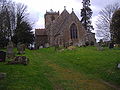
Dodford Church
-
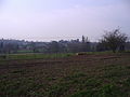
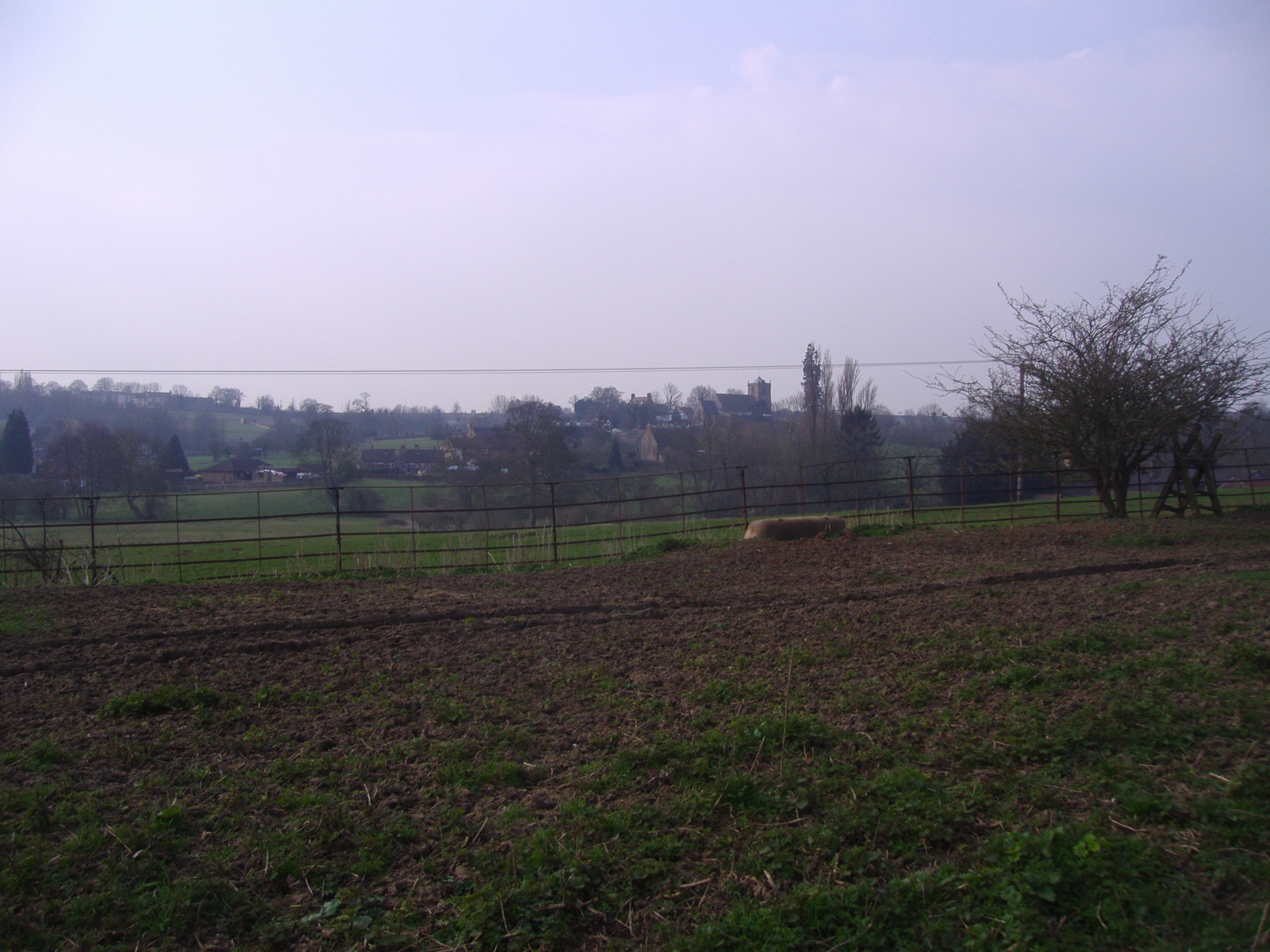
View across the valley to Dodford
-
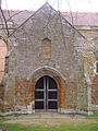
The Parvise over the south porch
References
- ^ ’OS Explorer Map’ 223 Northampton & Market Harborough ISBN 9780319463963
- ^ An Inventory of Archaeological Sites in North West Northamptonshire, page 22. ISBN 0-11-700900-8
- ^ An Inventory of Archaeological Sites in North West Northamptonshire, page 72 (BCS 792). ISBN 0-11-700900-8
- ^ An Inventory of Archaeological Sites in North West Northamptonshire, page 72, 5th par. ISBN 0-11-700900-8
Settlements on the River Nene, Source– Wash Yelvertoft · Badby · Newnham · Dodford · Everdon · Weedon · Flore · Nether Heyford · Northampton · Wellingborough · Little Irchester · Thrapston · Aldwincle · Peterborough · Whittlesey · Benwick · Wisbech · Sutton BridgeExternal links
Categories:- Villages in Northamptonshire
-


Wikimedia Foundation. 2010.