- Dockenfield
-
Coordinates: 51°09′31″N 0°48′58″W / 51.158498°N 0.81603460°W
Dockenfield 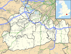
 Dockenfield
Dockenfield shown within SurreyPopulation 421 [1] The parish council clerk is R Liiv.[2] OS grid reference SU8289340582 District Waverley Shire county Surrey Region South East Country England Sovereign state United Kingdom Post town Godalming Postcode district GU10 4 Dialling code 01483 Police Surrey Fire Surrey Ambulance South East Coast EU Parliament South East England UK Parliament South West Surrey List of places: UK • England • Surrey Dockenfield is a civil parish in the borough of Waverley in Surrey. It has a population of 421.[3] The parish council clerk is R Liiv.[4]
References
Towns, villages and hamlets in the Waverley District of Surrey, England 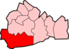 Alfold · Alford Crossways · Badshot Lea · Blackheath · Bowlhead Green · Bramley · Brook · Busbridge · Chiddingfold · Churt · Compton · Cranleigh · Dippenhall · Dockenfield · Dunsfold · Eashing · Elstead · Enton · Ewhurst · Farncombe · Farnham · Frensham · Godalming · Grayswood · Hale · Hambledon · Hascombe · Haslemere · Heath End · Hindhead · Hurtmore · Hydestile · Lower Bourne · Loxhill · Milford · Norney · North Munstead · Peper Harow · Puttenham · Ramsnest Common · Rowledge · Rowly · Runwick · Shackleford · Shamley Green · Shottermill · Thorncombe Street · Thursley · Tilford · Tuesley · Wheelerstreet · Witley · Wonersh · Wormley · WreccleshamCategories:
- Waverley, Surrey
- Civil parishes in Surrey
- Surrey geography stubs


Wikimedia Foundation. 2010.