- North Munstead
-
Coordinates: 51°09′44″N 0°35′14″W / 51.162122°N 0.58733940°W
North Munstead 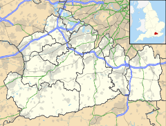
 North Munstead
North Munstead shown within SurreyOS grid reference SU9887741267 District Waverley Shire county Surrey Region South East Country England Sovereign state United Kingdom Post town GODALMING Postcode district GU8 4A Dialling code 01428 Police Surrey Fire Surrey Ambulance South East Coast EU Parliament South East England UK Parliament South West Surrey List of places: UK • England • Surrey North Munstead is a hamlet in the civil parish of Hascombe in the Waverley district of Surrey, England. Its nearest town is Godalming, which lies approximately 2.20 miles (3.54 km) north-west from the hamlet. The hamlet lies on the B1230 Road between Busbridge and Hascombe.
Towns, villages and hamlets in the Waverley District of Surrey, England 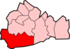 Alfold · Alford Crossways · Badshot Lea · Blackheath · Bowlhead Green · Bramley · Brook · Busbridge · Chiddingfold · Churt · Compton · Cranleigh · Dippenhall · Dockenfield · Dunsfold · Eashing · Elstead · Enton · Ewhurst · Farncombe · Farnham · Frensham · Godalming · Grayswood · Hale · Hambledon · Hascombe · Haslemere · Heath End · Hindhead · Hurtmore · Hydestile · Lower Bourne · Loxhill · Milford · Norney · North Munstead · Peper Harow · Puttenham · Ramsnest Common · Rowledge · Rowly · Runwick · Shackleford · Shamley Green · Shottermill · Thorncombe Street · Thursley · Tilford · Tuesley · Wheelerstreet · Witley · Wonersh · Wormley · WreccleshamCategories:
- Hamlets in Surrey
- Surrey geography stubs


Wikimedia Foundation. 2010.