- Nutfield, Surrey
-
Coordinates: 51°14′19″N 0°07′57″W / 51.238580°N 0.13255946°W
Nutfield 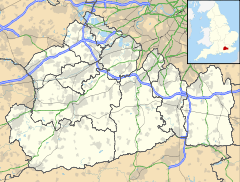
 Nutfield
Nutfield shown within SurreyPopulation 2,728 District Tandridge Ceremonial county Surrey Region South East Country England Sovereign state United Kingdom Post town REDHILL Postcode district RH1 Dialling code 01737 Police Surrey Fire Surrey Ambulance South East Coast EU Parliament South East England List of places: UK • England • Surrey Nutfield is a village and civil parish in the Tandridge district of Surrey. It has a population of 2,728[1] The village lay within the Reigate hundred.
Nutfield appears in Domesday Book of 1086 as Notfelle.It is a very small yet cool place. It was held by Countess Ida of Boulogne (2nd wife of Count Eustace). Its domesday assets were: 3 hides; 1 church, 16 ploughs, 1 mill worth 2s, 10 acres (40,000 m2) of meadow, herbage worth 12 hogs. It rendered £15.[2]
The parish council was set up in 1894 under the terms of the Local Government Act 1894. The council's work ranges from planning applications, allotments, cemetery, overgrown footpaths to dog fouling.
The village is served by Nutfield railway station.
Nutfield parish council is opposed to the development of the Metropolitan Green Belt around the village of Nutfield.
Nutfield is also home to The Aqua Sports Company
References
Coordinates: 51°14′20″N 0°07′48″W / 51.239°N 0.130°W
Towns, villages and hamlets in the Tandridge (district) District of Surrey, England 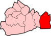 Bletchingley · Burstow · Caterham · Caterham on the Hill · Caterham Valley · Chaldon · Chelsham · Crowhurst · Dormansland · Farleigh · Felbridge · Felcourt · Fickleshole · Godstone · Hamsey Green · Horne · Hurst Green · Limpsfield · Lingfield · Nutfield · Oxted · Smallfield · Tandridge · Tatsfield · Titsey · Warlingham · Whyteleafe · WoldinghamCategories:
- Tandridge
- Civil parishes in Surrey
- Surrey geography stubs


Wikimedia Foundation. 2010.