- Maryland Route 348
-
Maryland Route 348
Laurel Road 
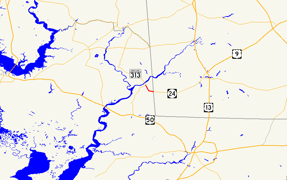
Maryland Route 348 highlighted in redRoute information Maintained by MDSHA Length: 1.39 mi[1] (2.24 km) Major junctions West end: Main Street in Sharptown  MD 313 in Sharptown
East end:  DE 24 near Sharptown
Location Counties: Wicomico Highway system Maryland highway system
Interstate • US • State • Minor • Former • Turnpikes←  MD 347
MD 349  →
→Maryland Route 348 (MD 348) is a state highway in the U.S. state of Maryland. Known for most of its length as Laurel Road, the state highway runs 1.39 miles (2.24 km) from Main Street just west of MD 313 in Sharptown east to the Delaware state line, where the highway continues as Delaware Route 24 (DE 24). MD 348 was constructed in the early 1930s. The state highway originally had its western terminus at State Street in Sharptown. MD 348's terminus was rolled back to its present location following the completion of MD 313's bypass of Sharptown in the late 1980s.
Contents
Route description
MD 348 begins at the intersection of Main Street and Eagles Avenue on the edge of Sharptown. Main Street continues northwest as a street in the town of Sharptown. The state highway heads southeast, where it immediately encounters MD 313 (Sharptown Road).[2] After crossing MD 313, MD 348 heads southeast as Laurel Road, a two-lane road that passes through farmland.[1][2] After passing Santo Domingo Road, the highway turns east and reaches its eastern terminus at the Delaware state line. The highway continues east as DE 24 (Sharptown Road) toward Laurel.[2]
History
MD 348 was constructed as a modern highway beginning in 1930.[3] The first segment of highway to be completed was from the Delaware state line to Santo Domingo Road.[4] The remainder of the highway to State Street in Sharptown, which was once MD 313, was completed by 1933.[5] The MD 313 bypass of Sharptown and the new bridge over the Nanticoke River were completed in 1987.[6] As a result, the portion of MD 348 between State Street and Eagles Avenue was transferred to local maintenance by 1999.[7]
Junction list
The entire route is in Sharptown in Wicomico County.
Mile
[1]Destinations Notes 0.00 Main Street west Western terminus 0.04 MD 313 (Sharptown Road) – Mardela Springs, Eldorado1.39 DE 24 east (Sharptown Road) – Laurel, DEEastern terminus; Delaware state line 1.000 mi = 1.609 km; 1.000 km = 0.621 mi References
- ^ a b c "Highway Location Reference: Wicomico County" (PDF). Maryland State Highway Administration. 2009. http://www.marylandroads.com/Location/2009_WICOMICO.pdf. Retrieved 2010-10-20.
- ^ a b c Google, Inc. Google Maps – Maryland Route 348 (Map). Cartography by Google, Inc. http://maps.google.com/maps?f=d&source=s_d&saddr=Main+St&daddr=DE-24+W%2FLaurel+Rd%2FMD-348+W&hl=en&geocode=FRz6SwIdtKt8-w%3BFa7MSwId7u58-w&mra=ls&sll=38.52507,-75.704041&sspn=0.015411,0.038581&ie=UTF8&ll=38.527857,-75.707045&spn=0.01541,0.038581&t=h&z=15. Retrieved 2010-04-21.
- ^ Report of the State Roads Commission of Maryland. 1927-1930. Baltimore: Maryland State Roads Commission. 1930-10-01. p. 234. http://www.archive.org/details/reportofstateroa1927mary. Retrieved 2010-04-21.
- ^ Maryland Geological Survey. Map of Maryland Showing State Road System: State Aid Roads and Improved County Road Connections (Map) (1930 ed.).
- ^ Maryland Geological Survey. Map of Maryland Showing State Road System: State Aid Roads and Improved County Road Connections (Map) (1933 ed.).
- ^ Maryland State Highway Administration. Maryland: Official Highway Map (Map) (1987 ed.).
- ^ "Highway Location Reference: Wicomico County" (PDF). Maryland State Highway Administration. 1999. http://www.marylandroads.com/Location/1999_WICOMICO.pdf. Retrieved 2010-10-20.
External links
Roads in Wicomico County, Maryland State highways 
U.S. Highways Categories:- State highways in Maryland
- Roads in Wicomico County, Maryland


Wikimedia Foundation. 2010.