- Drinkwater, Saskatchewan
-
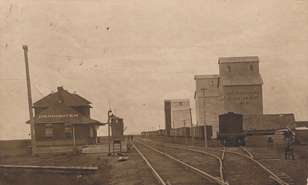
Drinkwater — Village — CPR Station Drinkwater, Saskatchewan c1908.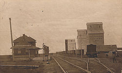
Coordinates: 50°18′N 105°08′W / 50.3°N 105.133°W Country Canada Province  Saskatchewan
Rural Municipality Federal Electoral District Assiniboia Provincial Constituency Settled Incorporated (Village) Government – Mayor - Steve Gilroy Time zone Central (UTC-6) [1] Drinkwater is a village in Saskatchewan, located on a branch of the Canadian Pacific Railway, 18 miles south-east of Moose Jaw and is named for Charles Drinkwater, an original director of the railway. It can be reached via Saskatchewan Highway 39.
Location
- Dominion Land Survey Sec.29, Twp.15, R.23, W2
- Long (DMS) 50° 18' 00" N
- Lat (DMS) 105° 08' 00" W
- Time zone (est) UTC-6[2]
Location relative to other communities
North: Belle Plaine West: Moose Jaw, Bushell Park Drinkwater East: Rouleau South:Briercrest References
- ^ Government of Saskatchewan (Wednesday, April 11, 2007) (– Scholar search), Municipal Directory System, archived from the original on 2005-03-19, http://web.archive.org/web/20050319155715/http://www.municipal.gov.sk.ca/apps/Pub/MDS/muniDetails.aspx?cat=3&mun=2141, retrieved 2007-05-05[dead link]
- ^ Government of Canada, Archivia Net, Post Offices and Postmasters, http://www.collectionscanada.ca/archivianet/post-offices/001001-100.01-e.php, retrieved 2007-05-05
 Subdivisions of Saskatchewan
Subdivisions Communities Cities Estevan · Flin Flon (part) · Humboldt · Lloydminster (part) · Martensville · Meadow Lake · Melfort · Melville · Moose Jaw · North Battleford · Prince Albert · Regina · Saskatoon · Swift Current · Weyburn · YorktonTopics Coordinates: 50°18′N 105°08′W / 50.3°N 105.133°W
Categories:- Villages in Saskatchewan
- Saskatchewan geography stubs
Wikimedia Foundation. 2010.