- Metheringham
-
Coordinates: 53°08′21″N 0°24′12″W / 53.1391°N 0.4034°W
Metheringham 
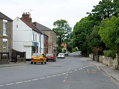
Metheringham High Street
 Metheringham shown within Lincolnshire
Population 3,384 (2001) OS grid reference TF0690061500 Parish Metheringham District North Kesteven Shire county Lincolnshire Region East Midlands Country England Sovereign state United Kingdom Post town LINCOLN Postcode district LN4 Dialling code 01526 Police Lincolnshire Fire Lincolnshire Ambulance East Midlands EU Parliament East Midlands UK Parliament Sleaford and North Hykeham List of places: UK • England • Lincolnshire Metheringham (population approx. 4500) is a medium sized village in Lincolnshire approximately ten miles (16 km) south of the English city of Lincoln. Some locals refer to Metheringham as 'Meg'.
Contents
Geography
Metheringham lies three miles (5 km) east of the Lincoln Cliff escarpment on the western edge of the extensive agriculturally rich plain of fenland that extends south-east towards Boston and The Wash. It lies on the north-south B1188 between Ruskington and Branston, and on the east west B1202 and B1189 (for Billinghay). To the north is Dunston and to the south is Scopwick and Blankney and its golf club. The railway station is on Station Road (B1189).
The centre of the village is a conservation area. To the west and the A15 is Metheringham Heath, on which is a SSSI at the local quarry. To the east is Metheringham Fen, across which lies Metheringham Delph, which drains into the River Witham from where it connects to the Car Dyke near the old wartime airfield. There is the Metheringham Delph nature reserve at Tanvats, and Sots Hole is nearby.
History
The village is a documented settlement in the Domesday Book of 1086. The village is thought to date from Saxon times, and to be associated with the name "Medrich". The addition of the plural ending "-es" together with the familiar "-ham" ending is thought to have produced "Medrichesham" (the homestead of Medrich), which in time became corrupted to the modern name of the village.
The earliest surviving document relating to the village is dated June 24, 1314 – during the rule of Edward II. The parish church is dedicated to St Wilfrid. In the Metheringham group of churches are Blankney and Dunston.
The Methodist church was built in 1907 by the architect Albert Edward Lambert. There is a primary school. Village pubs include the Star & Garter on Prince's Street, the White Hart Inn, and the Scarf & Goggles, on High Street. There is a Co-op. Eros Laboratories is a main employer on Fen Lane that makes cosmetics bottles.
Transport
Metheringham has good transport links to the surrounding villages, towns and the city of Lincoln. It boasts regular bus and rail services which go to many destinations. Metheringham is served by a host of bus companies such Brylaine, RoadCar, and Dunnline. The village also has rail services to Lincoln, Doncaster, Sleaford, Spalding, Peterborough, Newark, Nottingham and Leicester.
See also
- Metheringham railway station
- Spring line villages
- Metheringham Windmill
- RAF Metheringham
External links
- Metheringham and District Community website
- St Wilfrid's church
- Metheringham Windmill
- Aviation Museum
- Metheringham Airfield
- Meg Heath Kennels
News items
- Mother and daughter killed by drunk Polish immigrant in September 2005
- Man killed in March 2003 walking for petrol
Video clips
Categories:- Villages in Lincolnshire
- Sites of Special Scientific Interest in Lincolnshire
- Civil parishes in Lincolnshire
Wikimedia Foundation. 2010.

