- Ovillers-la-Boisselle
-
Ovillers-la-Boisselle

 Ovillers-la-Boisselle
Administration Country France Region Picardy Department Somme Arrondissement Péronne Canton Albert Intercommunality Pays du Coquelicot Mayor Line Wattraint
(2008)Statistics Elevation 80–153 m (260–502 ft)
(avg. 115 m/377 ft)Land area1 9.61 km2 (3.71 sq mi) Population2 362 (2006) - Density 38 /km2 (98 /sq mi) INSEE/Postal code 80615/ 80300 1 French Land Register data, which excludes lakes, ponds, glaciers > 1 km² (0.386 sq mi or 247 acres) and river estuaries. 2 Population without double counting: residents of multiple communes (e.g., students and military personnel) only counted once. Coordinates: 50°01′56″N 2°41′55″E / 50.0322°N 2.698611°E
Ovillers-la-Boisselle is a commune in the Somme department in Picardie in northern France.
Contents
Geography
The commune is situated on the D929 road, some 22 miles (35 km) northeast of Amiens.
Population
Population history 1962 1968 1975 1982 1990 1999 2006 312 333 336 390 392 371 362 Starting in 1962: Population without duplicates History
The commune consists of the two villages of Ovillers and La Boisselle, which were destroyed during World War I. It was the site of heavy fighting during the 1916 Battle of the Somme, and particularly during the first day on the Somme.
Places of interest
- Ovillers British Military Cemetery.
- The Gordon Dump Cemetery.
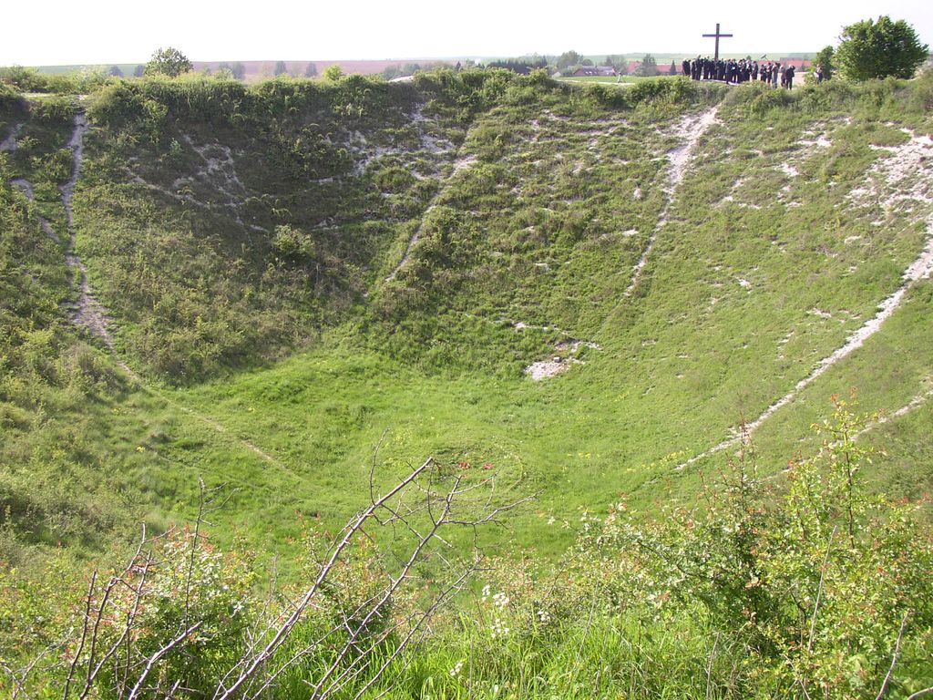
- Lochnagar Crater, testimony to the ravages of the Battle of the Somme is 100 metres in diameter and 30 metres deep. It was created on the 1st July 1916, the first day of the battle.
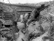 British trench (The Cheshires)
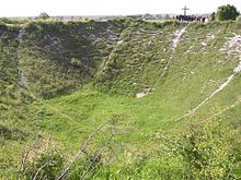 Lochnagar crater from World War I.
See also
References
External links
- Gordon Dump Cemetery (English)
- Ovillers-la-Boisselle on the Quid website (French)
- Lochnagar Crater (English)
- La Boisselle Study Group
Categories:- World War I sites
- Communes of Somme
- Battle of the Somme
- Somme geography stubs
- World War I stubs


Wikimedia Foundation. 2010.