- Mineiros do Tietê
-
Coordinates: 22°24′34″S 48°27′02″W / 22.40944°S 48.45056°W Mineiros do Tietê is a municipality in the state of São Paulo in Brazil, located at 22º24'34" S latitude and 48º27'02" W longitude, at an altitude of 669 meters. The estimated population in 2004 is 12,407 and the area is 212.44 km². It is situated in the center of the state of São Paulo, near the following cities: Dois Córregos (9 km), Barra Bonita (13 km), Jaú (18 km), São Manuel (45 km), Torrinha (35 km), Igaraçu do Tietê (15 km), Lençois Paulista (46 km), Pederneiras (45 km) and Bauru (82 km).
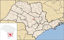 Location of the municipality within the state
History
The city was founded in 1840, when many tropical convoys left the mining towns of Caldas Novas, Santana do Sapucai and Alfenas with the objective of taking undeveloped lands. The same happened with the neighboring towns of Jaú, Brotas and Dois Córregos. A town was formed in the area, known as the Miners' Barrio. In 1875, after legalizing his properties, Vicente Valério dos Santos donated 4 alqueires of land to the Catholic Church for a diocese, and to build a chapel.
On January 17, 1891, this diocese and chapel were elevated to the status of District of Peace for the town of Dois Córregos.
On August 29, 1898, State Law number 581 was passed, elevating the town to the status of Municipality with the name of Mineiros, and electing a City Council, Mayor and other administrators.
In 1944, after a local election, the name was changed to Mineiros do Tietê, named after the local Tietê River, because there was another town named Mineiros in the neighboring state of Goiás.
Categories:- Populated places in São Paulo (state)
- Populated places established in 1840

Wikimedia Foundation. 2010.